
State Route 54 (SR 54) is a 70.5-mile-long (113.5 km) state highway that travels southwest-to-northeast through portions of Troup, Meriwether, Coweta...
21 KB (1,287 words) - 14:44, 30 May 2024

This is a list of former state routes in the U.S. state of Georgia. This list represents routes that traveled through the state but are no longer in operation...
142 KB (14,613 words) - 12:19, 25 October 2023

State Route 141 (SR 141) is a 34.1-mile-long (54.9 km) state highway that runs southwest-to-northeast in the northwest part of the U.S. state of Georgia...
24 KB (1,746 words) - 08:28, 7 October 2023
This is a list of former state routes in the U.S. state of Georgia. This list represents routes that traveled through the state but are no longer in operation...
131 KB (11,496 words) - 22:52, 6 February 2024

State Route 92 (SR 92) is a 97.81-mile-long (157.41 km) state highway in the U.S. state of Georgia. Its southern terminus is an intersection with US 19...
37 KB (4,011 words) - 01:19, 16 February 2024

State Route 14 (SR 14) is a 87.4-mile-long (140.7 km) state highway that travels southwest-to-northeast through portions of Troup, Coweta, and Fulton...
34 KB (2,326 words) - 13:40, 23 May 2023

State Route 166 (SR 166) is a state highway in the U.S. state of Georgia. It connects the Alabama state line with the city of Atlanta. The highway travels...
32 KB (3,824 words) - 10:06, 4 June 2024

runs 234.30 miles (377.07 km) from US 78, Georgia State Route 10 (SR 10), SR 17, and SR 47 in Washington, Georgia, east to US 501 Business in Conway, South...
47 KB (3,284 words) - 04:23, 15 June 2024
Florida to US 1/SR 4 in Wadley, Georgia, through the Panhandle of Florida and the southern portion of Georgia. The route starts as a two-lane highway at...
39 KB (2,117 words) - 15:18, 18 December 2023

including 5.2% of those under age 18 and 8.6% of those age 65 or over. Georgia State Route 54 (Jonesboro Road) These are roads with more than four lanes. Morrow...
13 KB (850 words) - 19:48, 10 April 2024

Highways in Hogansville include Interstate 85, U.S. Route 29, Georgia State Route 54, and Georgia State Route 100. According to the United States Census Bureau...
9 KB (325 words) - 00:07, 9 March 2024

State Route 19 (SR 19) is a 152-mile-long (245 km) state highway that travels southeast-to-northwest through portions of Bacon, Jeff Davis, Appling, Telfair...
31 KB (2,706 words) - 00:26, 28 April 2024

counties in the central and north-central parts of the U.S. state of Georgia. The route connects Byron with the Atlanta metropolitan area, via Forsyth...
22 KB (1,338 words) - 14:43, 30 May 2024

The State Routes in the U.S. state of Georgia (typically abbreviated SR) are maintained by the Georgia Department of Transportation (GDOT). Routes from...
301 KB (3,329 words) - 23:06, 5 June 2024

State Route 3 (SR 3) is a 351-mile-long (565 km) state highway that travels south-to-north through portions of the western part of the U.S. state of Georgia...
75 KB (6,578 words) - 03:05, 31 January 2024

Fayette, and Fulton counties in the central part of the U.S. state of Georgia. The route connects the Macon and Fairburn, via Thomaston, Woodbury, and...
15 KB (838 words) - 15:27, 26 February 2023

State Route 13 (SR 13) is a 49.5-mile-long (79.7 km) state highway in the north-central part of the U.S. state of Georgia, that travels through portions...
43 KB (4,567 words) - 15:45, 15 February 2024

State Route 6 (SR 6) is a 72.1-mile-long (116.0 km) state highway that travels northwest-to-southeast in the U.S. state of Georgia. It is known as Jimmy...
35 KB (3,456 words) - 05:35, 29 March 2023
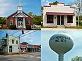
the Meriwether county seat, and north 12 miles (19 km) to Newnan. Georgia State Route 54 crosses US 27 Alternate in the center of Luthersville; it leads...
9 KB (402 words) - 19:02, 8 February 2024

State Route 8 (SR 8) is a 183-mile-long (295 km) state highway that travels west-to-east through portions of Haralson, Carroll, Douglas, Cobb, Fulton,...
55 KB (5,202 words) - 01:12, 16 February 2024

State Route 85 (SR 85) is a 96.5-mile-long (155.3 km) state highway in the west-central part of the U.S. state of Georgia. It travels within portions...
34 KB (3,363 words) - 05:23, 1 June 2024

State Route 25 (SR 25) is a state highway in the eastern part of the U.S. state of Georgia. It travels south-to-north near the Atlantic Ocean, serving...
65 KB (6,805 words) - 10:54, 23 May 2024

State Route 138 (SR 138) is a 59.2-mile (95.3 km) state highway in the northwestern part of the U.S. state of Georgia. The highway is a west-to-east route...
14 KB (821 words) - 04:26, 4 April 2024

counties in the southwestern and west-central parts of the U.S. state of Georgia. The route connects the Morgan area to Moreland, via Buena Vista, Manchester...
23 KB (1,564 words) - 11:38, 20 July 2023

State Route 16 (SR 16) is a 179-mile-long (288 km) state highway that travels west-to-east through portions of Haralson, Carroll, Coweta, Spalding, Butts...
31 KB (2,898 words) - 17:22, 5 February 2024

the north by the Town of Tyrone. It is crossed by Georgia State Route 74 and Georgia State Route 54. SR 74, the Joel Cowan Parkway, runs through the west...
28 KB (2,174 words) - 22:03, 7 June 2024

KML/Georgia State Route 32 KML is from Wikidata Media related to Georgia State Route 32 at Wikimedia Commons Georgia Roads (Routes 21 - 40) Georgia State...
35 KB (2,726 words) - 11:28, 11 May 2024
Florida) Georgia State Route 54 Georgia State Route 54B (former) Idaho State Highway 54 Illinois Route 54 Indiana State Road 54 Kentucky Route 54 Louisiana...
6 KB (445 words) - 23:10, 4 April 2024

615 km) route extending from the White Sands of New Mexico to Georgia's Atlantic coast. The highway's eastern terminus is in Brunswick, Georgia, at an...
23 KB (2,187 words) - 17:56, 24 March 2024

State Route 34 (SR 34) is a 43.6-mile-long (70.2 km) state highway that travels west-to-east through portions of Heard and Coweta counties in the west-central...
16 KB (1,459 words) - 13:12, 18 May 2024