
from this source, which is in the public domain. "MTSAT (Multi-functional Transport Satellite)". globalsecurity.org. Retrieved 19 August 2017. "Administrative:...
6 KB (617 words) - 06:19, 3 December 2024
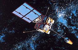
Multifunctional (redirect from Multi-functional)
narrower sense) Multi-tool Multi-function display Multi-touch Multi-Functional Transport Satellite Multifunctional Information Distribution System Multifunctional...
691 bytes (110 words) - 16:59, 3 December 2024
Multi-functional Satellite Augmentation System (MTSAT or MSAS) is a Japanese satellite based augmentation system (SBAS), i.e. a satellite navigation system...
3 KB (225 words) - 21:12, 17 December 2024
Technology Satellites Earth Polychromatic Imaging Camera Geostationary Extended Observations (GeoXO) Multi-Functional Transport Satellite Polar Operational...
40 KB (4,222 words) - 03:31, 26 April 2025

Geostationary Navigation Overlay Service (EGNOS); in Japan, it is the Multi-Functional Satellite Augmentation System (MSAS); and in India, it is the GPS-aided...
44 KB (4,550 words) - 11:44, 15 May 2025
JAXA (section Satellites for other agencies)
satellite, GCOM-C (Shikisai), was launched in 2017. For weather observation Japan launched in February 2005 the Multi-Functional Transport Satellite 1R...
68 KB (7,629 words) - 14:56, 20 March 2025

Solar sail (section Satellites)
broken reaction wheels and chemical thruster. MTSAT-1R (Multi-Functional Transport Satellite)'s solar sail counteracts the torque produced by sunlight...
99 KB (11,635 words) - 18:29, 21 May 2025

clocks. VDM Verlag. ISBN 978-3-639-16004-8. Spaceflight portal Multi-functional Satellite Augmentation System (MSAS) Inclined orbit Tundra orbit Petrovski...
23 KB (1,908 words) - 01:40, 26 February 2025

The H-II (H2) rocket was a Japanese satellite launch system, which flew seven times between 1994 and 1999, with five successes. It was developed by NASDA...
11 KB (786 words) - 15:34, 9 September 2024

conducted on 15 November 1999. The rocket, which was carrying a Multi-Functional Transport Satellite (MTSAT) payload, self-destructed after experiencing an engine...
21 KB (1,959 words) - 12:17, 13 May 2025
GNSS augmentation (redirect from Satellite Based Augmentation System)
EU's GSA). The Multi-functional Satellite Augmentation System (MSAS), operated by Japan's Ministry of Land, Infrastructure and Transport Japan Civil Aviation...
15 KB (1,588 words) - 13:54, 20 April 2025
such as probability of rain, typhoon forecast, images from multi-functional transport satellites, rainfall amount, temperature, images from Doppler stations...
17 KB (1,176 words) - 10:59, 17 March 2025

BeiDou (redirect from Beidou satellite navigation system)
The BeiDou Navigation Satellite System (BDS; Chinese: 北斗卫星导航系统; pinyin: běidǒu wèixīng dǎoháng xìtǒng) is a satellite-based radio navigation system owned...
67 KB (5,855 words) - 03:24, 17 April 2025
Exploration Agency. Retrieved 2020-02-24. "JAXA | Advanced Land Observing Satellite "DAICHI" (ALOS)". JAXA | Japan Aerospace Exploration Agency. Retrieved...
8 KB (252 words) - 02:38, 31 December 2024
with new IGS military satellite". NASASpaceflight. Bergin, Chris (11 December 2011). "Japanese H-2A lofts IGS (Radar-3) satellite into orbit". NASASpaceflight...
48 KB (605 words) - 14:20, 2 May 2025

Internet Protocol television (section Via satellite)
single and multi-source audio and video traffic, ranging from low to DVD quality, using both unicast and IP multicast Real-time Transport Protocol (RTP)...
62 KB (7,028 words) - 22:42, 26 April 2025

Geostationary orbit (redirect from Geostationary satellite)
EU's GSA); The Multi-functional Satellite Augmentation System (MSAS), operated by Japan's Ministry of Land, Infrastructure and Transport Japan Civil Aviation...
49 KB (4,893 words) - 06:24, 20 May 2025
within the commercial air transport industry. ARINC 628 is a standard for Cabin Equipment Interfaces ARINC 629 is a multi-transmitter data bus protocol...
22 KB (2,476 words) - 14:29, 30 January 2025
Global Positioning System (redirect from Global positional satellite)
The Global Positioning System (GPS) is a satellite-based hyperbolic navigation system owned by the United States Space Force and operated by Mission Delta...
185 KB (19,124 words) - 16:20, 13 May 2025

SES (company) (redirect from Société Européenne des Satellites)
satellite services provider, Intelsat to create a more competitive multi-orbit satellite operator. The transaction is expected to complete regulatory approvals...
113 KB (12,158 words) - 18:39, 30 April 2025
through a web page or API on the internet, the actual satellite connection might use an MPEG Transport Stream with no IP layer at all. as a service "ISO/IEC...
8 KB (823 words) - 03:11, 19 March 2025
responsible for Space exploration, missile defence, satellites, other networking services and also the Orion Multi-Purpose Crew Vehicle (Orion MPCV) and Space...
64 KB (5,970 words) - 13:18, 4 May 2025
Joint All-Domain Command and Control (redirect from Multi-Domain Command and Control)
being planned. MDO (multi-domain operations) and JADC2 (joint all-domain command and control) thus entails: Penetrate phase: satellites detect enemy shooters...
55 KB (4,974 words) - 00:09, 15 April 2025

DisplayPort (redirect from Multi-Stream Transport)
streams (daisy-chain connection with multiple monitors) called Multi-Stream Transport (MST), facilities for stereoscopic 3D, increased AUX channel bandwidth...
155 KB (12,632 words) - 05:56, 20 May 2025
Thales Alenia Space and Russian satellite specialist NPO PM have agreed to develop the new Express-4000 multi-mission satellite bus, which incorporates Russian...
30 KB (2,649 words) - 20:32, 27 April 2025
with new IGS military satellite". NASASpaceflight. Chris Bergin (11 December 2011). "Japanese H-2A lofts IGS (Radar-3) satellite into orbit". NASASpaceflight...
34 KB (294 words) - 16:32, 16 December 2024

Moon (redirect from Luna (satellite))
The Moon is Earth's only natural satellite. It orbits Earth at an average distance of 384399 km (238,854 mi; about 30 times Earth's diameter). The Moon's...
270 KB (26,410 words) - 13:30, 17 May 2025
receives live digital video broadcast (DVB) MPEG transport streams (channels) from terrestrial aerials, satellite dishes, or cable feeds and converts them into...
7 KB (687 words) - 16:30, 22 February 2025
can increase heat transport length, they remain very sensitive to spatial orientation relative to gravity. To extend the functional possibilities of two-phase...
7 KB (942 words) - 11:11, 15 February 2025
Internet protocol suite (section Transport layer)
protocols used in the Internet and similar computer networks according to functional criteria. The foundational protocols in the suite are the Transmission...
59 KB (6,803 words) - 08:41, 21 May 2025