
Route 463, also known as Lourdes Road, is a rural highway in Newfoundland and Labrador that leads from Route 460 at Abraham's Cove to Cape St. George....
4 KB (229 words) - 06:40, 24 December 2024
This is a list of highways in Newfoundland and Labrador. Newfoundland and Labrador is unusual among jurisdictions in Canada in that it exclusively uses...
39 KB (2,795 words) - 03:06, 2 March 2024

The Trans-Labrador Highway (TLH) is the primary public road in Labrador, the mainland portion of the province of Newfoundland and Labrador, Canada. The...
25 KB (1,536 words) - 11:01, 17 February 2025

Newfoundland and Labrador. It leads from Sheppardville, at Route 1 (Trans-Canada Highway), to a dead end in Fleur de Lys, Newfoundland and Labrador....
5 KB (314 words) - 03:31, 24 May 2025
numbered 463: Manitoba Provincial Road 463 Newfoundland and Labrador Route 463 Japan National Route 463 Arkansas Highway 463 Louisiana Highway 463 Mississippi...
1 KB (91 words) - 22:27, 4 April 2024

Cove-St. Philips in Newfoundland and Labrador, Canada. Route 40 also serves as the primary access to St. John's International Airport and the Bell Island...
4 KB (271 words) - 21:09, 30 August 2024

Route 30 is a 12.0-kilometre-long (7.5 mi) north-south provincial highway in Newfoundland and Labrador, extending from St. John's through Logy Bay-Middle...
3 KB (180 words) - 23:28, 14 February 2024

the Canadian province of Newfoundland and Labrador. The highway begins at a junction with the Trans-Canada Highway (Route 1) and continues to its southern...
2 KB (137 words) - 22:51, 24 May 2025

Route 100 (also known as The Cape Shore Highway and Argentia Access Road) is a major highway in Newfoundland and Labrador. The highway begins at its northern...
8 KB (472 words) - 23:31, 14 February 2024
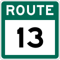
Route 13, also known as Witless Bay Line, is a 20.9-kilometre (13.0 mi), uncontrolled-access highway in Newfoundland and Labrador. Its western terminus...
2 KB (122 words) - 13:01, 5 March 2025

province of Newfoundland and Labrador. It straddles the line between the provinces two largest cities, the capital city of St. John's and the city Mount...
7 KB (610 words) - 21:57, 8 March 2025

province of Newfoundland and Labrador. The road provides a direct link from the Trans-Canada Highway (TCH) to downtown St. John's, Newfoundland, which was...
10 KB (653 words) - 22:11, 30 August 2024

Route 470, also known as La Poile Highway, is a highway on the West Coast of the Canadian province of Newfoundland and Labrador. It is the last provincial...
5 KB (368 words) - 01:44, 16 July 2024

Route 213 is a highway on the Burin Peninsula of the island of Newfoundland in the Canadian province of Newfoundland and Labrador. It is one of a small...
3 KB (189 words) - 15:10, 22 October 2022

Avalon Peninsula of Newfoundland in the Canadian province of Newfoundland and Labrador. Its southern terminus is at Route 10 in Goulds and its northern terminus...
4 KB (295 words) - 01:44, 16 July 2024

province of Newfoundland and Labrador. Its western terminus is the intersection at Route 410, about 7 kilometres south of Baie Verte, and its eastern terminus...
5 KB (215 words) - 01:44, 16 July 2024
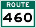
Route 460 is an 87.5-kilometre-long (54.4 mi) east-west Canadian provincial highway in Newfoundland and Labrador. It is located on the west coast of the...
9 KB (612 words) - 15:35, 15 July 2024
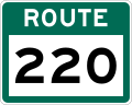
Route 220 is the southern portion of the Heritage Run in the Canadian province of Newfoundland and Labrador, running along the southern and western coastlines...
9 KB (517 words) - 06:11, 1 September 2024

Lourdes is a town in the Canadian province of Newfoundland and Labrador. The town had a population of 465 in the Canada 2016 Census. The current mayor...
8 KB (455 words) - 13:54, 30 November 2024

kind in the entire province of Newfoundland and Labrador. Route 520 begins at an intersection with Route 500 (Trans Labrador Highway) at the western edge...
4 KB (225 words) - 23:55, 10 May 2023

Route 408, also known as Cape Ray Road, is a highway on the west coast of Newfoundland in the Canadian province of Newfoundland and Labrador. The intersection...
3 KB (177 words) - 00:41, 22 March 2023

island of Newfoundland in the Canadian province of Newfoundland and Labrador. It is a relatively short highway with no other towns on the route other than...
2 KB (100 words) - 01:44, 16 July 2024

in the Canadian province of Newfoundland and Labrador. It connects the town of Burgeo with the Trans-Canada Highway (Route 1). The highway is a winding...
4 KB (286 words) - 16:35, 18 April 2023
of Newfoundland. It is located entirely with the town of St. Jacques-Coomb's Cove, connecting the communities on the western half of town with Route 362...
3 KB (166 words) - 14:20, 27 April 2024

Route 403 is a minor highway in the western region of Newfoundland in the Canadian province of Newfoundland and Labrador. The highway begins at a junction...
2 KB (134 words) - 01:45, 16 July 2024
in the province of Newfoundland and Labrador. It serves as the only road connection to the town of Terra Nova, connecting with Route 1 (Trans-Canada Highway)...
3 KB (173 words) - 13:17, 5 March 2025
Route 404 is a short provincial highway on the west coast of Newfoundland in the Canadian province of Newfoundland and Labrador. It is one of four provincial...
4 KB (213 words) - 01:44, 16 July 2024

passengers last year". CBC. 2020-05-15. Retrieved 2020-12-17. "Newfoundland and Labrador Route 364" (Map). Google Maps. Retrieved February 26, 2020....
5 KB (270 words) - 14:19, 27 April 2024
"Population and dwelling counts: Canada, provinces and territories, census divisions and census subdivisions (municipalities), Newfoundland and Labrador". Statistics...
6 KB (216 words) - 02:14, 28 January 2023

Peninsula of Newfoundland in the Canadian province of Newfoundland and Labrador. It extends from the city of St. John's west to Paradise. Route 50 begins...
4 KB (256 words) - 23:29, 14 February 2024