
The Philippine Nautical Highway System, also the Road Roll-on/Roll-off Terminal System (RRTS) or simply the RoRo System, is an integrated network of highway...
5 KB (498 words) - 18:27, 12 July 2024
Philippines portal Roads portal Asian highway network Philippine expressway network Philippine Nautical Highway System Manila's arterial road network Transportation...
110 KB (869 words) - 08:53, 1 June 2025

(N830) of the Philippine highway network. It also forms part of the Western Nautical Highway of the Philippine Nautical Highway System. True to its old...
7 KB (578 words) - 00:55, 26 July 2024

National Route 7 (N7) of the Philippine highway network and the Western Nautical Highway of the Philippine Nautical Highway System. True to its name, the road...
10 KB (459 words) - 01:07, 30 January 2025
Iloilo–Capiz Road (redirect from N505 highway (Philippines))
Route 505 (N505) of the Philippine highway network, as well as the Western Nautical Highway of the Philippine Nautical Highway System. The road starts near...
8 KB (316 words) - 06:42, 10 May 2025

The Pan-Philippine Highway, also known as the Maharlika Highway (Tagalog: Daang Maharlika; Cebuano: Dalang Halangdon), is a network of roads, expressways...
42 KB (3,246 words) - 10:48, 25 May 2025

Danao to Santander. The highway also forms part of the Philippine Nautical Highway System, particularly the Central Nautical Highway from Danao to Cebu City...
10 KB (518 words) - 09:46, 8 August 2024

The Philippine expressway network, also known as the High Standard Highway Network, is a controlled-access highway network managed by the Department of...
33 KB (2,523 words) - 09:38, 21 March 2025

Route 712 (N712) of the Philippine highway network and of the Western Nautical Highway of the Philippine Nautical Highway System. True to its name, the...
10 KB (642 words) - 06:14, 26 January 2025
National Route 6 (N6) of the Philippine highway network and of the Western Nautical Highway of the Philippine Nautical Highway System. Its 50-meter (160 ft)...
3 KB (182 words) - 13:19, 3 July 2024

Camiguin, to Cagayan de Oro is part of the Central Nautical Highway of the Philippine Nautical Highway System. Its section from Alae Bridge 2 at Tagoloan–Cagayan...
13 KB (744 words) - 01:05, 12 March 2025
country, including cities in the Luzon Archipelago via the Philippine Nautical Highway System. Built and completed in 2017 as the modern alternative to...
23 KB (2,028 words) - 11:13, 12 May 2025
Ferry (section Modernization of ferry system)
the Philippine Nautical Highway System forms the backbone of the nationwide transport system by integrating ports with highway systems; the system has...
69 KB (8,273 words) - 08:15, 20 May 2025

Cebu North Road (redirect from N810 highway (Philippines))
highway of National Route 810 (N810) of the Philippine highway network. It also forms part of the Central Nautical Highway of the Philippine Nautical...
10 KB (643 words) - 23:30, 27 November 2023

List of ports in the Philippines (category Use Philippine English from December 2022)
Ocean. Philippine Ports Authority Philippine Nautical Highway System Transportation in the Philippines West Philippine Sea Limited To Exclusive Economic...
15 KB (165 words) - 12:32, 7 May 2025

Mindoro Coastal Road/Occidental Mindoro National Highway and the Philippine Nautical Highway System. The town is served by the San Jose Airport via Cebu...
34 KB (2,362 words) - 07:27, 16 January 2025
rebrand. In 2004, the Philippine government invited the firm to be part of the Road-RoRo Terminal System-Strong Republic Nautical Highway project of the government...
9 KB (746 words) - 09:57, 13 March 2025

Transportation in the Philippines (category Use Philippine English from October 2022)
Tagbilaran. Most of these terminals comprise the Strong Republic Nautical Highway, a nautical system conceptualized under the term of President Gloria Macapagal...
49 KB (5,064 words) - 18:49, 26 April 2025

List of lighthouses in the Philippines (redirect from Philippine Lighthouse)
(120,000 sq mi) and having the fifth-longest coastline in the world, the Philippine coast has a total length of 36,289 km (22,549 mi) and is very irregular...
10 KB (539 words) - 04:14, 28 November 2024

Philippines (redirect from Philippine Islands)
Bridges across Oceans: Initial Impact Assessment of the Philippines Nautical Highway System and Lessons for Southeast Asia (Report). Metro Manila, Philippines:...
468 KB (35,623 words) - 08:34, 1 June 2025

Transportation in Metro Manila (category Use Philippine English from August 2023)
Department of Public Works and Highways Department of Transportation Philippine highway network Philippine Nautical Highway System "Why GrabTaxi?". Grab. Satre...
39 KB (2,720 words) - 08:28, 4 January 2025
College (MPC) is a maritime school located at the junction of the National Highway and the Makar-Koronadal Road, about 7 kilometers from downtown General...
3 KB (240 words) - 07:50, 7 September 2024

roll-on/roll-off nautical highway. Barbaza has a total road length of 52.7 km (32.7 mi), including a 10.2 km (6.3 mi) National Highway. Dalanas Bridge...
20 KB (1,468 words) - 05:53, 8 May 2025

Oriental under the Philippine Coast Guard Central Visayas District. As a major point of the Philippine Western Nautical Highway System, there are daily...
59 KB (4,964 words) - 13:50, 15 May 2025

Lucena (redirect from Lucena (Philippine city))
elected Municipal president during the first Philippine Republic. Lucena was involved in the Philippine–American War and in the subsequent establishment...
54 KB (4,860 words) - 09:50, 21 May 2025
and the Bicol Region, as well as other provincial buses plying the nautical highway in the south pending the completion of, and as an alternative to, the...
10 KB (956 words) - 11:02, 31 July 2024
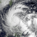
as the 32nd tropical depression of the season, the system formed on September 26 over the Philippine Sea. On September 27, it was named Nalgae as it explosively...
27 KB (2,855 words) - 05:17, 6 May 2025

Cawayan (category Political divisions established by Philippine executive order)
Masbate. LGU Cawayan Masbate Website Philippine Standard Geographic Code Philippine Census Information Local Governance Performance Management System...
19 KB (1,241 words) - 07:21, 9 December 2024

Puerto Princesa (category Use Philippine English from January 2023)
approximately 306 nautical miles (567 km) from the Philippine capital of Manila, 205 nautical miles (380 km) from Panay and 250 nautical miles (460 km) from...
47 KB (3,912 words) - 21:28, 24 April 2025
Carlock Street in Cebu. During this period, the Philippine Nautical School, now known as the Philippine Merchant Marine Academy, remained in operation...
142 KB (14,358 words) - 02:36, 31 May 2025