
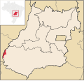
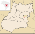
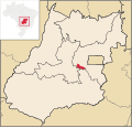
Santa Rita do Novo Destino is a municipality in northeastern Goiás state, Brazil. Santa Rita do Novo Destino is 82 km. east of Ceres and 15 km. north of...
4 KB (216 words) - 18:27, 20 February 2022
Araguaia, Goiás Santa Rita do Novo Destino, Goiás Santa Rita do Trivelato, Mato Grosso Santa Rita do Pardo, Mato Grosso do Sul Santa Rita de Caldas, Minas...
3 KB (321 words) - 20:42, 26 June 2022
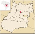
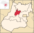
Santa Rita do Araguaia is a municipality in southwestern Goiás state, Brazil. Santa Rita is located on the Araguaia River and is connected to the state...
5 KB (362 words) - 18:27, 20 February 2022

North: Nova Iguaçu de Goiás and Campinorte South: Hidrolina and Santa Rita do Novo Destino East: Niquelândia West: Hidrolina On the west the municipal boundary...
6 KB (581 words) - 18:27, 20 February 2022

Educativa Evangélica, Faculdade de Filosofia São Miguel Arcanjo, Faculdade do Instituto Brasil-FIBRA, Faculdade Anhanguera de Anápolis, and Faculdade Raízes...
18 KB (1,828 words) - 02:48, 21 March 2024
north: Niquelândia south: Goianésia east: Padre Bernardo west: Santa Rita do Novo Destino The foundation of Barro Alto began in 1949 on the Fazenda Barro...
5 KB (421 words) - 01:28, 23 June 2023

called "Porto de Santa Rita" or just "Porto". Soon a chapel was built dedicated to Santa Rita and the settlement was known as Santa Rita do Paranaíba, after...
13 KB (854 words) - 04:30, 31 May 2024

the Fartura, Cerrado, and São Domingos. The main streams are the Santana, Santa Rosa, São Manoel and Diamantina. The climate of the region is hot and semi-humid...
6 KB (618 words) - 18:27, 20 February 2022

Cora Coralina Casa do Bispo Igreja de Nossa Senhora d'Abadia Igreja de Nossa Senhora do Carmo Palácio do Conde dos Arcos Quartel do XX List of municipalities...
19 KB (1,372 words) - 21:53, 4 June 2024
São Luíz do Norte / GO-338. See Seplan Municipal boundaries are with: north: Uruaçu south: São Luíz do Norte east: Santa Rita do Novo Destino west: Pilar...
5 KB (407 words) - 18:27, 20 February 2022

BR-153. See Seplan Neighboring municipalities: Hidrolina, Santa Rita do Novo Destino, Goianésia, Santa Isabel, Nova Glória and Itapaci. Urban population: 3...
4 KB (232 words) - 18:27, 20 February 2022
Novo Planalto is a municipality in north Goiás state, Brazil. Novo Planalto is in the São Miguel do Araguaia Microregion, 47 kilometers east of São Miguel...
6 KB (468 words) - 18:27, 20 February 2022
Novo Gama is a municipality in eastern Goiás state, Brazil. In 2020 the population was 117,703 inhabitants. Novo Gama is part of the Entorno do Distrito...
6 KB (482 words) - 20:28, 25 November 2023

Piracanjuba / GO-217 / GO-139 / GO-213. Neighboring municipalities are: North: Santa Cruz de Goiás and Piracanjuba South: Corumbaíba East: Ipameri West: Rio...
11 KB (1,165 words) - 04:16, 13 February 2024

with: North: Federal District South: Luziânia East: Cidade Ocidental West: Novo Gama It is served by highways BR-040, BR-060, BR-020 BR-251, and DF-290....
6 KB (515 words) - 06:16, 13 March 2023

Paraíso de Goiás, Barro Alto, Campinaçu, Colinas do Sul, Mimoso de Goiás, Santa Rita do Novo Destino, São João d'Aliança, Uruaçu and Vila Propício. The...
7 KB (669 words) - 06:53, 30 March 2024

north of Jaraguá. See Seplan Neighboring municipalities: Rialma, Santa Rita do Novo Destino, Jaraguá, and Uruana Urban population: 3,657 Population density:...
5 KB (313 words) - 18:27, 20 February 2022

municipalities of Britânia, Montes Claros de Goiás, Fazenda Nova, Santa Fé de Goiás, Novo Brasil and Itapirapuã and is crossed by highways BR-070 and by...
6 KB (504 words) - 23:11, 21 December 2023

/ Santa Terezinha de Goiás / GO-347 / Crixás / GO-156. Municipal boundaries are with: north: Mundo Novo south: Crixás east: Nova Crixás west: Santa Terezinha...
5 KB (399 words) - 18:27, 20 February 2022
Rialma 10,485 Rianápolis 4,167 Rubiataba 18,025 Santa Isabel 3,485 Santa Rita do Novo Destino 3,372 São Luís do Norte 4,266 São Patrício 2,051 Uruana 13,712...
3 KB (203 words) - 21:27, 25 September 2021

made by BR-352 / Bela Vista de Goiás / Cristianópolis / BR-352 / G-020 / Santa Cruz de Goiás / Palmelo. Distancias Rodoviarias Sepin Neighboring municipalities...
7 KB (658 words) - 18:27, 20 February 2022

of Nazário. At first it was a district of the now extinct municipality of Novo Horizonte, which later, in 1938 became Anicuns. In 1948 Nazário got its emancipation...
5 KB (413 words) - 18:27, 20 February 2022

boundaries are with: Buriti de Goiás, Córrego do Ouro, Israelândia, Jaupaci, Jussara, Montes Claros de Goiás and Novo Brasil. Districts, villages, and hamlets...
5 KB (367 words) - 03:57, 30 October 2022

Novo Brasil is a municipality in eastern Goiás state, Brazil. Novo Brasil is located east of the capital near Iporá and São Luís de Montes Belos. Distance...
6 KB (483 words) - 18:27, 20 February 2022

municipalities are: north: São Miguel do Passa Quatro south: Piracanjuba and Santa Cruz de Goiás east: Bela Vista de Goiás west: Pires do Rio Population density: 3...
5 KB (395 words) - 18:27, 20 February 2022
Laguna Central-West GO Barro Alto, Santa Rita do Novo Destino Tomás Cardoso Central-West GO Cachoeira Dourada Córrego do Inhambú Central-West GO Caiapônia...
136 KB (69 words) - 16:32, 26 May 2024
municipality in the state of Goiás, Brazil. Abadiânia is part of the Entorno do Distrito Federal statistical micro-region. Neighboring municipalities are:...
6 KB (415 words) - 13:30, 25 July 2023

/ BR-080 / GO-342 / BR-153 / Uruaçu / Santa Tereza de Goiás / GO-241 / Formoso / GO-142 / Trombas. Montividiu do Norte is surrounded by the following municipalities:...
6 KB (450 words) - 18:27, 20 February 2022

Falls; Almécegas II Falls; Loquinhas Falls; Segredo Falls; Raizama Falls; Santa Bárbara Falls; Macaquinho Falls (little monkey falls); Carioquinhas Falls;...
15 KB (1,630 words) - 13:49, 20 August 2023

name was changed from Anicuns to Novo Horizonte. In 1933 the district of Nazário was created to become part of Novo Horizonte. In 1938 the name was changed...
7 KB (729 words) - 18:27, 20 February 2022