Satellite navigation software or GNSS navigation software a category of software that provide positioning services by utilizing data from satellite navigation...
6 KB (589 words) - 05:06, 25 March 2025
This is a list of notable commercial satellite navigation software (also known as GPS software) for various devices, with a specific focus on mobile phones...
16 KB (246 words) - 02:45, 19 June 2025

A satellite navigation (satnav) device or GPS device is a device that uses satellites of the Global Positioning System (GPS) or similar global navigation...
39 KB (4,142 words) - 23:23, 17 April 2025

A satellite navigation or satnav system is a system that uses satellites to provide autonomous geopositioning. A satellite navigation system with global...
45 KB (4,560 words) - 11:19, 28 May 2025
contains a list with gratis (but not necessarily open source) satellite navigation (or "GPS") software for a range of devices (PC, laptop, tablet PC, mobile phone...
33 KB (1,539 words) - 19:29, 17 June 2025
The iGO Navigation Engine, developed by Hungary-based NNG LLC (formerly Nav N Go) is a GPS navigation software package. NNG sells some versions of the...
7 KB (676 words) - 17:43, 9 June 2025
IATA-Code IGO of Jaime Ortiz Betancur Airport, Colombia iGO (software), a satellite navigation software package I-GO, a car-sharing service in Chicago, Illinois...
1,012 bytes (164 words) - 16:31, 24 May 2025
TomTom AmiGO (category Android (operating system) software)
TomTom AmiGO, formerly known as TomTom Speed Cameras, is a satellite navigation software for Android and iOS mobile devices, created and operated by the...
2 KB (159 words) - 21:45, 4 January 2025

CoMaps (category Satellite navigation software)
open-source software portal Comparison of free off-line satellite navigation software List of free and open-source software packages Comparison of satellite navigation...
7 KB (566 words) - 14:30, 14 June 2025

Turn-by-turn navigation is a feature of some satellite navigation devices where directions for a selected route are continually presented to the user in...
9 KB (893 words) - 04:17, 5 June 2025
GPS software can mean: Comparison of satellite navigation software Comparison of free off-line satellite navigation software GPS navigation software This...
207 bytes (56 words) - 03:28, 28 December 2019

Organic Maps (category Satellite navigation software)
open-source software portal Comparison of free off-line satellite navigation software List of free and open-source software packages Comparison of satellite navigation...
8 KB (738 words) - 14:32, 14 June 2025
Here WeGo (category 2015 software)
Here We Go (stylised HERE WeGo) is a web mapping and satellite navigation software available on the Web and mobile platforms, operated by Here Technologies...
27 KB (2,554 words) - 21:27, 20 May 2025
The Global Positioning System (GPS) is a satellite-based hyperbolic navigation system owned by the United States Space Force and operated by Mission Delta...
184 KB (19,110 words) - 08:39, 20 June 2025

Indian Regional Navigation Satellite System (IRNSS), with an operational name of NavIC (acronym for Navigation with Indian Constellation; also, nāvik 'sailor'...
64 KB (5,319 words) - 09:49, 11 June 2025
Waze (category Navigation system companies)
FreeMap Israel, is a subsidiary company of Google that provides satellite navigation software on smartphones and other computers that support the Global Positioning...
36 KB (3,657 words) - 01:38, 1 June 2025

NNSS (for Navy Navigation Satellite System), was the first satellite navigation system to be used operationally. The radio navigation system was primarily...
32 KB (3,712 words) - 08:02, 31 May 2025
Trimble Inc. (redirect from Trimble Navigation Ltd.)
is an American software, hardware, and services technology company. Trimble also does hardware development of global navigation satellite system (GNSS)...
8 KB (567 words) - 09:34, 26 March 2025
The GPS-aided GEO augmented navigation (GAGAN) is an implementation of a regional satellite-based augmentation system (SBAS) by the Government of India...
24 KB (2,667 words) - 03:41, 24 March 2025

Tyne introduced School Streets with similar restrictions. Most satellite navigation software does not avoid LTZs. Waze added support for LTZs in select cities...
13 KB (1,222 words) - 05:13, 7 February 2025

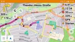
Locus Map (category Satellite navigation software)
Locus Map is a multi-functional outdoor navigation application, available for Android and iOS devices. Primarily it is designed and used for leisure time...
9 KB (883 words) - 14:24, 17 June 2025
BeiDou (redirect from Beidou satellite navigation system)
The BeiDou Navigation Satellite System (BDS; Chinese: 北斗卫星导航系统; pinyin: běidǒu wèixīng dǎoháng xìtǒng) is a satellite-based radio navigation system owned...
68 KB (5,866 words) - 01:18, 2 June 2025
off-line satellite navigation software Comparison of free software for audio Comparison of FTP client software Comparison of FTP server software packages...
21 KB (2,369 words) - 08:16, 15 June 2025
States Uruguay Venezuela Comparison of satellite navigation software "Fun on the Autobahn: Google Maps Navigation in 11 more Countries". GoogleMobile.BlogSpot...
8 KB (828 words) - 14:10, 7 May 2025
OsmAnd (category Satellite navigation software)
and open-source software portal Comparison of free off-line satellite navigation software Comparison of satellite navigation software Comparison of commercial...
12 KB (1,295 words) - 21:00, 4 May 2025

Mapy.com (category Satellite navigation software)
OpenStreetMap Foundation. "Mapy.cz: maps & navigation". Google Play. Retrieved 2024-12-06. "Mapy.cz: maps & navigation". App Store. Retrieved 2024-12-06. "The...
7 KB (580 words) - 18:03, 30 May 2025
A software GNSS receiver is a Global Navigation Satellite System (GNSS) receiver that has been designed and implemented using software-defined radio. A...
14 KB (1,670 words) - 20:26, 23 April 2025
Galileo is a global navigation satellite system (GNSS) created by the European Union through the European Space Agency (ESA) and operated by the European...
104 KB (10,186 words) - 08:22, 4 June 2025

The European Geostationary Navigation Overlay Service (EGNOS) is a satellite-based augmentation system (SBAS) developed by the European Space Agency and...
18 KB (1,748 words) - 14:46, 17 February 2025
Maps.me (category Satellite navigation software)
In September 2015, the app was open sourced and a free and open-source software version was additionally made available on F-droid until the application...
9 KB (715 words) - 21:59, 28 May 2025