
The World Geodetic System (WGS) is a standard used in cartography, geodesy, and satellite navigation including GPS. The current version, WGS 84, defines...
24 KB (2,842 words) - 03:41, 26 April 2025

A geodetic datum or geodetic system (also: geodetic reference datum, geodetic reference system, or geodetic reference frame, or terrestrial reference...
32 KB (3,377 words) - 03:19, 15 May 2025
The Geodetic Reference System 1980 (GRS80) consists of a global reference ellipsoid and a normal gravity model. The GRS80 gravity model has been followed...
7 KB (1,078 words) - 12:07, 24 August 2024


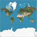
A geographic coordinate system (GCS) is a spherical or geodetic coordinate system for measuring and communicating positions directly on Earth as latitude...
23 KB (2,540 words) - 22:18, 14 May 2025

Retrieved December 25, 2018. National Geospatial Intelligence Agency. "World Geodetic System 1984 datasheet" (PDF). United Nations Office for Outer Space Affairs...
9 KB (912 words) - 16:39, 14 December 2024
geographic coordinates (latitude and longitude). Examples include the World Geodetic System and the 1927 and 1983 North American Datum. A datum generally consists...
15 KB (1,570 words) - 12:19, 7 May 2025
EPSG Geodetic Parameter Dataset (also EPSG registry) is a public registry of geodetic datums, spatial reference systems, Earth ellipsoids, coordinate transformations...
5 KB (444 words) - 20:42, 28 January 2025
The Hellenic Geodetic Reference System 1987 or HGRS87 (Greek: Ελληνικό Γεωδαιτικό Σύστημα Αναφοράς 1987 or ΕΓΣΑ'87) is a geodetic system commonly used...
7 KB (827 words) - 10:33, 27 October 2024
The European Terrestrial Reference System 1989 (ETRS89) is an ECEF (Earth-Centered, Earth-Fixed) geodetic Cartesian reference frame, in which the Eurasian...
6 KB (615 words) - 22:40, 28 February 2025
also known as MGRS-New, which is used for WGS84 and some other modern geodetic datums, the letter for the first row – just north of the equator – is A...
15 KB (2,136 words) - 19:17, 1 June 2025

of latitude, longitude and altitude are currently defined by the World Geodetic System (WGS), and take into account the flattening of the Earth at the...
43 KB (6,355 words) - 20:55, 14 April 2025

Ellipsoid was used. The World Geodetic System WGS84 ellipsoid is now generally used to model the Earth in the UTM coordinate system, which means current...
18 KB (2,858 words) - 13:14, 29 May 2025
Web Mercator projection (category Geographic coordinate systems)
MEMBER["World Geodetic System 1984 (Transit)", ID["EPSG",1166]], MEMBER["World Geodetic System 1984 (G730)", ID["EPSG",1152]], MEMBER["World Geodetic System 1984...
16 KB (1,712 words) - 13:28, 25 May 2025

Spherical Earth (redirect from Round World)
(Delambre, Everest). The modern value as determined by the US DoD World Geodetic System since the 1960s is close to 1/298.25. The scientific study of the...
17 KB (1,903 words) - 15:49, 14 May 2025

Satellite geodesy (redirect from Space geodetic techniques)
worldwide triangulation networks allowed for the establishment of the World Geodetic System. The development of GPS by the United States in the 1980s allowed...
21 KB (2,338 words) - 10:15, 25 November 2024

Center. "Department of Defense World Geodetic System 1984: Its Definition and Relationships with Local Geodetic Systems". Retrieved 2018-10-17. "Info"...
42 KB (4,474 words) - 20:57, 9 June 2025
Geographic coordinate conversion (category Geographic coordinate systems)
of geographic coordinates, conversion of coordinate systems, or transformation to different geodetic datums. Geographic coordinate conversion has applications...
34 KB (5,207 words) - 08:18, 10 August 2024
Earth Geodesy Earth's circumference Earth's radius Geodetic datum History of geodesy World Geodetic System Ancient units of length such as the cubit, stadion...
29 KB (1,683 words) - 18:50, 15 June 2025

Earth ellipsoid (section Geodetic coordinates)
TR8350.2, "Department of Defense World Geodetic System 1984, Its Definition and Relationships With Local Geodetic Systems", Third Edition, 4 July 1997 [1]...
24 KB (2,826 words) - 18:03, 25 May 2025

position, the height of the geoid (e.g., the EGM96 geoid) over the World Geodetic System (WGS) ellipsoid. They are then able to correct the height above...
29 KB (3,445 words) - 01:09, 2 June 2025
BeiDou (redirect from Compass navigation system)
China and the EU. In November 2014, BeiDou became part of the World-Wide Radionavigation System (WWRNS) at the 94th meeting of the International Maritime...
68 KB (5,866 words) - 01:18, 2 June 2025

map projection (with specific parameters), a choice of geodetic datum to bind the coordinate system to real locations on the earth, an origin point, and...
21 KB (2,805 words) - 00:44, 11 June 2025
reference for the determining of locators should be based on the World Geodetic System 1984 (WGS-84). A Maidenhead locator compresses latitude and longitude...
16 KB (1,933 words) - 23:59, 7 June 2025

District on April 1, 1889 with the creation of the modern municipalities system. It was elevated to city status February 2, 2002. Moriya has a mayor-council...
11 KB (835 words) - 16:41, 5 January 2025

coordinate system Earth orientation parameters Geodetic datum International Celestial Reference System and its realizations Terrestrial reference frame World Geodetic...
9 KB (783 words) - 11:33, 25 February 2025

A geodetic airframe is a type of construction for the airframes of aircraft developed by British aeronautical engineer Barnes Wallis in the 1930s (who...
9 KB (934 words) - 01:56, 4 May 2025

like North American Datum of 1983 for U.S. measurements, and the World Geodetic System for worldwide measurements. The latitude and longitude on a map...
103 KB (13,339 words) - 13:57, 13 June 2025

known as the reference ellipsoid, instead of a sphere. The current World Geodetic System model uses a spheroid whose radius is 6,378.137 km (3,963.191 mi)...
15 KB (2,094 words) - 03:00, 12 June 2025

OpenCRG (section World geodetic system)
visualization of OpenCRG data. Real world OpenCRG data files may be generated by several laser scans along a road. World geodetic system coordinates (WGS84), as used...
10 KB (977 words) - 17:35, 23 December 2023