New York State Route 25B (NY 25B) is a 7.25-mile (11.67 km) east–west state highway located on Long Island in New York, United States. The western terminus...
15 KB (1,486 words) - 05:01, 29 May 2024

New York State Route 25C (NY 25C) was an east–west state highway on Long Island in New York in the United States. The route began in Queens at an intersection...
8 KB (704 words) - 18:23, 16 February 2024

Belt Parkway (redirect from New York State Route 907B)
System are designated as New York State Route 907C (NY 907C), NY 907D, NY 907B, and NY 907A, respectively, by the New York State Department of Transportation...
31 KB (2,856 words) - 04:46, 2 June 2024
New York State Route 878 (NY 878) is an expressway on Long Island and in New York City. The route exists in two sections, which both form the Nassau Expressway...
43 KB (4,020 words) - 14:25, 5 May 2024

New York State Route 25 (NY 25) is an east–west state highway in downstate New York in the United States. The route extends along the central parts and...
42 KB (3,577 words) - 21:52, 3 June 2024
Template:Attached KML/New York State Route 25A KML is from Wikidata New York State Route 25A (NY 25A) is a state highway on Long Island in New York, United States...
44 KB (3,850 words) - 01:00, 5 June 2024

numbered state highways in the U.S. state of New York. Signed state highways in New York, referred to as "touring routes" by the New York State Department...
167 KB (908 words) - 11:59, 30 April 2024
Avenue. Furthermore, the hamlet's southernmost border touches New York State Route 25B. Roslyn Heights is served by the Oyster Bay Branch of the Long...
27 KB (2,496 words) - 15:35, 3 June 2024

of the island. The parkway is designated New York State Route 908G (NY 908G) – an unsigned reference route – and has been ceremoniously named Purple...
89 KB (11,319 words) - 15:41, 8 June 2024

Parkway. The Meadowbrook Parkway is designated New York State Route 908E (NY 908E), an unsigned reference route. Most of the road is limited to non-commercial...
34 KB (3,559 words) - 19:44, 5 May 2024

Cross Island Parkway (redirect from New York State Route 907A)
Southern State Parkway, acting as a sort of separation point which designates the limits of New York City. The road is designated as New York State Route 907A...
38 KB (3,991 words) - 18:16, 1 June 2024
Boulevard (New York State Route 25A), Hillside Avenue (New York State Route 25B), Jericho Turnpike (New York State Route 25), New York State Route 24, and...
132 KB (11,463 words) - 04:20, 21 May 2024

New York State Route 265 (NY 265) is a 19.75-mile (31.78 km) long state highway located in the western part of New York in the United States. NY 265 is...
16 KB (1,407 words) - 14:49, 9 June 2024

Queens (redirect from Queens, New York, New York)
York State Route 25B (Hillside Avenue), New York State Route 25 (Queens Boulevard, Hillside Avenue, and Braddock Avenue), New York State Route 24 (Hempstead...
267 KB (22,594 words) - 14:57, 11 June 2024
24 New York State Route 25 New York State Route 25A New York State Route 25B New York State Route 25D New York State Route 27 New York State Route 895...
45 KB (5,440 words) - 17:08, 2 June 2024

New York State Route 110 (NY 110) is a major north–south state highway along the western border of Suffolk County, New York. It runs between the village...
17 KB (1,707 words) - 23:08, 17 April 2024
numbered 25B: County Road 25B (Alachua County, Florida) Nebraska Link 25B New Hampshire Route 25B New Jersey Route 25B (former) New York State Route 25B Vermont...
710 bytes (72 words) - 11:49, 5 January 2023

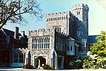
Public Library, is located within the hamlet. Hillside Avenue (New York State Route 25B) forms the hamlet's southern border. Other major roads which travel...
16 KB (1,369 words) - 03:09, 29 March 2024

Parkway. New York State Route 25A is the northernmost west-east route in the town, and is a suffixed route of NY 25. New York State Route 25B is another...
35 KB (2,540 words) - 16:12, 5 May 2024
Bay Parkway (Jones Beach) (redirect from New York State Route 909E)
Meadowbrook State Parkway and Ocean Parkway. East of the Meadowbrook/Ocean interchange, the Bay Parkway is designated New York State Route 909E (NY 909E)...
5 KB (453 words) - 00:48, 28 April 2024

Route 25 was a major state highway in New Jersey, United States prior to the 1953 renumbering, running from the Benjamin Franklin Bridge in Camden to...
26 KB (2,122 words) - 18:18, 16 February 2024

New York State Route 101 (NY 101) is a 3.58-mile (5.76 km) long state highway in northwestern Nassau County, New York, in the United States. It runs north–south...
27 KB (2,617 words) - 20:32, 3 June 2024

New York State Route 231 (NY 231) is a 9.05-mile (14.56 km) long state highway located in Suffolk County, on Long Island, in New York, in the United States...
15 KB (1,470 words) - 15:38, 8 June 2024

Metropolitan Transportation Authority (MTA) operates a number of bus routes in Queens, New York, United States, under two different public brands. Some of them...
435 KB (12,379 words) - 04:13, 12 June 2024

New York State Route 25D (NY 25D) was a state highway located on Long Island in the U.S. state of New York. It was originally the designation of Horace...
8 KB (718 words) - 18:27, 16 February 2024

New York, with the Canada–United States border at Lewiston, New York, near Niagara Falls. Officially, I-190 from I-90 north to New York State Route 384...
23 KB (1,745 words) - 20:34, 18 May 2024

exit 24 at Witmer Road (New York State Route 31), exit 25A at Military Road (New York State Route 265) and exit 25B for Route 104 and the Niagara Scenic...
23 KB (2,165 words) - 01:26, 5 May 2024
Interstate 678 (redirect from New York State Route 678)
or /væn ˈwaɪk/ van WYKE) from JFK Airport to Northern Boulevard (New York State Route 25A or NY 25A), the Whitestone Expressway from NY 25A north to the...
82 KB (6,854 words) - 03:40, 5 June 2024
Glen Cove Road (redirect from New York State Route 900B)
107) is New York State Route 900B (NY 900B) – an unsigned reference route. From there to Pulaski Street, it is New York State Route 107 (NY 107). This segment...
16 KB (1,289 words) - 20:08, 3 June 2024

County routes in Nassau County, New York are maintained by the Nassau County Department of Public Works. Route numbers were originally posted on unique...
76 KB (544 words) - 20:50, 17 May 2024