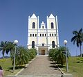
19°08′40″S 40°37′22″W / 19.14444°S 40.62278°W / -19.14444; -40.62278 São Domingos do Norte is a municipality located in the Brazilian state of Espírito Santo...
551 bytes (49 words) - 23:26, 8 February 2021

Mantenópolis and Pancas. (north) Barra de São Francisco and Nova Venécia. (south) São Domingos do Norte. (east) São Gabriel da Palha. The municipality is...
4 KB (153 words) - 01:20, 31 March 2024
Santa Luzia do Azul, Santo Agostinho and Vila Nelita. The territorial area of Água Doce do Norte was donated by a local farmer named Domingos Marculino...
4 KB (270 words) - 18:25, 30 August 2023
Gerais São Domingos do Maranhão, Maranhãop São Domingos do Norte, Espírito Santo São Domingos de Pombal, Paraíba São Domingos do Prata, Minas Gerais São Domingos...
2 KB (232 words) - 01:50, 13 April 2022
21°01′30″S 41°39′14″W / 21.02500°S 41.65389°W / -21.02500; -41.65389 São José do Calçado is a municipality located in the Brazilian state of Espírito...
1 KB (53 words) - 12:11, 5 August 2021
19°44′20″S 40°39′25″W / 19.73889°S 40.65694°W / -19.73889; -40.65694 São Roque do Canaã is a municipality located in the Brazilian state of Espírito Santo...
665 bytes (65 words) - 12:14, 5 August 2021

Bom Jesus do Norte is a municipality located in the Brazilian state of Espírito Santo. Its population was 9,962 (2020) and its area is 89.0 km². IBGE 2020...
3 KB (34 words) - 12:23, 28 July 2021

Domingos Martins, Santa Maria de Jetibá and Itarana (N) Laranja da Terra and the neighbouring state of Minas Gerais, (W) Brejetuba (S) Conceição do Castelo...
5 KB (241 words) - 13:31, 29 September 2023
include: (E) Domingos Martins, (N) Afonso Claudio, (W) Conceição do Castelo and Castelo in the south. IBGE 2020 IBGE - [1] "Normais Climatológicas Do Brasil...
6 KB (134 words) - 16:58, 21 May 2024

IBGE. Wikivoyage has a travel guide for Domingos Martins. Domingos Martins [1] Descubra mais sobre Domingos Martins Archived 2019-07-26 at the Wayback...
8 KB (557 words) - 08:46, 9 February 2024
Guarapari, (north) Marechal Floriano and Domingos Martins, (west) Vargem Alta, (south) Iconha and Rio Novo do Sul. The municipality is mountainous, though...
4 KB (146 words) - 16:56, 21 May 2024

(Museu Solar Monjardim) Domingos Martins Palace (Palácio Domingos Martins) The Monastery of São Francisco (Monastério de São Francisco) Church of Our...
35 KB (3,129 words) - 17:35, 25 May 2024

culture, as represented in festivals such as the Sommerfest in Domingos Martins. Domingos Martins also hosts a Colonization Museum, where one can find old...
47 KB (4,826 words) - 00:27, 14 May 2024

Santo, Brazil. São Mateus was founded on 21 of September 1544, receiving municipal autonomy only in 1764. Originally, it was called Povoado do Cricaré, being...
10 KB (442 words) - 19:54, 21 May 2024

triathlete. Church of Our Lady of the Rosary Prainha Historic Site Fort of São Francisco Xavier de Piratininga Memory House Museum IBGE 2020 "Archived copy"...
8 KB (568 words) - 20:26, 15 April 2024

Porto Canoa Rosário de Fátima Santo Antonio São Diogo I São Diogo II São Geraldo São Marcos I São Marcos II São Marcos III Serra Dourada I Serra Dourada...
5 KB (346 words) - 14:34, 30 April 2023

Barra de São Francisco is a municipality located in the Brazilian state of Espírito Santo. Its population was 44,979 (2020) and its area is 945 km². IBGE...
2 KB (54 words) - 12:14, 28 July 2021

Cidades | Pará | São Domingos do Capim". cidades.ibge.gov.br. Retrieved 2016-05-19. Wikimedia Commons has media related to São Domingos do Capim. v t e...
3 KB (93 words) - 22:58, 9 February 2022

grouped into 4 mesoregions. Mesoregions Central Espirito-Santense Litoral Norte Espirito-Santense Noroeste Espirito-Santense Sul Espirito-Santense Geography...
4 KB (62 words) - 21:27, 13 May 2023

Cachoeiro de Itapemirim (redirect from Cachoeiro do Itapemirim)
120 acres) Itabira Natural Monument. The city is nicknamed A capital oculta do mundo, meaning "the secret capital of the world". Bujica (Marcelo Ribeiro)...
9 KB (592 words) - 05:15, 23 February 2024

tape in Wiktionary, the free dictionary. São José do Norte is a municipality in the state of Rio Grande do Sul, Brazil. As of 2020, the estimated population...
3 KB (45 words) - 06:51, 6 June 2023

the Cachoeira do Christófari. Itaguaçu borders the municipalities of Baixo Guandu to the northeast, Colatina to the north, São Roque do Canaã to the east...
6 KB (369 words) - 19:47, 8 November 2023

the state of Espírito Santo, Brazil. Once part of the municipality of Domingos Martins, the town of Marechal Floriano separated on October 31, 1991, becoming...
3 KB (155 words) - 08:10, 30 March 2024

19°01′01″S 40°32′09″W / 19.01694°S 40.53583°W / -19.01694; -40.53583 São Gabriel da Palha is a municipality located in the Brazilian state of Espírito...
1 KB (54 words) - 22:02, 21 March 2022
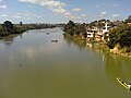
The São Mateus River is a river primarily in Espírito Santo state in eastern Brazil. The São Mateus River rises in the Brazilian state of Minas Gerais...
3 KB (246 words) - 13:53, 17 February 2023

Castelo's borders are: Alfredo Chaves and Domingos Martins (E), Venda Nova do Imigrante and Conceição do Castelo (N), Muniz Freire and Alegre (W) and...
7 KB (405 words) - 12:08, 18 February 2024
20°51′46″S 40°56′09″W / 20.86278°S 40.93583°W / -20.86278; -40.93583 Rio Novo do Sul is a municipality located in the Brazilian state of Espírito Santo. Its...
692 bytes (65 words) - 21:11, 17 July 2023

2016-10-26. Retrieved 2016-10-26. "Heavy Minerals". Industrias Nucleares do Brasil. Archived from the original on 2012-11-27. Retrieved 2012-08-06. "High...
9 KB (634 words) - 23:09, 15 April 2024

Divino de São Lourenço is a municipality located in the Brazilian state of Espírito Santo. Its population was 4,649 (2015) and its area is 174 km2. IBGE...
3 KB (31 words) - 01:31, 12 July 2022

following the São Paulo Revolt of 1924, in which some labor leaders took part, Passos was deported to the penal colony of Clevelândia do Norte, on the border...
17 KB (2,362 words) - 20:56, 11 April 2024