
The term tithe map is usually applied to a map of an English or Welsh parish or township, prepared following the Tithe Commutation Act 1836. This act...
8 KB (1,121 words) - 02:51, 14 March 2025

A tithe (/taɪð/; from Old English: teogoþa "tenth") is a one-tenth part of something, paid as a contribution to a religious organization or compulsory...
71 KB (8,623 words) - 17:20, 22 April 2025
Tithe commutation was a 19th-century reform of land tenure in Great Britain and Ireland, which implemented an exchange of the payment of a tithe to the...
5 KB (563 words) - 23:37, 18 August 2024

A tithe barn was a type of barn used in much of northern Europe in the Middle Ages for storing rents and tithes. Farmers were required to give one-tenth...
11 KB (978 words) - 14:28, 8 July 2025


West Chelborough (section Tithe map)
decennial census was as follows: The subsoil is chalk and greensand. The tithe map, dated 1839, is at the scale of one inch to six chains. George Bullock...
8 KB (827 words) - 23:18, 25 June 2025
This holding still exists, although by the time of the 19th-century tithe map it had become known as Whitehall Six Acres. The Peasants' Revolt was triggered...
3 KB (231 words) - 02:45, 6 February 2025

the maps. It is entitled ′Conventional signs to be used in the plans made under the Act for the Commutation of Tithes in England and Wales′ Tithes were...
10 KB (1,239 words) - 20:40, 28 April 2025

Cotta’s Ridge, and there is a clear ridge running up from Breedon Hill. The Tithe Map records a feature of Near and Far Motts, now beneath the housing development...
68 KB (10,304 words) - 13:37, 30 May 2025

National Library of Wales (section Maps)
Sense of Place" project has created a unified tithe map of Wales by digitising over a thousand tithe maps. Cynefin is a partnership between Archives Wales...
113 KB (11,979 words) - 18:00, 4 June 2025

Llyn y Tri Greyenyn (category Articles using infobox body of water without pushpin map alt)
Morrises of Anglesey (1735-1786), Y Cymmrodor, vol. XLIX, part I (1947), p. 196. Dolgellau Parish Tithe Map, Welsh Tithe Maps, National Library of Wales....
5 KB (693 words) - 15:05, 22 September 2024

Gilbert de Clare, 1st Earl of Pembroke before his death in 1148. The 1850 tithe map, drawn up before the parish boundaries were extended in the later 19th...
39 KB (4,728 words) - 03:20, 7 July 2025

the undisputed sovereign of all the mountains in South Wales'. On the tithe map for Cantref parish (1839), the peak of Pen y Fan is called 'Beacon'. This...
18 KB (1,854 words) - 10:01, 19 June 2025

undisputed sovereign of all the mountains in South Wales', and an 1839 tithe map of Cantref parish labels the mountain simply 'Beacon'. A slightly wider...
15 KB (1,331 words) - 11:07, 24 May 2025

later given a Latin name, Vaga, an adjective meaning 'wandering'. The Tithe map references a Vagas Field in both Whitchurch and Chepstow. Philologists...
46 KB (4,548 words) - 15:34, 29 June 2025
Tithal is an out growth in Valsad district of Gujarat. Tithal is located around 4.1 kilometer away from its district headquarter Valsad. It is known for...
3 KB (68 words) - 03:32, 31 October 2023

'Hellgelders', marked on the Tithe Map". www.heritagegateway.org.uk. Heritage Gateway. 2012. Retrieved 9 June 2019. The Tithe Award for Egloshayle records...
80 KB (9,180 words) - 03:53, 8 November 2024

to 761. The Tithe Commissioners' survey carried out in 1841 provides details of the size and tenure of every piece of land. The tithe map reveals the...
61 KB (6,830 words) - 11:51, 4 July 2025
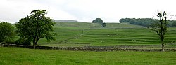
unitary North Yorkshire Council. According to the Austwick & Lawkland Tithe Map of 21 October 1851 the parish has an area of 8,201 acres (33.19 km2) of...
8 KB (959 words) - 16:55, 2 July 2025

Historically, Ham covered a larger area. The boundaries shown in the tithe map of 1843 are believed to have changed little, if at all, for centuries...
47 KB (4,998 words) - 17:29, 14 June 2025
Precedence. Examples of this may be found in the parish tithe map schedules made under the Tithe Commutation Act 1836. Later examples appear in the list...
39 KB (4,542 words) - 00:31, 4 July 2025

Roads Act 1768 The Wellow Tithe Map, 1839 The Dunkerton Tithe Map, 1841 The Camerton Tithe Map, 1844 The Dunkerton Tithe Map, 1841; field 326 1841 United...
22 KB (2,510 words) - 18:36, 25 January 2025

East Dundry (section Tithes)
Bristol Record Office accession 44394 Ordnance Survey Geology map See "FARM" on the tithe map Inhabitant's childhood night memories. Parish website...
12 KB (1,622 words) - 22:23, 15 June 2025
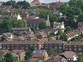
1830 Borstal House was built near the farm, and at the time of the 1840s Tithe Map the settlement was just a hamlet of a few cottages, mostly owned by local...
6 KB (791 words) - 13:03, 11 June 2025

ISBN 0-85033-161-7. Tithe Map and Apportionments of Northfield Parish, Worcestershire. 1839. Walker, Peter L, ed. (2011). Tithe Apportionments of Worcestershire...
48 KB (6,907 words) - 20:12, 4 May 2025
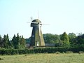
century at Farningham. The windmill was marked on Greenwoods map of 1821 and the Farningham Tithe Map of 1840. In 1880, it was moved to Kingsdown, where there...
10 KB (1,336 words) - 23:44, 10 May 2025

Studies Cheshire Tithe Maps Online Grid Ref SJ771599 Map Ref EDT 44/2 Township Betchton Map Date 1841 Available at Cheshire Tithe Maps Online Cheshire...
25 KB (3,712 words) - 07:17, 3 July 2025

ISBN 0-85033-161-7. Tithe Map and Apportionments of Northfield Parish, Worcestershire. 1839. Walker, Peter L, ed. (2011). Tithe Apportionments of Worcestershire...
76 KB (11,470 words) - 08:26, 7 July 2025

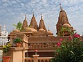
Tithing is a commandment accepted by various churches in the Latter Day Saint movement. In practicing tithing, adherents make willing tithe donations...
24 KB (2,522 words) - 20:36, 3 May 2025

out formal gardens between the two sites. Plans of 1674 and 1807, and a tithe map of 1738, show a two-storey mansion with mansard roofs and shallow projecting...
8 KB (801 words) - 04:46, 8 July 2025