
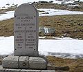
Col de la Bonette (el. 2,715 metres (8,907 ft)) is a high mountain pass in the French Alps, near the border with Italy. It is situated within the Mercantour...
6 KB (495 words) - 07:41, 13 November 2023
Jersey Companion to the Tour de France. London: Yellow Jersey Press. p. 261. ISBN 0-224-06318-9. Map of the Col de la Bonette and the Col de Restefond...
2 KB (150 words) - 08:41, 31 May 2024
Valley and Saint-Martin-d'Entraunes. It lies parallel to the Col d'Allos and Col de la Bonette in the Parc National du Mercantour. The Var River has its...
2 KB (114 words) - 21:47, 13 November 2023
Cime de la Bonette reaching the summit of 2802 m, which is the highest point reached by the Tour de France, before re-passing the Col de la Bonette. On...
3 KB (294 words) - 02:00, 13 November 2023

the Col de Vars (2,111 m (6,926 ft)) and onto Barcelonnette via Jausiers, where the choice can be made to turn south over the Col de la Bonette (2,802 m...
3 KB (372 words) - 10:16, 30 October 2023

the Ubaye Valley and Colmars. It lies parallel to the Col de la Cayolle and Col de la Bonette west of the Parc National du Mercantour. The source of...
4 KB (391 words) - 22:08, 15 December 2023
mountain passes Preview of Bonette Stage in 2008 Tour de France Profile on climbbybike.com Le col de la Lombarde dans le Tour de France (in French) v t e...
3 KB (205 words) - 16:55, 13 November 2023
Its source is on the east side of the Col de la Bonette, in the Maritime Alps. It flows through Saint-Étienne-de-Tinée, Isola and Saint-Sauveur-sur-Tinée...
2 KB (110 words) - 14:03, 27 November 2021
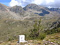
860 m (9,383 ft) at the Cime de la Bonette in the Alps, a short loop road which forks from the summit of the Col de la Bonette. As of 2019[update], this...
129 KB (6,065 words) - 13:52, 22 May 2024

artillery block and three observation blocks at the summit of the Col de la Bonette. The entry block and an artillery block were not completed, and a...
7 KB (641 words) - 07:25, 19 May 2021

Vermenagna creek, Col de Tende - which connects them with the Ligurian Alps - and Roya (east); Mediterranean Sea and Var valley (south) Verdon, Col d'Allos -...
7 KB (352 words) - 08:12, 30 May 2024

topographical order from west to east, the Maddalena Pass, the Col de Montgenèvre, the Col du Mont Cenis, the two St Bernard passes (Little St Bernard Pass...
16 KB (1,063 words) - 05:48, 16 March 2024

of the Var in the commune of Entraunes. Then the route follows the Col de la Bonette – the highest pass in Europe at 2,715 metres (8,907 ft) – to connect...
47 KB (4,337 words) - 08:43, 31 May 2024

Jack Thompson (cyclist) (category CS1 German-language sources (de))
Project. The locations for this expedition were Passo Stelvio in Italy, Col de la Bonette in France and Port d’Envalira in Andorra. Thompson set the Guinness...
12 KB (1,027 words) - 08:14, 8 February 2024

Europe: the main road D64 reaches an altitude of 2802 m near the Col de la Bonette (2715 m) and connects the region of Barcelonnette to the Tinée and...
56 KB (6,191 words) - 12:50, 9 March 2024

ISBN 9783829766135. "Le col ou cime de la Bonette ou col de Restefond dans le Tour de France" (in French). ledicodutour. Retrieved 8 August 2022. "Cols du Télégraphe...
88 KB (1,247 words) - 15:47, 19 May 2024

Pass – Austria Bocchetta del Croso – Italy Bocchetto Sessera – Italy Col de la Bonette – France Brenner Pass – Austria/Italy Colle di Cadibona – Italy Colle...
43 KB (3,236 words) - 11:09, 27 March 2024

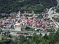
Alpes-Maritimes General Council completed the route leading to the Col de la Bonette. The RN 205 is downgraded to RD 2205 following the reform of 1972...
7 KB (704 words) - 11:56, 27 September 2023

Les Laussets: the lakes of Morgon. On the way of the Col de la Bonette from the Saint-Étienne-de-Tinée side, two main itineraries are possible. From the...
3 KB (312 words) - 17:16, 9 January 2022

Ubaye Valley (category Landforms of Alpes-de-Haute-Provence)
Cayolle and Col d'Allos (closed in winter) From the Tinée (South) : Col de la Bonette at 2,750 meters, the highest road of Alps and the highest road in...
5 KB (655 words) - 04:12, 9 March 2024
Hors catégorie (category Tour de France)
per Tour. When the mountains classification in the Tour de France originated in the 1933 Tour de France, there was only one type of mountain. Points were...
13 KB (443 words) - 05:33, 4 August 2023

of the Pra on the route of the col de la Bonette or from Saint-Étienne-de-Tinée. "Grands sites de la Tinée: les lacs de Vens". Le Parc national du Mercantour...
2 KB (138 words) - 18:05, 9 January 2022

the Col de la Bonette from the Tinée side, stop at the Camp des Fourches, and go to the Col des Fourches. Follow the GR 5 to go down in the ravin de Cougnas...
3 KB (223 words) - 17:16, 9 January 2022

Massif du Mercantour-Argentera (category CS1 German-language sources (de))
mountain range between the Rocher des Trois-Évêques (near the Col de la Bonette) and the Col de Tende. The massif is made up of a main range, oriented northwest/southeast...
81 KB (8,040 words) - 01:44, 4 June 2024

climb to the summit of the Cime de la Bonette Alpine mountain, including the Col de Restefond and Col de la Bonette passes, was used for the first time...
108 KB (7,503 words) - 14:28, 25 January 2024
highest peak ever reached is Cime de la Bonette-Restefond (2,802 m (9,193 ft)), used in the 1962, 1964, 1993 and 2008 Tour de France. The highest mountain...
51 KB (1,271 words) - 17:58, 30 May 2024
de Beille Little St Bernard Pass Col du Berthiand Col de la Bonette Col du Bonhomme Mont Cenis Chamrousse Col des Chevrères Col de la Colombière Col de...
8 KB (834 words) - 11:38, 27 September 2023

to France on this short stage, via the hors catégorie Col de la Lombarde and Col de la Bonette (the highest pass in Europe at over 2,800 m altitude),...
57 KB (2,921 words) - 18:15, 25 January 2024

was the Cime de la Bonette-Restefond in the 1962 Tour de France, reaching 2802 m. The highest mountain finish in the Tour was at the Col du Galibier in...
42 KB (2,616 words) - 10:08, 16 May 2024

difficult than the 1992 Tour de France. The highest point of elevation in the race was 2,802 m (9,193 ft) at the Cime de la Bonette loop road on stage 11. The...
57 KB (1,682 words) - 20:11, 2 June 2024