
Hyperbolic navigation is a class of radio navigation systems in which a navigation receiver instrument is used to determine location based on the difference...
38 KB (5,303 words) - 23:05, 31 August 2024

global-range radio navigation system, operated by the United States in cooperation with six partner nations. It was a hyperbolic navigation system, enabling...
22 KB (2,818 words) - 08:37, 13 April 2025
Global Positioning System (redirect from Navigation Signal Timing and Ranging Global Positioning System)
satellite-based hyperbolic navigation system owned by the United States Space Force and operated by Mission Delta 31. It is one of the global navigation satellite...
185 KB (19,124 words) - 16:20, 13 May 2025

global-range radio hyperbolic navigation system, no longer in use Alpha, the Russian counterpart of the Omega Navigation System Celestial navigation using the...
10 KB (967 words) - 13:41, 14 December 2024

needed] Since the 1960s, navigation has increasingly moved to satellite navigation systems. These are essentially hyperbolic systems whose transmitters...
40 KB (5,315 words) - 22:23, 16 January 2025

The field of navigation includes four general categories: land navigation, marine navigation, aeronautic navigation, and space navigation. It is also the...
82 KB (9,369 words) - 16:49, 21 April 2025

metres at ranges up to about 350 miles (560 km). It was the first hyperbolic navigation system to be used operationally, entering service with RAF Bomber...
53 KB (7,603 words) - 20:11, 13 February 2025
known: the problem is to identify the positions for all sensors. Hyperbolic navigation is one pre-GPS technology that uses distance geometry for locating...
19 KB (3,316 words) - 06:13, 27 January 2024
Pseudo-range multilateration (redirect from Hyperbolic positioning)
the TOAs are multiple and known. When MLAT is used for navigation (as in hyperbolic navigation), the waves are transmitted by the stations and received...
73 KB (9,850 words) - 15:55, 4 February 2025
LORAN (redirect from Loomis radio navigation)
LORAN (Long Range Navigation) was a hyperbolic radio navigation system developed in the United States during World War II. It was similar to the UK's...
40 KB (5,780 words) - 12:16, 23 April 2025
ELoran (category Aeronautical navigation systems)
E-LORAN, or e-LORAN) is a long-range radio navigation system that uses terrestrial towers and the hyperbolic navigation technique. It is an advancement in receiver...
5 KB (510 words) - 13:33, 27 April 2025
Loran-C (category Radio navigation)
Loran-C is a hyperbolic radio navigation system that allows a receiver to determine its position by listening to low frequency radio signals that are...
82 KB (8,941 words) - 12:32, 23 April 2025

the TOAs are multiple and known. When MLAT is used for navigation (as in hyperbolic navigation), the waves are transmitted by the stations and received...
3 KB (1,261 words) - 18:44, 31 May 2024

at a point on an ellipsoid of revolution, the hyperbolae used in hyperbolic navigation (which determines position based on the difference in received signal...
12 KB (1,056 words) - 02:30, 20 January 2025

Missile guidance (section Proportional navigation)
navigation Global positioning system (GPS) Global navigation satellite system (GLONASS) Hyperbolic navigation DECCA LORAN C Preset guidance is the simplest...
25 KB (3,288 words) - 11:42, 4 February 2025
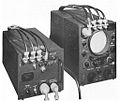
Transponder-based navigation system – GEE-H AMES Type 700, 1.7–2.0 MHz Hyperbolic navigation system – LORAN AMES Type 7000, 30–60 MHz Hyperbolic navigation system...
11 KB (1,476 words) - 14:58, 13 November 2024

Project 3, a long-range navigation system, was of particular interest to Great Britain. They had an existing hyperbolic navigation system, called GEE, but...
26 KB (3,404 words) - 14:37, 4 May 2025
Decca Navigator System (redirect from Decca navigation)
The Decca Navigator System was a hyperbolic radio navigation system that allowed ships and aircraft to determine their position by using radio signals...
30 KB (4,330 words) - 21:08, 29 April 2025

CORDIC (redirect from Hyperbolic mode)
CORDIC (Jack E. Volder), Linear CORDIC, Hyperbolic CORDIC (John Stephen Walther), and Generalized Hyperbolic CORDIC (GH CORDIC) (Yuanyong Luo et al.)...
71 KB (7,232 words) - 23:22, 8 May 2025
started development of a number of night navigation aids and were already testing the Gee hyperbolic navigation system on operations. These would be available...
36 KB (5,134 words) - 22:46, 16 February 2025

SHANICLE (Short Range Navigation Vehicle) guidance system. This was essentially an adaptation of the LORAN hyperbolic navigation system to microwave frequencies...
23 KB (2,866 words) - 19:23, 18 April 2025

SOFAR channel (category Navigation)
the 1962 edition of The American Practical Navigator among the hyperbolic navigation systems. The early applications relied on fixed shore stations,...
23 KB (2,403 words) - 23:43, 17 April 2025

Gudermannian function (redirect from Hyperbolic amplitude)
In mathematics, the Gudermannian function relates a hyperbolic angle measure ψ {\textstyle \psi } to a circular angle measure ϕ {\textstyle \phi } called...
38 KB (5,369 words) - 03:48, 30 March 2025

Hyperbola (redirect from Hyperbolic arc)
cone Hyperbolic cylinder Hyperbolic paraboloid Hyperboloid of one sheet Hyperboloid of two sheets Elliptic cone Hyperbolic cylinder Hyperbolic paraboloid...
75 KB (13,585 words) - 01:57, 27 January 2025
Lorenz beam (redirect from Lorenz (navigation))
Blanchard, Walter (September 1991). "Air Navigation Systems Chapter 4. Hyperbolic Airborne Radio Navigation Aids – A Navigator's View of their History...
12 KB (1,805 words) - 14:33, 15 April 2025
from Blanchard, W. F. (September 1991). "Air Navigation Systems Chapter 4. Hyperbolic Airborne Radio Navigation Aids – A Navigator's View of their History...
18 KB (2,682 words) - 20:11, 13 February 2025

Azimuth (category Navigation)
to 360° or in the signed range -180° to +180°. The concept is used in navigation, astronomy, engineering, mapping, mining, and ballistics. The word azimuth...
14 KB (1,766 words) - 01:59, 15 February 2025
Möbius transformation (redirect from Hyperbolic transform)
orientation-preserving isometries of hyperbolic 3-space and therefore plays an important role when studying hyperbolic 3-manifolds. In physics, the identity...
70 KB (10,603 words) - 05:07, 10 April 2025

Rhumb line (category Navigation)
In navigation, a rhumb line, rhumb (/rʌm/), or loxodrome is an arc crossing all meridians of longitude at the same angle, that is, a path with constant...
21 KB (2,870 words) - 08:32, 14 January 2025

Gnomonic projection (category Navigation)
projection of the hyperboloid of two sheets, treated as a model for the hyperbolic plane, is called the Beltrami–Klein model. The gnomonic projection is...
13 KB (1,522 words) - 18:23, 16 March 2025