The Imperial Highway is a west-east thoroughfare in the counties of Los Angeles, Orange, Riverside, San Diego, and Imperial in the U.S. state of California...
8 KB (683 words) - 00:15, 11 February 2024
/ 33.930984; -118.233048 It is located at 11541 Croesus Avenue on Imperial Highway, between Grape Street and Mona Boulevard, near the 105 Freeway. The...
4 KB (390 words) - 13:22, 22 April 2024
California county routes in zone S (redirect from Imperial Country Route S80)
county highways in Imperial, Orange, Riverside, San Diego, and Santa Barbara counties. County Route S1 (CR S1), also known as Sunrise Highway for a portion...
105 KB (6,564 words) - 16:37, 15 April 2024

California State Route 90 (redirect from California State Highway 90)
just past Culver Boulevard. The eastern portion of SR 90 runs along Imperial Highway between Beach Boulevard (State Route 39) in La Habra and State Route...
16 KB (1,434 words) - 00:32, 23 February 2024
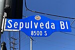
Pacific Coast Highway from Rosecrans Avenue to Imperial Highway where SR 1 continues again as Sepulveda Boulevard. Past Imperial Highway, it crosses the...
20 KB (1,617 words) - 00:00, 23 March 2024
Imperial is a town in the Canadian province of Saskatchewan. The town is located along Highway 2. In the 2021 Census of Population conducted by Statistics...
9 KB (302 words) - 05:09, 2 May 2024

Interstate 105 (California) (redirect from California State Highway 105)
The western terminus of I-105 is at Sepulveda Boulevard (SR 1) and Imperial Highway on the southern edge of Los Angeles International Airport (LAX), near...
22 KB (1,962 words) - 19:34, 29 April 2024
Learning Center, is a museum located at 6661 Imperial Highway and was formerly known as the "West Imperial Terminal". This building used to house some...
189 KB (12,570 words) - 08:18, 27 May 2024

March of the Iron Will (section Imperial highway)
to be superfluous. Badoglio's mechanized force advanced along the Imperial Highway between Dessie and Addis Ababa. The Italian Commander-in-Chief was...
19 KB (2,290 words) - 22:22, 24 May 2024
County Fire Department. The LACFD operates Station #147 at 3161 East Imperial Highway and Station #148 at 4262 Martin Luther King Jr. Boulevard, both in...
32 KB (2,609 words) - 00:35, 25 May 2024

Campbell. The complex occupies the blocks northeast of the corner of Imperial Highway and Central Avenue, and southwest of 111th St and Compton Avenue. It...
5 KB (511 words) - 23:29, 22 April 2024

California State Route 1 (redirect from California State Highway 1)
Montana Highway 200. SR 1 has several portions designated as either Pacific Coast Highway (PCH), Cabrillo Highway, Shoreline Highway, or Coast Highway. Its...
136 KB (9,232 words) - 16:46, 12 May 2024

becoming the emperor. He was also made the faujdar of Mathura, and the imperial highway from Delhi to Agra was placed under his protection by the Mughal Emperor...
5 KB (509 words) - 13:51, 20 May 2024

I-405 south (San Diego Freeway) I-405 south exit 45B/Imperial Highway east 1.0 1.6 Imperial Highway to I-405 north (San Diego Freeway) I-405 north exit...
12 KB (747 words) - 08:01, 31 March 2024

Interstate 8 (redirect from Kumeyaay Highway)
1964 state highway renumbering; east of San Diego, the US 80 roadway was slowly replaced by I-8 as construction progressed in the Imperial Valley. The...
111 KB (11,974 words) - 18:13, 28 May 2024

Imperial Highway (SR 90) and Yorba Linda Boulevard/Weir Canyon Road run as south–north roads in the city of Anaheim, but north of Anaheim, Imperial Highway...
81 KB (7,218 words) - 14:49, 24 May 2024

California State Route 142 (redirect from California State Highway 142)
route is known as Chino Hills Parkway. Running from State Route 90, Imperial Highway, in Brea to State Route 71 in Chino Hills, SR 142 is a popular shortcut...
7 KB (1,052 words) - 06:00, 22 August 2023

The imperial system of units, imperial system or imperial units (also known as British Imperial or Exchequer Standards of 1826) is the system of units...
76 KB (6,563 words) - 20:39, 17 May 2024

neighborhood of the city of Los Angeles. It is bounded on the north by Imperial Highway, on the east by Vermont Avenue, on the south by El Segundo Boulevard...
6 KB (448 words) - 23:22, 27 May 2024

Huntington Drive Imperial Highway La Brea Avenue Manchester Avenue Melrose Avenue Mission Road Mulholland Drive Normandie Avenue Pacific Coast Highway Slauson...
4 KB (255 words) - 10:05, 30 October 2023

the east side of the river from Willow Street in Long Beach to the Imperial Highway. Mileage markers are painted on the pavement and signs are posted at...
5 KB (329 words) - 01:09, 19 May 2024
Chang, Andrea (April 17, 2018). "L.A. Times will move to 2300 E. Imperial Highway in El Segundo". Los Angeles Times. Retrieved July 19, 2018. "Biotech...
96 KB (9,772 words) - 21:05, 27 May 2024

three sides. It also shares a small border on the northeast along Imperial Highway with the unincorporated community of Westmont. The Century Freeway...
46 KB (3,907 words) - 09:06, 21 May 2024

Aviation/LAX station (redirect from Aviation/Imperial station)
Boulevard, after which the station is named, near its intersection with Imperial Highway and south of Century Freeway in Los Angeles, California. It opened...
10 KB (634 words) - 10:43, 29 April 2024

Angeles Times building (2018— ), a mid-century eight-story building on Imperial Highway in El Segundo, located near the Los Angeles International Airport The...
5 KB (395 words) - 10:05, 8 May 2024

Inglewood, California (redirect from Crenshaw-Imperial)
the east, and Imperial Highway on the south. A shopping center on the northeastern quadrant of the intersection of Crenshaw and Imperial was also constructed...
104 KB (8,793 words) - 00:32, 25 May 2024

blunt-force trauma. Hereford was last seen at Snappy's Liquor near Imperial Highway and Normandie Avenue in Westmont, California, placing her in the same...
47 KB (5,189 words) - 13:51, 24 May 2024
freeways and three California state highways; SR 39 (covers Whittier and Beach Boulevards), SR 90 (Imperial Highway), and SR 72 (Whittier Boulevard) serve...
30 KB (2,404 words) - 17:37, 14 May 2024

California State Route 86 (redirect from California State Highway 86)
State Route 86 (SR 86) is a north–south state highway in the U.S. State of California that connects the Imperial and Coachella valleys in the southeastern...
13 KB (1,095 words) - 05:31, 28 March 2024
Interstate 605 (redirect from California State Highway 605)
Freeway) is a 27-mile-long (43 km) major north–south auxiliary Interstate Highway in the Greater Los Angeles urban area of Southern California. It runs from...
16 KB (1,036 words) - 23:08, 3 May 2024