
The scale of a map is the ratio of a distance on the map to the corresponding distance on the ground. This simple concept is complicated by the curvature...
35 KB (5,382 words) - 16:07, 7 March 2024

commonly used to depict geography, maps may represent any space, real or fictional, without regard to context or scale, such as in brain mapping, DNA mapping...
35 KB (4,295 words) - 20:26, 23 May 2024

In modern mapping, a topographic map or topographic sheet is a type of map characterized by large-scale detail and quantitative representation of relief...
20 KB (2,043 words) - 19:20, 2 May 2024
A linear scale, also called a bar scale, scale bar, graphic scale, or graphical scale, is a means of visually showing the scale of a map, nautical chart...
6 KB (605 words) - 06:42, 18 May 2024

assign slightly different coordinates to the same location, so in large scale maps, such as those from national mapping systems, it is important to match...
58 KB (6,482 words) - 15:55, 11 January 2024
the distance on a map to the corresponding actual distance Scale (geography) Weighing scale, an instrument used to measure mass Scale (ratio), the ratio...
4 KB (548 words) - 23:29, 27 March 2024
Cartographic generalization (redirect from Map generalization)
generalization, or map generalization, includes all changes in a map that are made when one derives a smaller-scale map from a larger-scale map or map data. It...
34 KB (4,327 words) - 21:04, 1 March 2024

world map is a map of most or all of the surface of Earth. World maps, because of their scale, must deal with the problem of projection. Maps rendered...
9 KB (834 words) - 21:28, 20 May 2024

Cartogram (redirect from World map scaled by population)
symbol maps, which scale point features, and many flow maps, which scale the weight of linear features. However, these two techniques only scale the map symbol...
41 KB (4,106 words) - 12:09, 21 March 2024
time, one of the most reliable maps of the two hemispheres was the first large-scale map drawn in Armenian. The world map was created in a Western cartographic...
74 KB (8,674 words) - 21:29, 20 May 2024

Ordnance Survey (redirect from OS Map(s))
classified as either "large-scale" (in other words, more detailed) or "small-scale". The Survey's large-scale mapping comprises 1:2,500 maps for urban areas and...
84 KB (8,594 words) - 08:19, 9 May 2024

A map series is a group of topographic or thematic charts or maps usually having the same scale and cartographic specifications, and with each sheet appropriately...
17 KB (2,087 words) - 00:41, 27 January 2024
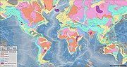
In geography, scale is the level at which a geographical phenomenon occurs or is described. This concept is derived from the map scale in cartography....
4 KB (407 words) - 11:43, 2 June 2023

A city map is a large-scale thematic map of a city (or part of a city) created to enable the fastest possible orientation in an urban space. The graphic...
8 KB (939 words) - 15:28, 10 December 2023

Mercator projection (redirect from Mercator map projection)
latitude scale on the map, then the rhumb distance between map points with latitudes φ1 and φ2 is given by the above. If there is no such scale then the...
44 KB (6,205 words) - 22:16, 23 May 2024

a dimensional scale. A weather map at some scale may be annotated with wind arrows at a dimensional scale of 1 cm to 20 mph. Map scales require careful...
4 KB (510 words) - 19:13, 3 April 2023

000 scale sheet, the work was completed. The map sheets have been produced in several different versions: topographic maps, tourist maps, special maps (for...
4 KB (426 words) - 07:44, 5 September 2023

A road map, route map, or street map is a map that primarily displays roads and transport links rather than natural geographical information. It is a type...
12 KB (1,462 words) - 15:59, 14 April 2024
Scale (ratio) Scale (map) Scale factor (computer science) Scale factor (cosmology) Scales of scale models Scaling in statistical estimation Scaling in...
10 KB (1,610 words) - 14:19, 9 May 2024

outward to the edges. Instead, each triangle edge of the Dymaxion map matches the scale of a partial great circle on a corresponding globe, and other points...
12 KB (1,246 words) - 21:23, 6 February 2024
booklets (memoirs) are produced for many sheets at the 1:50,000 scale. Small scale thematic maps (1:1,000,000 to 1:100,000) are also produced covering geochemistry...
12 KB (1,560 words) - 21:30, 16 November 2023

Contour line (redirect from Contour map)
contour interval should be the same over a single map. When calculated as a ratio against the map scale, a sense of the hilliness of the terrain can be...
36 KB (4,352 words) - 21:08, 14 May 2024
Orders of magnitude (length) Scale (analytical tool) Scale (geography) Scale (map) Scale (ratio) Location of Earth "Scale". The Pennsylvania State University...
3 KB (234 words) - 19:33, 8 February 2024
Outside the US and Canada, Yahoo! Maps Beta can recognize city, province, and country names, and provide a small-scale map or satellite views. Right click...
10 KB (1,115 words) - 08:34, 5 January 2024
The Kardashev scale (Russian: Шкала́ Кардашёва, romanized: Shkalá Kardashova) is a method of measuring a civilization's level of technological advancement...
142 KB (16,821 words) - 17:14, 15 May 2024

original scale of 1/11.5. The map was made in response to a request by Prince Charles Alexander of Lorraine. It is the first systematic, large scale mapping...
2 KB (295 words) - 18:49, 14 September 2023
dropped. The rules above are to be obeyed for large-scale maps. If the map being drawn is a small-scale map (less than 1:500 000 according to Imhof), rules...
6 KB (676 words) - 18:43, 7 October 2023
Scalability is the property of a system to handle a growing amount of work. One definition for software systems specifies that this may be done by adding...
16 KB (1,940 words) - 15:48, 24 January 2024

conception of scaling. The OS-Map regards the scale as a statistical description of how many best-matching nodes an input has in the map. Deep learning...
33 KB (3,866 words) - 02:43, 4 May 2024

Transverse Mercator projection (redirect from Gauss–Krüger map projection)
accurate large-scale maps. In constructing a map on any projection, a sphere is normally chosen to model the Earth when the extent of the mapped region exceeds...
37 KB (4,481 words) - 08:45, 7 November 2023