
Germany, as many German maps portray the two entities as such. Derivative works of this file: BlankMap-World-WWII-2011-23-08.PNG English determination...
(1,500 × 740 (103 KB)) - 16:49, 26 November 2023

"File:BlankMap-World-1985.png" (World map: blank, with borders (1985)) 2006-03-26T17:41:59 E Pluribus Anthony (talk | contribs) uploaded "File:BlankMap-World-1985...
(1,500 × 740 (90 KB)) - 16:48, 26 November 2023

Blank political map of the world showing 2005 borders (i.e. before the independence of Montenegro and Kosovo). Based on Image:BlankMap-World.png; as it...
(1,425 × 625 (18 KB)) - 16:48, 26 November 2023

Blank political map of the world showing 2007 borders (i.e. before the independence of Kosovo). Based on Image:BlankMap-World-2005.png; as it is PD, this...
(1,425 × 625 (18 KB)) - 16:48, 26 November 2023

2006-06-14 23:55 Earl Andrew 1357×628× (46593 bytes) {{pd-self}} based on [http://upload.wikimedia.org/wikipedia/commons/1/1d/BlankMap-World-WWII.PNG] English...
(1,280 × 1,280 (522 KB)) - 14:43, 14 June 2023

Previous map currently available (there are missing steps, see here): Image:BlankMap-World-1990.png Next map: Image:BlankMap-World-2000.png English determination...
(1,500 × 740 (90 KB)) - 16:48, 26 November 2023

Blank map of the world showing 2000 borders (i.e. before 9/11 and the independence of E. Timor and Montenegro). Based off Image:BlankMap-World.png; as...
(1,425 × 625 (18 KB)) - 16:48, 26 November 2023

Blank map of the world showing 1990 borders. Based off Image:BlankMap-World.png; as it is PD, this is too. (Accurate for the period between German re-unification...
(1,425 × 625 (17 KB)) - 16:48, 26 November 2023

Blank political map of the world from 1946, derived from Image:BritishEmpire1921.png. Derivative works of this file: Kellogg Briand Pact countries.png...
(1,425 × 625 (39 KB)) - 16:48, 26 November 2023

Blank map of countries around the time of World War I (1914-18), based on w:Image:WWI.png English determination method or standard: SHA-1...
(1,425 × 625 (40 KB)) - 16:49, 26 November 2023

World map Blank political map of the world in 1500 based on Image:BlankMap-World.png I, the copyright holder of this work, hereby publish it under the...
(1,356 × 627 (45 KB)) - 19:11, 5 September 2024

Blank political map of the world in 1872 based on Image:BlankMap-World.png I, the copyright holder of this work, hereby publish it under the following...
(1,356 × 627 (14 KB)) - 19:11, 5 September 2024

This map was created by SteveGOLD (original upload on 10 June 2006) based on map by Astrokey44 and was located at en:File:1934 World Cup.png (page also...
(1,357 × 628 (51 KB)) - 21:04, 23 August 2023

Operators of the [[Gloster Gladiator]] and Sea Gladiator. Own work, derivative of image:BlankMap-World-WWII.png. == Licensing == {{PD-self}} English...
(1,357 × 628 (29 KB)) - 11:41, 24 January 2022

Blank map of the world in 1840 based on Image:BlankMap-World.png I, the copyright holder of this work, hereby publish it under the following licenses:...
(1,356 × 627 (20 KB)) - 16:48, 26 November 2023

Blank map of the world in 1861 based on Image:BlankMap-World.png I, the copyright holder of this work, hereby publish it under the following licenses:...
(1,356 × 627 (20 KB)) - 19:09, 5 September 2024

World political map, derived from Image:World 820(1).png English determination method or standard: SHA-1...
(1,357 × 628 (31 KB)) - 19:40, 22 May 2024

English: world empires and colonies 1920 (following the First World War) derived from Image:BlankMap-World-WWII.PNG 中文:第一次世界大戰後1920年世界上的帝國和殖民地 Great...
(1,616 × 634 (35 KB)) - 15:10, 10 November 2024

the license of your choice. English Operators of the Boeing P-26. Own work, derivative of File:BlankMap-World-WWII.PNG. Chinese 波音P-26戰鬥機的運營商。 自己的作品。...
(1,357 × 628 (29 KB)) - 08:39, 8 January 2025

Derivative works of this file: Romania WWII ES.png Romania WWII blank.png English Wikimedia username: Ori~ URL: https://commons.wikimedia.org/wiki/user:Ori%7E...
(366 × 289 (27 KB)) - 23:18, 27 October 2020

Political map of the world 1866, derived from Image:Imperio Ruso.PNG English determination method or standard: SHA-1...
(1,357 × 628 (18 KB)) - 19:08, 5 September 2024

GPL. Search: România Romania Gangleri | Th | T 10:59, 1 Apr 2005 (UTC) Derivative works of this file: Romania WWII ES.png Romania WWII blank.png English...
(366 × 289 (30 KB)) - 18:11, 14 September 2020
العالمية الثانية English: world empires and colonies 1936 (before the Second World War) derived from Image:BlankMap-World-WWII.PNG 中文(中国大陆):1936年,第二次世界大...
(1,527 × 624 (44 KB)) - 15:39, 16 July 2023

World map with 1962 borders. This is accurate between July 1, 1962 (Belgian colony of Ruanda-Urundi separated into Rwanda and Burundi.) and August 31...
(1,357 × 628 (48 KB)) - 16:48, 26 November 2023

Blank map of the world showing 1957 borders. This is accurate in the period between December 13, 1956 (British Togoland joins with the Gold Coast before...
(1,425 × 625 (37 KB)) - 16:48, 26 November 2023

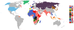
339 242 1480 625 Oceania 6 372 255 235 1480 625 Oceania English A blank map of the world as of 2022 Indonesian Sebuah peta kosong dunia sejak tahun 2022...
(1,500 × 740 (43 KB)) - 01:47, 6 May 2025

Blank map of the world from 1710, derived from Image:WaroftheSpanishSuccession.png. I, the copyright holder of this work, hereby publish it under the following...
(1,357 × 628 (43 KB)) - 19:11, 5 September 2024

|Description= map of the Mediterranean theatre of operations in WWII. |Source= derived from [[:Image:BlankMap-World6.svg|Image:BlankMap-World6.svg]] |Date=...
(800 × 448 (113 KB)) - 23:35, 25 February 2023

Map of the world with 1970 borders. Differences with 1985 map include: Portuguese Timor separate from Indonesia, Sikkim independent from India, North...
(1,357 × 628 (48 KB)) - 16:48, 26 November 2023

File:Battle_of_Greece_WWII_map-blank.png licensed with Cc-by-sa-2.5, GFDL 2006-11-26T03:01:02Z Sting 810x1100 (313040 Bytes) {{Information| |Description=Blank map of the...
(810 × 1,100 (638 KB)) - 12:46, 5 November 2023