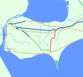
King's Highway 77, commonly referred to as Highway 77, is a provincially maintained highway in the Canadian province of Ontario. One of three highways...
10 KB (895 words) - 18:55, 30 April 2024
This is a List of Ontario Tourist Routes throughout the province, which are designated to highlight places of cultural, environmental, or social importance...
27 KB (2,929 words) - 14:58, 29 April 2023

Ontario (/ɒnˈtɛərioʊ/ on-TAIR-ee-oh; French: [ɔ̃taʁjo]) is the southernmost province of Canada. Located in Central Canada, Ontario is the country's most...
162 KB (13,398 words) - 20:00, 15 June 2024
County routes in Ontario County, New York, provide main arterial connections that are not otherwise provided by state highways. County routes never enter...
15 KB (190 words) - 16:54, 11 March 2022
List of secondary highways in Algoma District (redirect from Ontario Route 546)
populated areas in the Algoma District of northeastern Ontario. Some of the shorter ones are also access routes for communities with moderate amounts of tourism...
32 KB (2,521 words) - 21:20, 16 January 2024

42°51′N 77°17′W / 42.85°N 77.29°W / 42.85; -77.29 Ontario County is a county in the U.S. State of New York. As of the 2020 census, the population was...
26 KB (2,184 words) - 18:02, 26 April 2024
in the Canadian province of Ontario. Comprising a privately leased segment as well as a publicly owned segment, the route spans the entire Greater Toronto...
107 KB (8,333 words) - 22:59, 19 May 2024

U.S. Route 77 (US-77) is a part of the U.S. Highway System that runs from the Veteran's International Bridge in Brownsville, Texas north to Interstate...
11 KB (565 words) - 13:03, 16 May 2024
Belfield Expressway, is a 400-series highway in the Canadian province of Ontario that extends from Highway 401 in Toronto to Pearson International Airport...
16 KB (1,446 words) - 12:09, 14 April 2024
List of secondary highways in Thunder Bay District (redirect from Ontario Route 527)
in the Canadian province of Ontario, which serves to connect the small community of Hurkett to Highway 17, the main route of the Trans-Canada Highway...
30 KB (1,905 words) - 15:53, 3 September 2023
as "Main Street Ontario" and was one of the first roads in what would later become Ontario. It was devised as an overland military route between York (Toronto)...
131 KB (9,529 words) - 22:24, 9 June 2024
List of secondary highways in Kenora District (redirect from Ontario Route 116)
maintained secondary highway in the Canadian province of Ontario. Located in Kenora District, the route branches off Highway 17, the Trans-Canada Highway, between...
30 KB (2,153 words) - 02:37, 7 July 2023
Queensland State Route 77 British Columbia Highway 77 Manitoba Highway 77 Ontario Highway 77 National Highway 77 (India) Road 77 Highway 77 (Israel) Malaysia...
6 KB (424 words) - 22:42, 4 April 2024
List of secondary highways in Cochrane District (redirect from Ontario Route 572)
connecting Iroquois Falls, Ontario to Highway 11/Trans Canada Highway, and to Highway 101. This provides a very direct route for Timmins-Iroquois Falls...
18 KB (1,354 words) - 10:20, 11 August 2022

Quebec City–Windsor Corridor (category Geographic regions of Ontario)
nucleus of what later became Ontario. By contrast, many of the Ontario towns along the old fur-trading and logging route to the north, through the Ottawa...
19 KB (1,887 words) - 17:11, 3 June 2024

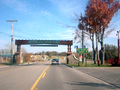
enters rural southwestern Ontario, and is dominated by farmland for much of its length through Essex County. The now four-laned route becomes divided as it...
77 KB (6,465 words) - 17:47, 1 May 2024
It is also a Core Route in the National Highway System of Canada. The route is maintained by the Ministry of Transportation of Ontario (MTO) and patrolled...
228 KB (16,186 words) - 11:38, 17 June 2024

direct access; previously, traffic had to exit at State Route 21 (SR 21) to get to the Turnpike. I-77 is also known as the "Vietnam Veterans Memorial Highway"...
24 KB (918 words) - 04:14, 4 December 2023
Highway Network consists of all the roads in Ontario maintained by the Ministry of Transportation of Ontario (MTO), including those designated as part of...
119 KB (11,363 words) - 08:06, 29 May 2024
border between the provinces of Ontario and Quebec, east of which the four lane freeway continues as Autoroute 40. The route proceeds west, south of the former...
62 KB (5,032 words) - 06:30, 17 April 2024
Garrison Petawawa (redirect from CFB Petawawa, Ontario)
45°55′N 77°17′W / 45.91°N 77.29°W / 45.91; -77.29 4 Canadian Division Support Base Petawawa, commonly referred to as Garrison Petawawa, is located...
17 KB (2,062 words) - 20:19, 14 December 2023
provincially maintained highway and the primary route of the Trans-Canada Highway through the Canadian province of Ontario. It begins at the Manitoba boundary, 50 km...
89 KB (6,792 words) - 21:13, 16 January 2024
smaller towns and communities. Once the primary east–west route across the southern portion of Ontario, most of Highway 2 was bypassed by Highway 401, which...
85 KB (5,555 words) - 07:21, 20 April 2024

rural township in the Regional Municipality of Waterloo in southwestern Ontario, Canada. The earliest concrete evidence of human activity within Wilmot...
23 KB (1,974 words) - 02:24, 23 April 2024
colloquially as the 427, is a 400-series highway in the Canadian province of Ontario that runs from the Queen Elizabeth Way (QEW) and Gardiner Expressway in...
51 KB (4,542 words) - 11:16, 14 April 2024
List of numbered roads in Essex County (redirect from List of numbered routes in Essex County, Ontario)
(length and route)" (Map). Google Maps. Google. Retrieved December 21, 2022. Google (December 21, 2022). "Highway 77 in Essex County (length and route)" (Map)...
41 KB (1,101 words) - 16:26, 7 May 2024
Canadian province of Ontario that connects Highways 401 and 403 to Brampton. North of Brampton, the commuter freeway ends and the route becomes Highway 10...
34 KB (3,191 words) - 01:16, 19 April 2024
Queen Elizabeth Way (redirect from Ontario Route QEW)
in Ontario, the QEW is directionally signed using locations along the route as opposed to cardinal directions. Driving towards Toronto, the route is signed...
95 KB (9,203 words) - 01:31, 15 June 2024
List of secondary highways in Timiskaming District (redirect from Ontario Route 558)
province of Ontario. The highway is 7.6 kilometres (4.7 mi) in length, connecting Highway 112 in Dane with the now abandoned Adams Mine site. The route was designated...
17 KB (982 words) - 16:49, 10 April 2023

U.S. Route 20 and U.S. Route 26, and north of Cairo Junction, it is the Olds Ferry-Ontario Highway No. 455. At the Idaho state line, Oregon Route 201 becomes...
5 KB (333 words) - 09:21, 23 June 2023