
Nautical map Physical map Political map Relief map Resource map Road map Star map Street map Thematic map Topographic map Train track map Transit map Weather...
36 KB (4,374 words) - 12:48, 13 July 2025
HTTP 404 (redirect from 404 File Not Found)
standard response code, to indicate that the browser was able to communicate with a given server, but the server could not find what was requested. The...
16 KB (1,945 words) - 23:09, 3 June 2025
1964–1970 Since 1970 the map has used a reversed (red on white) British Rail "double arrow" beside the station name to indicate main line interchanges....
73 KB (6,157 words) - 12:37, 12 June 2025
crowdsourced contributions to Google Maps were not discontinued as the company announced those features would be transferred to the Google Local Guides program...
164 KB (14,286 words) - 00:43, 17 July 2025
allowed cartographers to estimate the extent of their geographical knowledge, and to indicate parts of the planet known to exist but not yet explored as terra...
74 KB (8,610 words) - 04:58, 21 July 2025

example, colors can be used to indicate a classification of roads. These signs are usually explained in the margin of the map, or on a separately published...
20 KB (2,055 words) - 15:28, 25 May 2025

References today to the Fuller projection or Dymaxion usually indicate this version. Unlike other polyhedral map projections, the Dymaxion map does not use a gnomonic...
13 KB (1,367 words) - 00:51, 12 July 2025
informational purposes and are of use to passengers for selection of their seat at booking or check-in. Seat maps usually indicate the basic seating layout; the...
7 KB (957 words) - 23:18, 16 April 2025

Cartography (redirect from Map making)
color in map-making cannot be narrowed down to one reason. There are arguments that color started as a way to indicate information on the map, with aesthetics...
65 KB (7,619 words) - 14:12, 13 July 2025

coastline for Asia distinct from the Americas, the Waldseemüller map apparently indicates the existence of a new ocean between the trans-Atlantic regions...
52 KB (7,165 words) - 16:45, 6 July 2025

An emergency position-indicating radiobeacon (EPIRB) is a type of emergency locator beacon for commercial and recreational boats; it is a portable, battery-powered...
86 KB (10,208 words) - 07:25, 3 July 2025

worldtime label to instruments that merely indicate time for two or a few time zones, but the term should be used only for timepieces that indicate time for...
3 KB (285 words) - 16:04, 15 July 2023
Mercator projection (redirect from Mercator map projection)
generally not believed to be based on any deliberate map projection, included windrose networks of criss-crossing lines which could be used to help set...
49 KB (6,857 words) - 01:05, 21 July 2025

such as Hungarian). Square brackets indicate a term that has not yet been confirmed. The table below indicates the types and, where known, numbers of...
137 KB (2,188 words) - 01:39, 21 July 2025
Wardley map, indicating that the service is closer to being a commodity. Other components are mapped similarly. For example, a drone operator needs to be aware...
14 KB (1,651 words) - 11:11, 29 March 2025
Liveuamap (redirect from Live Universal Awareness Map)
Universal Awareness Map, commonly known as Liveuamap, is an internet service to monitor and indicate activities on online geographic maps, particularly of...
7 KB (465 words) - 05:50, 22 June 2025

The use of N to indicate "none" long survived in the historic apothecaries' system of measurement: used well into the 20th century to designate quantities...
75 KB (7,544 words) - 08:44, 4 July 2025
NATO Joint Military Symbology (redirect from Military map symbol)
a unit as a headquarters, or indicates the object's actual location on the map when it has been shifted away in order to declutter the display. It goes...
74 KB (3,774 words) - 13:58, 29 June 2025

Pictorial maps (also known as illustrated maps, panoramic maps, perspective maps, bird's-eye view maps, and geopictorial maps) depict a given territory...
13 KB (1,595 words) - 19:44, 26 June 2025
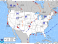
(−40 °F) indicate a lack of significant icing, as long as there is no active thunderstorm activity. A surface weather analysis is a type of weather map that...
25 KB (2,826 words) - 23:21, 16 April 2025

The Babylonian Map of the World (also Imago Mundi or Mappa mundi) is a Babylonian clay tablet with a schematic world map and two inscriptions written...
17 KB (1,692 words) - 16:38, 28 June 2025
Unicode (section Mapping to legacy character sets)
units. All UTF encodings map code points to a unique sequence of bytes. The numbers in the names of the encodings indicate the number of bits per code...
111 KB (11,534 words) - 09:49, 17 July 2025

Map, also known as the Madaba Mosaic Map, is part of a floor mosaic in the early Byzantine church of Saint George in Madaba, Jordan. The mosaic map depicts...
19 KB (2,084 words) - 12:54, 29 May 2025
artists who, after winning the map to El Dorado in Spain, wash ashore in the New World. The map leads the two men to the city of El Dorado, where its...
48 KB (4,479 words) - 18:31, 10 July 2025
National Weather Service (category Coordinates not on Wikidata)
and if caution is not exercised, [..] could lead to situations that may threaten life and/or property." In earnest, they indicate that hazardous weather...
101 KB (10,374 words) - 13:55, 9 July 2025
Perceptual mapping (redirect from Perceptual map)
model will look for an area on the map free from competitors. Some perceptual maps use different-sized circles to indicate the sales volume or market share...
13 KB (1,623 words) - 04:02, 18 July 2025

Hash table (redirect from Hash map)
and the resulting hash indicates where the corresponding value is stored. A map implemented by a hash table is called a hash map. Most hash table designs...
54 KB (6,078 words) - 16:13, 17 July 2025

relative to the axis of the Earth's orbit), in the top half. Maps are usually labelled to indicate which direction on the map corresponds to a direction...
14 KB (1,747 words) - 19:39, 13 May 2025

Elevation (section Maps and GIS)
data for spatial analysis or cartography. A topographical map is the main type of map used to depict elevation, often through contour lines. In a Geographic...
6 KB (561 words) - 17:58, 4 May 2025