King's Highway 141, commonly referred to as Highway 141, is a provincially maintained highway in the Canadian province of Ontario. Its western terminus...
9 KB (689 words) - 17:22, 7 June 2024
List of secondary highways in Algoma District (redirect from Ontario Route 546)
populated areas in the Algoma District of northeastern Ontario. Some of the shorter ones are also access routes for communities with moderate amounts of tourism...
32 KB (2,521 words) - 21:20, 16 January 2024
in the Canadian province of Ontario. Comprising a privately leased segment as well as a publicly owned segment, the route spans the entire Greater Toronto...
107 KB (8,333 words) - 22:59, 19 May 2024
numbered 141: Ontario Highway 141 Prince Edward Island Route 141 Quebec Route 141 National Route 141 National Highway 141 (India) Japan National Route 141 Fukuoka...
4 KB (299 words) - 23:32, 4 April 2024
List of secondary highways in Thunder Bay District (redirect from Ontario Route 527)
in the Canadian province of Ontario, which serves to connect the small community of Hurkett to Highway 17, the main route of the Trans-Canada Highway...
30 KB (1,905 words) - 15:53, 3 September 2023
List of secondary highways in Cochrane District (redirect from Ontario Route 572)
connecting Iroquois Falls, Ontario to Highway 11/Trans Canada Highway, and to Highway 101. This provides a very direct route for Timmins-Iroquois Falls...
18 KB (1,354 words) - 10:20, 11 August 2022
books under 2021 Ontario Highways Program". Sudbury.com. Retrieved August 27, 2021. Google (August 27, 2021). "Highway 69 – Length and Route" (Map). Google...
58 KB (4,519 words) - 01:54, 10 June 2024
List of secondary highways in Kenora District (redirect from Ontario Route 116)
maintained secondary highway in the Canadian province of Ontario. Located in Kenora District, the route branches off Highway 17, the Trans-Canada Highway, between...
30 KB (2,153 words) - 02:37, 7 July 2023
as "Main Street Ontario" and was one of the first roads in what would later become Ontario. It was devised as an overland military route between York (Toronto)...
131 KB (9,529 words) - 22:24, 9 June 2024
List of numbered roads in Essex County (redirect from List of numbered routes in Essex County, Ontario)
3: 1917 to 1947. Canadian Government Publishing Centre. p. 141. ISBN 0-660-00359-7. Ontario Provincial Standards for Roads and Public Works (Report). Vol...
41 KB (1,101 words) - 16:26, 7 May 2024
It is also a Core Route in the National Highway System of Canada. The route is maintained by the Ministry of Transportation of Ontario (MTO) and patrolled...
228 KB (16,186 words) - 11:38, 17 June 2024
List of secondary highways in Timiskaming District (redirect from Ontario Route 558)
province of Ontario. The highway is 7.6 kilometres (4.7 mi) in length, connecting Highway 112 in Dane with the now abandoned Adams Mine site. The route was designated...
17 KB (982 words) - 16:49, 10 April 2023
Trans-Canada Highway (TCH), the Georgian Bay Route, and is part of the highest-capacity route from southern Ontario to the Canadian West, via a connection with...
81 KB (6,022 words) - 19:06, 16 June 2024
(Bradford Bypass) – Route Planning and Environmental Assessment Study (PDF) (Report). Ministry of Transportation of Ontario. pp. 141–148. Retrieved April...
119 KB (11,363 words) - 08:06, 29 May 2024

Temiskaming Shores (redirect from Haileybury, Ontario)
Temiskaming Shores is a city in the Timiskaming District in Northeastern Ontario, Canada. It was created by the amalgamation of the town of New Liskeard...
23 KB (2,082 words) - 12:17, 8 March 2024
List of secondary highways in Manitoulin District (redirect from Ontario Route 540)
the isolated and sparsely populated areas in the Manitoulin District of Ontario. Secondary Highway 540, commonly referred to as Highway 540, is the primary...
11 KB (764 words) - 22:20, 31 March 2021
provincially maintained highway and the primary route of the Trans-Canada Highway through the Canadian province of Ontario. It begins at the Manitoba boundary, 50 km...
89 KB (6,792 words) - 21:13, 16 January 2024
Orillia and Midland before ending at Highway 93. It forms the Central Ontario Route of the Trans-Canada Highway system from north of Sunderland (Highway...
21 KB (1,314 words) - 18:37, 1 June 2024
List of secondary highways in Rainy River District (redirect from Ontario Route 600)
a secondary highway in the Canadian province of Ontario, located in Rainy River District. The route connects Highway 71 (the Trans-Canada Highway) with...
8 KB (525 words) - 15:52, 3 September 2023
List of secondary highways in Parry Sound District (redirect from Ontario Route 559)
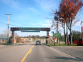
province of Ontario, located in Parry Sound District. The highway extends for 10.7 kilometres (6.6 mi) from a junction with Highway 141 in Rosseau to...
25 KB (1,585 words) - 21:30, 1 September 2022
List of numbered roads in York Region (redirect from York Region, Ontario roads)
p. 141. ISBN 0-660-00359-7. "Illustrated Sign and Signal Display Index". Ontario Traffic Manual. Vol. 1A. Ministry of Transportation of Ontario. July...
44 KB (1,043 words) - 12:11, 15 June 2024

Wawa is a township in the Canadian province of Ontario in the Algoma District. Formerly known as the Township of Michipicoten, named after a nearby river...
31 KB (2,764 words) - 07:52, 1 May 2024
the southwestern portion of the Canadian province of Ontario. The 91.4-kilometre (56.8 mi) route links Chatham and Sarnia via Wallaceburg, following close...
41 KB (3,728 words) - 21:06, 16 March 2024
border between the provinces of Ontario and Quebec, east of which the four lane freeway continues as Autoroute 40. The route proceeds west, south of the former...
62 KB (5,032 words) - 06:30, 17 April 2024
smaller towns and communities. Once the primary east–west route across the southern portion of Ontario, most of Highway 2 was bypassed by Highway 401, which...
85 KB (5,555 words) - 07:21, 20 April 2024
Queen Elizabeth Way (redirect from Ontario Route QEW)
in Ontario, the QEW is directionally signed using locations along the route as opposed to cardinal directions. Driving towards Toronto, the route is signed...
95 KB (9,203 words) - 01:31, 15 June 2024

Ontario. U.S. Route 53 also ends here. On the other side of the bridge, Trans-Canada Highway (Ontario Highway 11) is an east–west route while Ontario...
33 KB (3,488 words) - 09:36, 16 January 2024
the former route of Highway 83. From there, it continues north, passing through the communities of Hensall, Ontario and Vanastra, Ontario before terminating...
24 KB (1,308 words) - 22:07, 30 January 2024

Transportation of Ontario, in 1956. However, the original route was in Muskoka, between the village of Windermere and Highway 11 east of Utterson. This route was mostly...
11 KB (1,063 words) - 20:22, 12 May 2021
route is signed at 80 km/h (50 mph). Like other provincial routes in Ontario, Highway 48 is maintained by the Ministry of Transportation of Ontario....
23 KB (1,938 words) - 22:31, 9 June 2024