List of towns in Japan (redirect from 町) A town (町; chō or machi) is a local administrative unit in Japan. It is a local public body along with prefecture (ken or other equivalents), city (shi)... 148 KB (122 words) - 00:34, 2 May 2024 |
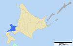
 | Suttsu (寿都町, Suttsu-chō) is a town located in Shiribeshi Subprefecture, Hokkaido, Japan. As of September 2016, the town has an estimated population of... 8 KB (326 words) - 05:32, 13 April 2024 |
 | District Village Shakotan 積丹町 238.2 2,215 Shakotan District Town Shimamaki 島牧村 437.26 1,560 Shimamaki District Village Suttsu 寿都町 95.36 3,113 Suttsu District... 7 KB (115 words) - 12:20, 16 April 2024 |
 | Sōbetsu 壮瞥町 205.04 2,665 Iburi Subprefecture Usu District Town Suttsu 寿都町 95.36 3,113 Shiribeshi Subprefecture Suttsu District Town Taiki 大樹町 816.38 5... 134 KB (6,925 words) - 20:20, 27 April 2024 |
 | Erimo. "日高町町章、日高町町旗". Hidaka. "TOWN TOPICS ~まちのできごと~". Hidaka. Archived from the original on 26 May 2011. "新冠町章、新冠町旗". Niikappu. "新冠町開町130年・町制施行50年記念式典"... 187 KB (4,200 words) - 21:19, 20 April 2024 |
 | information Location Aza Kuromatsunai, Kuromatsunai, Suttsu, Hokkaido (北海道寿都郡黒松内町字黒松内) Japan Coordinates 42°40′11″N 140°18′21″E / 42.669608°N 140.305703°E... 4 KB (116 words) - 07:43, 3 February 2024 |
 | General information Location Shiroikawa, Kuromatsunai, Suttsu, Hokkaido (北海道寿都郡黒松内町字白井川) Japan Coordinates 42°40′32″N 140°22′30″E / 42.67556°N 140.37500°E... 2 KB (78 words) - 07:38, 3 February 2024 |