 | 『地理学』、東京専門学校(1897.4)(以降1901年頃まで、同じ書名で年度ごとの講義録を刊行) 『内外地理学講義』、谷島屋書店(1899.1) 『新万国地図 5版』、丸善(1900.8) 『地理學講義 11版』、文武堂(1901.11) 『中学地理. 日本之部』、冨山房(1903.4) 『地理教科書... 12 KB (1,667 words) - 06:05, 16 March 2024 |
numeric names: authors list (link) 岩田, 一彦. "辻村太郎の景観地理学と思想的源泉". 社会科研究. 33: 1–14. "大和ハウス、副社長に大成建設前社長の村田氏". 日本経済新聞 (in Japanese). 2021-05-17. Retrieved 2024-02-05... 12 KB (1,379 words) - 23:43, 16 March 2024 |
 | registered in UNESCO World Heritage Site as "Yakushima". Miyanoura 日本の主な山岳標高:鹿児島県(国土地理院、2010年12月28日閲覧) Media related to Mount Miyanoura at Wikimedia Commons... 1 KB (76 words) - 13:47, 23 August 2023 |
 | The Geospatial Information Authority of Japan (国土地理院, Kokudo Chiri-in), or GSI, is the national institution responsible for surveying and mapping the national... 6 KB (598 words) - 21:22, 10 January 2024 |
 | コトバンク. 日本国語大辞典. Retrieved 28 October 2023. Titsingh, Isaac. (1834). Annales des empereurs du japon, p. 414. 中野犬小屋本論『武蔵野歴史地理. 第2冊』高橋源一郎編, 武蔵野歴史地理学会, 1928... 18 KB (1,977 words) - 14:04, 15 December 2023 |
13, 2020. "2022年度番組主な新キャスター" (PDF). Retrieved February 10, 2022. "2010年度日本地理学会賞(団体貢献部門)受賞者決定のお知らせ". The Association of Japanese Geographers. March 9,... 9 KB (959 words) - 01:13, 12 March 2024 |
 | 25000:1 札内川上流 荒井魏 『日本三百名山』 毎日新聞社編、1997年 "標高値を改定する山岳一覧 資料2" (PDF). 国土地理院. Retrieved 2014-03-26. GNSS測量等の点検・補正調査による2014年4月1日の国土地理院『日本の山岳標高一覧-1003山-』における改定値。なお、旧版での標高は1... 5 KB (534 words) - 23:41, 20 October 2023 |
 | 2021. Ha, Yeon; Geum, Yu; Gim, Bin (1425). Gyeongsang-do Jiriji 경상도지리지(慶尙道地理志) [Geography of Gyeongsang Province] (in Korean). Joseon Korea. Yi, Haeng... 24 KB (2,203 words) - 00:18, 10 April 2024 |
 | means "river spawning salmon and trout." There is a mountain of the same name "Ichankoppesan" nearby. 国土地理院 基準点成果等閲覧サービス 『山渓カラー名鑑 日本の山1000』山と渓谷社、1992年... 2 KB (113 words) - 02:47, 9 August 2023 |
 | Activities Sasebo Western Army (Japan) "平成28年全国都道府県市区町村別面積調 島面積" (PDF). 国土地理院. 2016-10-01. Retrieved 2017-02-27. "Kujū-san, Japan". Peakbagger.com. "離島とは(島の基礎知識)... 22 KB (1,956 words) - 09:42, 27 February 2024 |
 | Region Geospatial Information Authority of Japan") (in Japanese) 国土地理院刊行 地図一覧図 日本地図センタ] ("Published by Geospatial Information Authority of Japan Map List... 24 KB (2,765 words) - 14:50, 6 March 2024 |
 | spiritual Mount Tateyama". InsideJapan Tours. Retrieved April 22, 2022. "地理院地図|国土地理院". Fay, Tom; Lang, Wes (2019-03-27). Hiking and Trekking in the Japan... 9 KB (576 words) - 20:11, 26 March 2024 |
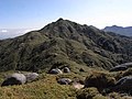
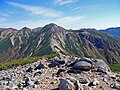
 | Wikipedia article at [[:ja:日本の地理]]; see its history for attribution. You should also add the template {{Translated|ja|日本の地理}} to the talk page. For more... 24 KB (1,440 words) - 19:17, 8 February 2024 |
 | Nagano, Niigata)". www.snowjapan.com. Retrieved 17 December 2017. 地図とデータでよくわかる日本地理 [Understanding Japanese geography through maps and data] (in Japanese). Jtb... 6 KB (607 words) - 09:51, 23 September 2023 |
 | rooms for guests. Hallway. 岩鼻通明 (1992). 出羽三山信仰の歴史地理学的研究 (in Japanese). 名著出版. p. 3. ISBN 978-4-626-01430-6. 日本の美術 (in Japanese). 至文堂. 2005. p. 84. Earhart,... 2 KB (188 words) - 21:38, 2 June 2023 |
 | 福田珠己 (1996). "Akagawara wa nani o kataru ka" 赤瓦は何を語るか". Chirigaku hyōron 地理学評論 Ser. A (in Japanese). 69 (9): 727–743. doi:10.4157/grj1984a.69.9_727. Morita... 8 KB (628 words) - 16:20, 16 March 2024 |
 | 2016-08-15. "日本測地系2011(JGD2011)とは? - 空間情報クラブ". club.informatix.co.jp. 2015-08-20. Archived from the original on 2016-08-20. "座標変換ソフトウェア TKY2JGD|国土地理院". www... 29 KB (3,073 words) - 16:06, 31 December 2023 |
 | Ethnologue (25th ed., 2022) Noguchi 2001, p. 76. "平成17年 全国都道府県市区町村別面積調" (PDF). 国土地理院. 1 October 2005. p. 189. Archived from the original (PDF) on 20 January 2013... 62 KB (5,750 words) - 13:49, 5 April 2024 |
 | Japan Times. Hironaka, Yuriko (March 2009). "母性保護論争における与謝野晶子" (PDF). 兵庫教育大学地理学研究室研究報告. Tomida, Hiroko (2004). "The Controversy over the Protection of Motherhood... 13 KB (1,474 words) - 04:10, 25 May 2023 |
(植物分類・地理, Shokubutsu bunrui・chiri) (APG) is a scientific journal of plant taxonomy and botany published by the Japanese Society for Plant Systematics (日本植物分類学会)... 3 KB (179 words) - 02:19, 5 May 2023 |
 | ni 1. 3 Mētoru idō kokudo chiri-in ga zantei-chi" 石川県輪島市、地震で西に1.3メートル移動 国土地理院が暫定値 [Wajima City, Ishikawa Prefecture, moved 1.3 meters west due to earthquake;... 238 KB (22,917 words) - 16:10, 17 April 2024 |
 | separately described. 田代博、藤本一美、清水長正、高田将志 『山の地図と地形』 山と渓谷社、1996年 日本の主な山岳標高 都道府県別最高地点の一覧(国土地理院) 『山の便利手帳2001』山と渓谷2001年1月号第786号付録、山と渓谷社、2001年、P350 The highest... 10 KB (278 words) - 08:56, 2 April 2023 |
 | Retrieved February 9, 2021. Nagaoka, Yori (October 6, 2020). "Android/iOS用地理情報ゲーム「PAC-MAN GEO」配信! 「パックマン」生誕40周年を記念した様々な企画が展開中". Game Watch (in Japanese)... 50 KB (3,722 words) - 04:36, 7 April 2024 |
in Indian society in Japan—focused on the case of Kobe residents] (PDF), 兵庫地理 (in Japanese), vol. 50, pp. 4–15, archived from the original (PDF) on 8 December... 39 KB (4,002 words) - 15:19, 13 April 2024 |
 | Mount Washiba seen from Sugoroku Mountain Villa "日本の主な山岳標高(富山県の山)". 国土地理院. Retrieved 2010-01-05. 『日本百名山』深田久弥(著)、朝日新聞社、1982年、ISBN 4-02-260871-4, pp. 202-205... 3 KB (122 words) - 02:07, 21 December 2023 |
 | 農文協編 2004, p. 94. 農文協編 2004, p. 95. 猪股慶子監修 成美堂出版編集部編 2012, p. 92. "福山のくわい". 地理的表示産品情報発信サイト. 2020-06-29. Retrieved 2024-01-01. 猪股慶子監修 成美堂出版編集部編 2012, p. 127... 22 KB (2,756 words) - 01:12, 24 February 2024 |
 | Ushirotateyama mountain range. "基準点成果等閲覧サービス". 国土地理院. Retrieved 2013-04-19. "日本の主な山岳標高(富山県・長野県)". 国土地理院. Retrieved 2013-04-19. 新日本山岳誌 (2005)、886-887頁 "中部山岳国立公園の区域図"... 3 KB (116 words) - 07:32, 25 December 2023 |
 | from the original on 2 March 2022. "金門的地理與歷史概說" [The overview of geography and history of Kinmen] (PDF). 第四章 金門的地理、歷史與總體經濟分析 (in Chinese (Taiwan)). National... 304 KB (30,574 words) - 02:16, 18 April 2024 |
 | (1962). "Pekin no Mindai sekaizu ni tsuite" 北京の明代世界図について. Chirigakushi Kenkyū 地理学史研究. II: 1–4. Miya Noriko 宮紀子 (2006). "Kon'itsu Kyōri Rekidai Kokuto no Zu"... 10 KB (1,298 words) - 07:48, 27 December 2023 |
latter is the primary academic geographic society in Japan. 地理学教科書(Chirigaku Kyokasyo)1900 大日本地誌(Dainihon Chishi)1903-1915 我が南洋(Waga nanyo)1916 氷河果して本邦に存在せざりしか(Hyoga... 1 KB (140 words) - 18:53, 22 February 2023 |