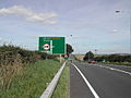
The A52 is a major road in the East Midlands, England. It runs east from a junction with the A53 at Newcastle-under-Lyme near Stoke-on-Trent via Ashbourne...
35 KB (3,797 words) - 10:00, 9 May 2024
A52 may refer to: Ubiquitin A-52 residue ribosomal protein fusion product 1, a human gene A52 road (England), a road connecting Newcastle-under-Lyme and...
836 bytes (154 words) - 23:36, 25 August 2022

longer A52 road which leads out of Belfast to the town of Crumlin (from Irish Cromghlinn, meaning 'crooked glen'). The lower section of the road houses...
33 KB (3,584 words) - 23:00, 27 February 2024

surrounded by Wetley Moor, a Site of Special Scientific Interest, and has the A52 road running through the middle of the village. The village was first recorded...
15 KB (1,646 words) - 19:27, 23 June 2022


750 yards (690 m) east of the A15 road, between Sleaford and the point near Threekingham where it crosses the A52 road. In 1921 the parish had a population...
7 KB (632 words) - 20:13, 26 December 2023

coast of England, in the East Lindsey district of Lincolnshire, on the A52 road 5 miles (8 km) south-west of Skegness and 14 miles (23 km) north-east of...
13 KB (1,156 words) - 04:15, 3 February 2024

approximately 9 miles (10 km) west-south-west from Boston, and on the A52 road. The medieval estuary, Bicker Haven, which is now a village, took its name...
8 KB (733 words) - 14:48, 31 January 2024

The A52 is a main road (German: Autostrasse) (American English: Expressway) connecting Zumikon in the canton of Zürich with Hinwil and Rapperswil-Jona...
3 KB (256 words) - 00:29, 21 February 2023
Peak District (section Roads)
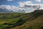
on a track near Deer Hill in Meltham; its southernmost point is on the A52 road near Ashbourne. The boundaries were drawn to exclude built-up and industrial...
121 KB (11,668 words) - 15:47, 19 May 2024

Clifton Bridge is a road bridge spanning the River Trent and carrying the A52 road to the west of the city of Nottingham, in the county of Nottinghamshire...
4 KB (392 words) - 13:13, 9 September 2022
entertainment centre across the canal from Dunkirk, adjacent to Clifton Boulevard (A52 road). Dunkirk has a population of just over 10,000, with the average household...
13 KB (857 words) - 18:52, 7 April 2024

about 5 miles (8 km) west of Ashbourne, Derbyshire, just south of the A52 road and north of the Churnet Valley. The area is often considered to be the...
3 KB (371 words) - 15:35, 3 April 2024

Staffordshire-Cheshire border. Audley is located on the B5500, the former A52 road. Just south of the A500, the village is approximately five minutes from...
8 KB (799 words) - 20:46, 4 February 2024

subsidiary, the River Whipling to the east, mainly north of the trunk A52 road, 12 miles (19 km) east of Nottingham. It had a population of 843 at the...
7 KB (697 words) - 10:58, 14 February 2024
renumbering of Clifton Boulevard to the A52, concurrent with the numbering of the A614 to A6514, the section from the A52 to A606 was also A614. Originally...
8 KB (797 words) - 16:55, 6 August 2023

of the centre of Grantham, Lincolnshire, England fronting onto the main A52 road. The station opened in 1915 as Royal Flying Corps Station Grantham, becoming...
6 KB (545 words) - 17:45, 3 November 2023

by the building of the A52 road. A route was identified which followed the course of the Polser Brook, which passes under the A52 to the north of the canal...
22 KB (2,659 words) - 19:46, 15 May 2024
Derby district. Chaddesden lies to the east of Derby city centre, with the A52 road forming its southern boundary. It is bordered by the wards of Spondon,...
10 KB (1,145 words) - 14:48, 30 April 2024
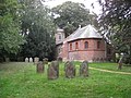
village of Anderby consists mainly of a stretch of housing just off the main A52 road. Anderby church is built of red brick, and is dedicated to Saint Andrew...
6 KB (444 words) - 23:16, 25 August 2023

while the Railway Terrace bridge is proposed to re-use one of two 17-metre road bridges removed as part of reconstruction work at Reading station in 2011...
41 KB (4,977 words) - 18:52, 12 March 2024

situated approximately 8 miles (13 km) north-east from Boston, and on the A52 road between Leverton and Wrangle at the junction of the B1184 (from Sibsey)...
9 KB (555 words) - 01:21, 20 February 2021
Beeston, Nottinghamshire (section Roads)
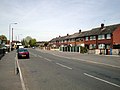
wards. The North ward includes some residential estates north of the A52 (Derby Road), including a small part of the Wollaton urban area that falls within...
50 KB (5,608 words) - 07:41, 1 March 2024

List of A roads in zone 5 in Great Britain starting north/east of the A5, west of the A6, south of the Solway Firth/Eden Estuary (roads beginning with...
53 KB (46 words) - 08:06, 14 May 2024
after being served with an improvement notice by the Office of Rail and Road in October 2020 for not having an "established a safety management system...
26 KB (3,460 words) - 13:40, 1 April 2024

Lincolnshire, England. It is situated 2 miles (3.2 km) south from the A52 road, 12 miles (19 km) east from Grantham and 8 miles (13 km) north from Bourne...
8 KB (812 words) - 19:33, 12 January 2024

The A16 road is a principal road of Lincolnshire in the East Midlands region of England, connecting the port of Grimsby and Peterborough, where it meets...
17 KB (1,051 words) - 11:12, 8 September 2023

The A523 is a road in Cheshire, Derbyshire, Greater Manchester, and Staffordshire, England running from a junction with the A52 north west of Ashbourne...
2 KB (110 words) - 17:08, 17 December 2023
northwest of Derby and 2 miles (3.2 km) south east of Brailsford on the A52 road. The population of the civil parish taken at the 2011 Census (including...
4 KB (380 words) - 12:30, 28 August 2022
19th century The boundary post on the southeast side of Painter's Lane (A52 road) is in cast iron. It has a triangular plan, a sloping upper part, and a...
32 KB (892 words) - 01:51, 9 November 2023