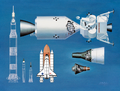
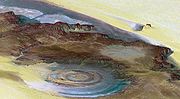
 | The Aerial Regional-scale Environmental Survey (ARES) was a proposal by NASA's Langley Research Center to build a robotic, rocket-powered airplane that... 8 KB (759 words) - 14:36, 1 March 2024 |
and missiles Aerial Reconfigurable Embedded System, a DARPA concept for a robotic VTOL vehicle Aerial Regional-scale Environmental Survey, a robotic spacecraft... 5 KB (718 words) - 21:16, 16 March 2024 |
 | (PLUTOKE) – replaced by New Horizons Mars Scout program Aerial Regional-scale Environmental Survey (ARES) (2000-2010 concept) TAU (spacecraft)- probe to... 49 KB (4,040 words) - 16:20, 21 April 2024 |
program Ares ICBM, a proposed ICBM and SST launch vehicle Aerial Regional-scale Environmental Survey (ARES), a proposed Martian rocket airplane Aries (rocket)... 418 bytes (93 words) - 17:54, 12 September 2020 |
Mars Aerial and Ground Global Intelligent Explorer or MAGGIE is a proposed compact, autonomous, fixed wing, vertical take-off/landing (VTOL), electric... 3 KB (314 words) - 03:00, 3 March 2024 |
 | takeoff, horizontal landing reusable launch vehicle. Aerial Regional-scale Environmental Survey Skylon (spacecraft) SpaceShipTwo XCOR Lynx Zero Emission... 33 KB (4,082 words) - 06:32, 11 February 2024 |
 | the USGS abandoned traditional methods of surveying, revising, and updating topographic maps based on aerial photography and field checks. Today's U.S... 34 KB (3,664 words) - 17:46, 1 April 2024 |
wind speed by measuring tracers in the vortex. In most cases, aerial and ground damage surveys of structures and vegetation are utilised, sometimes with engineering... 18 KB (1,170 words) - 21:07, 30 December 2023 |
 | it is also known as aerial videography. Platforms for aerial photography include fixed-wing aircraft, helicopters, unmanned aerial vehicles (UAVs or "drones")... 43 KB (4,823 words) - 17:26, 5 March 2024 |
 | Mars aircraft (category Pages using multiple image with auto scaled images) Chasma Proposed Mars airplane concepts include: ARES (Aerial Regional-scale Environmental Survey) MAGE (Mars Airborne Geophysical Explorer) AME (Airplane... 22 KB (2,052 words) - 02:26, 22 April 2024 |
Mars Exploration Program (category Pages using multiple image with auto scaled images) Collection for Investigation of Mars), and the ARES ("Aerial Regional-scale Environmental Survey") Mars airplane. SCIM was a sample return mission that... 36 KB (3,052 words) - 10:19, 26 January 2024 |
 | applications. These include aerial photography, area coverage, precision agriculture, forest fire monitoring, river monitoring, environmental monitoring, policing... 136 KB (12,586 words) - 22:51, 22 April 2024 |
 | Cancelled proposals Aerial Regional-scale Environmental Survey Astrobiology Field Laboratory Beagle 3 Marsokhod Mars 4NM & 5NM Mars 5M (Mars-79) Mars-Aster... 10 KB (1,061 words) - 17:15, 12 January 2024 |
 | The Kardashev scale (Russian: Шкала́ Кардашёва, romanized: Shkalá Kardashova) is a method of measuring a civilization's level of technological advancement... 142 KB (16,823 words) - 11:37, 19 April 2024 |
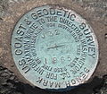 | The National Geodetic Survey (NGS) is a United States federal agency based in Washington, D.C. that defines and manages a national coordinate system, providing... 7 KB (786 words) - 05:32, 25 November 2023 |
classifications of other continents. During the early 1900s, the study of regional-scale geomorphology was termed "physiography". Physiography later was considered... 15 KB (1,765 words) - 02:44, 22 April 2024 |
 | each project. One of the four finalists was Levine's Aerial Regional-scale Environmental Survey (ARES) program, a proposal to send a rocket powered airplane... 67 KB (6,302 words) - 16:14, 8 January 2024 |
 | characterization up to mineralogical scale, while longer wavelengths reveal larger scale surface information, e.g. regional thermal anomalies, surface roughness... 58 KB (6,685 words) - 15:33, 12 April 2024 |
 | (Report). National Centers for Environmental Information. Retrieved April 7, 2021. Peters, Brian E. (1998). "Aerial Damage Survey of the Central Texas Tornadoes... 81 KB (7,712 words) - 20:31, 9 April 2024 |
Glossary of geography terms (N–Z) (category Pages using multiple image with auto scaled images) orthophotograph An aerial photograph or satellite image that has been geometrically corrected or orthorectified such that the scale is uniform across all... 192 KB (18,282 words) - 23:46, 27 January 2024 |
 | Crowdmapping Environmental technology Project Grab Bag Unmanned aerial vehicle § Applications: drones can be used for various types of environmental monitoring... 56 KB (6,737 words) - 16:50, 23 March 2024 |
 | " "Place," "Time," "Scale," and "Landscape." The 2nd edition of the book expanded on these key concepts by adding "Environmental systems," "Social Systems... 91 KB (9,327 words) - 08:17, 13 April 2024 |
 | and aerial imagery, powerful computers and Web technology are changing the quality, utility, and expectations of GIS to serve society on a grand scale, but... 99 KB (13,047 words) - 12:42, 12 April 2024 |
 | Coastal management (section Aerial photographs) visible in the field, and can be interpreted on both colour and grey scale aerial photographs. The HWL represents the landward extent of the most recent... 55 KB (6,689 words) - 09:20, 10 March 2024 |
initially reviewed in which a hierarchy of environmental gradients is first identified either by visual means (maps, aerial photographs etc..) or through numerical... 11 KB (1,570 words) - 01:55, 28 March 2024 |
 | Las Médulas (section Environmental impact) Cultural Landscape is listed by UNESCO as a World Heritage Site. Advanced aerial surveys conducted in 2014 using LIDAR have confirmed the wide extent of the... 13 KB (1,350 words) - 07:38, 9 December 2023 |
 | Aerial topdressing is the aerial application of fertilisers over farmland using agricultural aircraft. It was developed in New Zealand in the 1940s and... 31 KB (4,454 words) - 21:59, 22 March 2024 |
 | landslide tailings depicted in 2006 aerial photograph, with topology map comparisons". Historic Aerials. Nationwide Environmental Title Research, LLC. "Flash... 61 KB (5,122 words) - 07:26, 18 April 2024 |
 | regarding aerial spraying. Mr. Holmes has collected signatures from across the country from concerned Canadians who believe that chemicals used in aerial sprayings... 44 KB (4,610 words) - 11:16, 18 April 2024 |
those practices. The environmental impact of agriculture varies widely based on practices employed by farmers and by the scale of practice. Farming communities... 26 KB (6,732 words) - 12:19, 18 April 2024 |