 | The Arica y Parinacota Region (Spanish: Región de Arica y Parinacota pronounced [aˈɾikaj paɾinaˈkota]) is one of Chile's 16 first order administrative... 18 KB (1,429 words) - 02:17, 19 April 2024 |
 | the Arica Province and the Arica and Parinacota Region. Arica is located at the bend of South America's western coast known as the Arica Bend or Arica Elbow... 36 KB (3,196 words) - 02:26, 19 February 2024 |
 | Parinacota Province (Spanish: Provincia de Parinacota) is one of two provinces of the Chilean region of Arica y Parinacota. Its capital is Putre. It is... 6 KB (282 words) - 20:05, 19 April 2022 |
 | Parinacota is a Chilean hamlet in Putre, Parinacota Province, Arica and Parinacota Region. It is situated on the highlands at an elevation of 4,400 metres... 6 KB (366 words) - 09:27, 25 June 2022 |
 | Arica Province (Spanish: Provincia de Arica) is one of two provinces of Chile's northernmost region, Arica y Parinacota. The province is bordered on the... 6 KB (321 words) - 00:35, 10 April 2024 |
 | Guallatiri (category Volcanoes of Arica y Parinacota Region) in the summit region. The volcano lies in the Putre municipality, Arica y Parinacota Region. It is located south of Lake Chungará and 4 km (2.5 mi) west... 54 KB (5,891 words) - 00:00, 20 April 2024 |
 | two provinces, Iquique and Tamarugal. It borders the Chilean Arica y Parinacota Region to the north, Bolivia's Oruro Department and Potosí Department on... 7 KB (329 words) - 20:03, 16 January 2024 |
 | Chinchorro mummies (redirect from Arica mummies) the dead. The Chinchorro culture settlements and artificial mummification process in Arica and Parinacota were declared a World Heritage Site by UNESCO... 16 KB (2,096 words) - 08:02, 20 February 2024 |
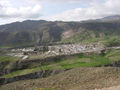 | Putre (category Populated places in Parinacota Province) Chilean town and commune, capital of the Parinacota Province in the Arica-Parinacota Region. It is located 130 km (81 mi) east of Arica, at an altitude... 8 KB (381 words) - 13:32, 31 October 2023 |
Acotango Aritinca Capurata Guallatiri Parinacota Pomerape Taapaca Tacora Alto Toroni Irruputuncu Isluga Acamarachi Aguas Calientes Aucanquilcha Azufre... 9 KB (268 words) - 14:17, 13 November 2023 |
 | Chacalluta International Airport (redirect from Arica Airport) Chacalluta Arica) (IATA: ARI, ICAO: SCAR) is an airport serving the city of Arica, capital of the Arica Province in the northern Arica y Parinacota Region of... 3 KB (155 words) - 19:03, 7 October 2023 |
 | Umurata (category Mountains of Arica y Parinacota Region) Cordillera Occidental on the border of Bolivia and Chile. It is located in the Arica and Parinacota Region of Chile and in the Oruro Department of Bolivia, in... 3 KB (175 words) - 21:39, 6 December 2023 |
 | Regions of Chile (redirect from Chilean region) ("Metropolitan Region" in Spanish). With the creation of regions XIV (Los Ríos Region) and XVI (Ñuble Region) in the south and XV (Arica y Parinacota Region) in... 13 KB (825 words) - 22:20, 6 March 2024 |
 | Cotacotani Lake (category Lakes of Arica y Parinacota Region) the Parinacota Province, Arica-Parinacota Region, Chile. It lies 4 km northwest of Chungará Lake, which is one of the highest lakes in the world and is... 10 KB (1,085 words) - 09:46, 9 March 2024 |
| Chungará Lake (category Lakes of Arica y Parinacota Region) Altiplano of Arica y Parinacota Region in the Lauca National Park. It has a surface area of about 21.5–22.5 square kilometres (8.3–8.7 sq mi) and has a maximum... 28 KB (3,052 words) - 22:56, 3 January 2024 |
coordinates) The information regarding List of rivers in the Arica y Parinacota Region on this page has been compiled from the data supplied by GeoNames... 13 KB (1,286 words) - 03:20, 8 March 2022 |
Villa Frontera (category Coasts of Arica y Parinacota Region) a village within the Arica Province of the Arica and Parinacota Region, Chile. Villa Frontera is on the Pacific Ocean coast and on the northern bank of... 4 KB (227 words) - 12:35, 13 March 2024 |
 | Lauca River (category Rivers of Arica y Parinacota Region) river. It originates in the Chilean Altiplano of the Arica and Parinacota Region, crosses the Andes and empties into Coipasa Lake in Bolivia. The upper reach... 5 KB (415 words) - 14:22, 29 November 2023 |
 | the Parinacota Province of the Arica and Parinacota Region, about 5,439 metres (17,845 ft) high. It lies between the Taapaca volcanic complex and the... 2 KB (98 words) - 21:44, 6 December 2023 |
663 established the regional Battle of Arica holiday, to be observed only in the Arica and Parinacota region. On December 30, 2016, Law 20,983 declared... 20 KB (1,548 words) - 17:15, 24 February 2024 |
 | Marine and Coastal Protected Area Francisco Coloane Marine and Coastal Protected Area Hanga Oteo Marine and Coastal Protected Area Las Cruces Marine and Coastal... 12 KB (776 words) - 05:31, 3 May 2023 |
 | where most of the edifice is located, Parinacota lies in the commune of Putre, Arica y Parinacota Region, and in Bolivia in the Oruro Department of the... 79 KB (9,426 words) - 13:13, 15 January 2024 |
84. Northernmost point: Tripartite border with Bolivia and Peru in Arica and Parinacota Region near Visviri (17°29′54.0″S 69°28′6.5″W / 17.498333°S... 4 KB (582 words) - 14:41, 1 February 2023 |
Las Vicuñas National Reserve (category Protected areas of Arica y Parinacota Region) reserve located in the Parinacota Province, Arica y Parinacota Region, Chile. The reserve lies immediately south of Lauca National Park and in its southern portion... 2 KB (148 words) - 03:44, 4 May 2023 |
 | Kimsa Chata (Bolivia-Chile) (category Volcanoes of Arica y Parinacota Region) Kimsa Chata or Kimsachata (Aymara and Quechua kimsa three, Pukina chata mountain, "three mountains", Hispanicized Quimsa Chata, Quimsachata) is an 8 km... 3 KB (184 words) - 19:56, 19 April 2024 |
San Miguel de Azapa (category Populated places in Arica Province) San Miguel de Azapa is a village in the Arica and Parinacota Region, Chile. 18°31′02″S 70°10′34″W / 18.51722°S 70.17611°W / -18.51722; -70.17611 v... 2 KB (35 words) - 23:22, 28 May 2022 |
 | Ancuta (category Populated places in Parinacota Province) Ancuta is a village in the Arica and Parinacota Region, Chile. 18°27′01″S 69°12′04″W / 18.45028°S 69.20111°W / -18.45028; -69.20111 v t e... 2 KB (32 words) - 19:17, 28 May 2022 |
| Lauca National Park (category Protected areas of Arica y Parinacota Region) and the Acotango. Lauca features include archaeological sites, lava fields and volcanic calderas. Within the park is located the town of Parinacota with... 5 KB (456 words) - 04:46, 18 April 2024 |
 | Camarones, Chile (category Populated places in Arica Province) Camarones is a city and commune in the Arica y Parinacota Region in Chile. It forms part of the administrative Arica Province and has a population of... 6 KB (337 words) - 15:30, 19 January 2024 |
 | Payachata (category Volcanoes of Arica y Parinacota Region) Municipality, and on the Chilean side they lie in the Arica y Parinacota Region, Parinacota Province. According to helium surface dating, Parinacota has erupted... 3 KB (230 words) - 18:44, 3 April 2023 |