 | State Route 89A (SR 89A) is an 83.85-mile (134.94 km) state highway that runs from Prescott north to Flagstaff in the U.S. state of Arizona. The highway... 27 KB (2,115 words) - 20:08, 19 December 2023 |
 | related to U.S. Route 89A. KML file (edit • help) Template:Attached KML/U.S. Route 89A KML is from Wikidata US-89A at Arizona Roads State Route 11 at Utah... 10 KB (742 words) - 05:04, 25 September 2022 |
example, the Alternate route of U.S. Route 89 (US 89) is referred to as U.S. Route 89A (US 89A) instead of State Route 89A (SR 89A). The only exception... 50 KB (1,442 words) - 13:32, 15 August 2023 |
 | State Route 179, also known as SR 179, the Red Rock Scenic Byway, a north–south state highway in Arizona, United States, running from Interstate 17 to... 4 KB (310 words) - 01:18, 8 September 2023 |
 | State Route 79 (SR 79), also known as the Pinal Pioneer Parkway, is a 58.40 mi (93.99 km) long state highway in the U.S. state of Arizona. It serves as... 19 KB (1,926 words) - 21:22, 27 June 2023 |
 | Phoenix at 5,100 feet (1,600 m). elevation. PV has good access to Arizona State Route 89, SR-89A and SR-69, connecting to Interstates 17 and 40. Air service... 21 KB (1,824 words) - 20:42, 19 April 2024 |
 | State Route 89 (SR 89) is a 104.53-mile (168.22 km) state highway in the U.S. state of Arizona. It is part of the former route of U.S. Route 89 (US 89)... 5 KB (254 words) - 04:36, 19 March 2024 |
R. 89A. Arizona State Highway Department (1927). Arizona State Highway Commission Official State Routes and State Highways of the State of Arizona (Map)... 93 KB (8,974 words) - 19:46, 4 May 2024 |
 | of Arizona State Route 89A. Said to be named for its location at the geographical center of Arizona. Foothills Terrace, a development west of Arizona State... 22 KB (1,979 words) - 15:46, 19 April 2024 |
 | sole road that links U.S. Route 89A (US 89A) at Jacob Lake to the North Rim of Grand Canyon National Park. Along the route, the road heads through the... 14 KB (1,229 words) - 10:33, 5 April 2024 |
following highways are numbered 89A: U.S. Route 89A Arizona State Route 89A Illinois Route 89A (former) New York State Route 89A (former) This article includes... 375 bytes (64 words) - 11:55, 5 January 2023 |
 | north-central part of the U.S. state of Arizona. It connects State Route 89A in Cottonwood to U.S. Route 180 and U.S. Route 191 in Eagar. The highway begins... 8 KB (455 words) - 00:55, 19 March 2024 |
 | intersections The entire route was in Coconino County. U.S. Route 89A Arizona State Route 89 Arizona State Route 89A Arizona Department of Transportation... 22 KB (1,931 words) - 05:42, 1 November 2023 |
 | Oak Creek Canyon (redirect from Oak Creek Canyon, Arizona) a smaller cousin of the Grand Canyon because of its scenic beauty. State Route 89A enters the canyon on its north end via a series of hairpin turns before... 9 KB (1,020 words) - 23:30, 19 October 2023 |
 | southwest of Flagstaff along Arizona State Route 89A between Sedona to the east and Prescott to the west. The town is in Arizona's Black Hills, which trend... 62 KB (6,031 words) - 15:41, 19 April 2024 |
| there was another US 89A in Arizona between Prescott and Flagstaff via Sedona on which is now State Route 89A. In central Arizona, the need for a north–south... 19 KB (2,075 words) - 10:10, 23 March 2024 |
 | thoroughfares in and around Prescott are Arizona State Route 89A, Arizona State Route 69 and Arizona State Route 89. State Route 89A connects Sedona and Cottonwood... 70 KB (6,476 words) - 04:18, 1 May 2024 |
 | rest of Arizona. Only three major roads traverse the region: I-15 crosses the northwestern corner, while Arizona State Route 389 and U.S. Route 89A cross... 10 KB (1,133 words) - 05:40, 27 April 2024 |
 | the lake, Granite Creek passes through Granite Dells and under Arizona State Route 89A. Willow Creek enters from the left. From here the creek meanders... 6 KB (417 words) - 20:20, 18 February 2022 |
 | Arizona (/ˌærɪˈzoʊnə/ ARR-ih-ZOH-nə; Navajo: Hoozdo Hahoodzo [hoː˥z̥to˩ ha˩hoː˩tso˩]; O'odham: Alĭ ṣonak [ˈaɭi̥ ˈʂɔnak]) is a landlocked state in the Southwestern... 161 KB (13,656 words) - 20:00, 11 May 2024 |
 | Interstate 17 (redirect from Arizona State Route 79 (1950-1968)) (I-17) is a north–south Interstate Highway entirely within the US state of Arizona. I-17's southern terminus lies in Phoenix, at I-10/US 60 and its northern... 26 KB (1,442 words) - 03:47, 5 May 2024 |
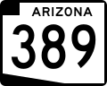 | before reaching its eastern terminus at US 89A. SR 389 was established in 1959 along its current route. Arizona Department of Transportation. "2008 ADOT... 4 KB (267 words) - 20:12, 20 April 2024 |
 | U.S. Route 66 (US 66, Route 66) also known as the Will Rogers Highway, was a major United States Numbered Highway in the state of Arizona from November... 149 KB (16,039 words) - 13:27, 19 March 2024 |
 | mountain grades of State Route 89A through Jerome. Despite its east–west alignment, this highway is marked as a north–south route. The western terminus... 3 KB (253 words) - 01:17, 8 September 2023 |
retired. Arizona portal U.S. Geological Survey Geographic Names Information System: The Gap Hwang, Kristen (February 25, 2013). "U.S. Highway 89A near Page... 6 KB (360 words) - 02:28, 20 January 2024 |
 | State Route 69 (SR 69) is a highway that serves as the main road to Prescott, Arizona, from Interstate 17. The highway mainly consists of four-lanes (two... 7 KB (586 words) - 02:39, 8 November 2023 |
 | (the freeway linking Phoenix to northern Arizona) in Flagstaff. For the majority of its routing through Arizona, I-40 follows the historic alignment of... 32 KB (2,323 words) - 04:56, 19 March 2024 |
 | former state highway designation (legislative overlay) for U.S. Route 89A in Kanab (in Kane County), that connected U.S. Route 89A in Arizona with U.S... 3 KB (253 words) - 03:39, 28 October 2023 |
 | Hildale and Colorado City, Arizona. The highway connects to US-89A through Arizona State Route 389. The route was added to the state highway system in 1914... 7 KB (741 words) - 16:44, 22 March 2023 |
| At the city of Kanab, US-89 meets the north end of US-89A, an alternate route south into Arizona, and abruptly turns north and begins climbing the staircase... 61 KB (4,336 words) - 16:08, 12 October 2023 |