 | The Army Map Service (AMS) was the military cartographic agency of the United States Department of Defense from 1941 to 1968, subordinated to the United... 15 KB (2,074 words) - 13:10, 8 March 2024 |
 | National Geospatial-Intelligence Agency (redirect from US Army Topographic Command) 1942, by General Order 22, OCE, June 19, 1942. The Army Map Service also combined many of the Army's remaining geographic intelligence organizations and... 52 KB (4,514 words) - 11:36, 14 April 2024 |
 | bear. U.S.Army Map Service (LU), Corps of Engineers "8661"(feet) toposheet "Dindigul, NC 43-8, Series U502" prepared by the Army Map Service (LU), Corps... 3 KB (289 words) - 16:35, 20 September 2023 |
 | Chinese postal romanization (redirect from Postal map spelling) map. "China, administrative divisions," United States. Central Intelligence Agency, 1969. "China 1:250,000," 1954, Series L500, U.S. Army Map Service... 22 KB (2,237 words) - 15:09, 13 April 2024 |
 | MacArthur Highway (category Infobox road maps tracking category) Manila (Map). 1:250,000. Washington D.C.: Army Map Service, Corps of Engineers. 1954. Retrieved November 20, 2021. 1944 Army Map Service Road Map of Northern... 21 KB (1,352 words) - 05:19, 6 April 2024 |
by the draft so he instead joined the Army Map Service Corps of Engineers as a civilian producing improved maps for the war effort. He continued this... 8 KB (1,141 words) - 00:39, 14 April 2024 |
 | Geography of Arunachal Pradesh (category Articles containing OSM location maps) 2021 U.S. Army Map Service (1955), NG 47-1 Putao. Tile of the Map Burma 1:250,000. Series U542, retrieved 5 July 2021 U.S. Army Map Service (1955), NG... 45 KB (2,710 words) - 18:16, 5 January 2024 |
S2CID 129161876. Rand McNally, The New International Atlas, 1993. U.S. Army Map Service, 1966, Manasarowar U.S. Army Map Service, 1966, Bihar GEOnet Names Server... 4 KB (314 words) - 07:43, 10 March 2024 |
Army Map Service's facilities adjacent to the Dalecarlia Reservoir. The facility served as headquarters of a succession of agencies: Army Map Service... 10 KB (932 words) - 02:09, 10 July 2022 |
Charles H. Ruth (category United States Army officers) father of the Army Map Service. Ruth was first commanding officer of the Army Engineer Reproduction Plant (ERP). Prior to 1917 the Army Corps of Engineers... 2 KB (215 words) - 22:27, 2 March 2024 |
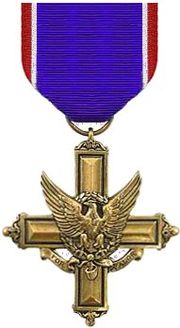
 | The Distinguished Service Cross (DSC) is the United States Army's second highest military decoration for soldiers who display extraordinary heroism in... 64 KB (6,329 words) - 03:29, 21 April 2024 |
 | its location see Belgaum (topographic map, 1:250,000), series U502, sheet ND 43-02, United States Army Map Service, May 1960 Bommanalli, Haliyal Taluka... 10 KB (894 words) - 16:57, 1 May 2023 |
 | Session Road (category Infobox road maps tracking category) February 21, 2023. 1944 Army Map Service Road Map of Northern Luzon, Philippines (Map). 1:500000. Washington D.C.: Army Map Service. 1944. Retrieved September... 7 KB (461 words) - 11:52, 3 April 2024 |
 | Frank Kameny (category United States Army personnel of World War II) Kameny was dismissed from his position as an astronomer in the U.S. Army's Army Map Service in Washington, D.C., because of his homosexuality, leading him... 56 KB (5,671 words) - 08:03, 30 April 2024 |
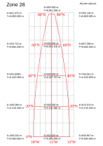
 | Projected coordinate system (redirect from Map Reference) the printing of grids on maps by the U.S. Army Map Service (AMS) and other combatants. Initially, each theater of war was mapped in a custom projection... 21 KB (2,802 words) - 02:18, 12 April 2024 |
 | DeepStateMap.Live is an open-source intelligence interactive online map of the military operations of the Russian and Ukrainian armies during the Russian... 36 KB (3,520 words) - 10:56, 14 April 2024 |
 | Indonesia portal Rand McNally, The New International Atlas, 1993. GEOnet Names Server Indonesia 1:250,000 Series T503, U.S. Army Map Service, (1954)... 4 KB (583 words) - 11:37, 5 February 2024 |
 | 1944 the US Army Map Service set up an intelligence team to collect mapping and surveying information from the Germans as the allied armies moved through... 8 KB (928 words) - 18:08, 2 August 2023 |
NF 46-3" U.S. Army Map Service, March 1960; and "1:250,000 topographic map, Series U542, Gangaw, Burma, NF 46-7" U.S. Army Map Service, April 1958 Ireland... 4 KB (405 words) - 16:10, 16 August 2023 |
Modern equipment of the Italian Army is a list of military equipment currently[when?] in service with the Italian Army. Source Source Source Source Source... 138 KB (3,501 words) - 11:35, 18 April 2024 |
Military Mapping Maidens (category Women in the United States Army) During World War II the Army Map Service (AMS), a heritage organization of the National Geospatial-Intelligence Agency, was losing a significant amount... 5 KB (574 words) - 10:21, 1 August 2023 |
325–327, map 18. Map 18 Perry–Castañeda Library Map Collection, China 1:250,000, Series L500, U.S. Army Map Service, 1954- . Topographic Maps of China... 5 KB (356 words) - 12:43, 27 April 2024 |
 | Chinese expedition in the 1980s Namcha Barwa, NH 46-12 (Map). 1:250,000. U.S. Army Map Service. 1955. Retrieved 2011-06-08. Virtual Aerial Tour Video... 10 KB (870 words) - 05:51, 6 April 2024 |


