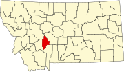
 | Broadwater County is a county in the U.S. state of Montana. As of the 2020 census, the population was 6,774. Its county seat is Townsend. The county was... 13 KB (891 words) - 23:16, 25 April 2024 |
 | Winston is a census-designated place (CDP) in Broadwater County, Montana, United States. The population was 147 at the 2010 census. The post office opened... 7 KB (500 words) - 21:38, 14 July 2023 |
 | Townsend is a city in and the county seat of Broadwater County, Montana, United States. The population was 1,787 at the 2020 census. Lewis and Clark passed... 17 KB (1,190 words) - 08:07, 7 April 2024 |
 | are approximate tallies of current listings by county. List of National Historic Landmarks in Montana The latitude and longitude information provided... 59 KB (640 words) - 13:23, 30 April 2024 |
 | 143. Townsend, Montana lies in the central part of Townsend Valley at an elevation of 3833 and is the county seat of Broadwater County. The town was named... 24 KB (565 words) - 23:15, 25 April 2024 |
 | Toston is a census-designated place (CDP) in Broadwater County, Montana, United States. The population was 108 at the 2010 census. Thomas Toston settled... 7 KB (551 words) - 05:45, 14 July 2023 |
 | Radersburg is an unincorporated rural village in Broadwater County, Montana, United States. Radersburg was established in 1865 when gold was discovered... 8 KB (619 words) - 18:00, 12 January 2024 |
Broadwater Energy, a proposed liquid natural gas terminal proposed for Long Island Sound Broadwater, Missouri Broadwater County, Montana Broadwater,... 2 KB (252 words) - 23:31, 18 December 2023 |
coordinates) There are at least 3 named lakes and reservoirs in Broadwater County, Montana. Boulder Lakes, 46°33′30″N 111°21′02″W / 46.55833°N 111.35056°W... 950 bytes (165 words) - 04:17, 8 April 2022 |
(secondary coordinates) There are at least 27 named mountains in Broadwater County, Montana. Avalanche Butte, 46°45′22″N 111°29′11″W / 46.75611°N 111.48639°W... 5 KB (1,210 words) - 17:05, 20 March 2022 |
 | Jefferson County has interchanges with S-399 east of Pipestone, Montana and S-359 east of Cardwell before meeting the Jefferson–Broadwater county border... 37 KB (2,100 words) - 13:05, 16 April 2024 |
Canton was a small town in Broadwater County, Montana, now submerged beneath Canyon Ferry Lake near Helena, Montana. The town was flooded when nearby Canyon... 1 KB (144 words) - 12:53, 7 September 2022 |
 | Lombard is a ghost town in southeastern Broadwater County, Montana, United States. The town was located on the east bank of the Missouri River, just north... 3 KB (233 words) - 02:10, 27 July 2023 |
 | Missouri River (category Bodies of water of Broadwater County, Montana) 2013. Retrieved January 19, 2012. "Toston Dam (Broadwater-Missouri)" (PDF). Water Projects Bureau. Montana Department of Natural Resources and Conservation... 189 KB (18,043 words) - 23:28, 10 April 2024 |
Belt Mountains southwest of Townsend, Montana in Broadwater County, Montana. List of mountain ranges in Montana "Limestone Hills". Geographic Names Information... 1 KB (47 words) - 01:56, 29 July 2017 |
 | Horn County, Montana List of mountains in Blaine County, Montana List of mountains in Broadwater County, Montana List of mountains in Carbon County, Montana... 4 KB (586 words) - 18:51, 4 November 2023 |
 | Confederate Gulch and Diamond City (redirect from Montana Bar (Montana)) heyday, Diamond City was the county seat of Montana's Meagher County, though today the area is part of Broadwater County. While gold production was at... 42 KB (6,043 words) - 07:53, 1 May 2024 |
 | is a 69-mile (111 km) long tributary of the Missouri River in western Montana in the United States. It forms at the confluence of the Middle and South... 3 KB (270 words) - 22:52, 23 April 2022 |
 | Canyon Ferry Lake (category Bodies of water of Broadwater County, Montana) Lake is a reservoir on the Missouri River near Helena, Montana and Townsend, Montana. It is Montana's third largest body of water, covering 35,181 acres (142 km2)... 6 KB (296 words) - 15:05, 28 October 2023 |
Yorks Islands (redirect from Yorks Islands Montana) flood plain of the Missouri River, in Broadwater County, Montana, about 4 miles south (up-river) from Townsend, Montana, along U.S. Highway 287. The islands... 9 KB (896 words) - 03:46, 24 November 2023 |
 | (US 287) is a north-south United States Numbered Highway in the state of Montana. It extends approximately 281.2 miles (452.5 km) from Yellowstone National... 17 KB (1,110 words) - 05:35, 19 September 2022 |
 | County, Montana Confederate Gulch and Diamond City (historically in Meagher County, but now in Broadwater County) List of mountains in Meagher County... 13 KB (855 words) - 23:59, 25 April 2024 |
(Broadwater County, Montana), a mountain in Broadwater County, Montana Big Mountain (Flathead County, Montana), a mountain in Flathead County, Montana... 2 KB (217 words) - 16:15, 9 April 2024 |
 | The Silos is a census-designated place (CDP) in Broadwater County, Montana, United States. The population was 506 at the 2010 census. The Silos is located... 5 KB (157 words) - 05:42, 14 July 2023 |
 | (Beaverhead Mountains); 11,352 feet (3,460 m) Big Belt Mountains Broadwater County, Montana; 46°27′15″N 111°15′52″W / 46.45417°N 111.26444°W / 46.45417;... 25 KB (5,073 words) - 18:23, 7 March 2024 |
in Broadwater County, Montana, United States. The population was 355 at the 2010 census. Radersburg is located in the northwest corner of Broadwater County... 5 KB (166 words) - 21:38, 13 July 2023 |
 | State Bank of Townsend (category National Register of Historic Places in Broadwater County, Montana) site on the National Register of Historic Places located in Townsend, Montana. It was added to the Register on January 13, 1992. The bank opened in 1899... 1 KB (65 words) - 01:34, 27 October 2021 |
 | (US 12) is an east–west United States Numbered Highway in the state of Montana. It extends approximately 597.576 miles (961.705 km) from the Idaho state... 17 KB (679 words) - 22:25, 5 April 2024 |
Broadwater County, Montana List of lakes in Carbon County, Montana List of lakes in Carter County, Montana List of lakes in Cascade County, Montana List... 14 KB (2,119 words) - 23:56, 12 April 2024 |
 | Named for Broadwater County, Montana, she was the only U.S. Naval vessel to bear the name. After fitting out and underway tests, Broadwater began shakedown... 7 KB (733 words) - 18:20, 14 November 2022 |