34 routes assigned to the "S" zone of the California Route Marker Program, which designates county routes in California. The "S" zone includes county highways...
105 KB (6,564 words) - 16:37, 15 April 2024
28 routes assigned to the "A" zone of the California Route Marker Program, which designates county routes in California. The "A" zone includes county highways...
33 KB (1,680 words) - 21:03, 28 March 2024
21 routes assigned to the "G" zone of the California Route Marker Program, which designates county routes in California. The "G" zone includes county highways...
79 KB (6,434 words) - 15:01, 25 April 2024
45 routes assigned to the "J" zone of the California Route Marker Program, which designates county routes in California. The "J" zone includes county highways...
117 KB (4,843 words) - 16:47, 19 December 2023

9 routes assigned to the "N" zone of the California Route Marker Program, which designates county routes in California. The "N" zone includes county highways...
22 KB (1,206 words) - 15:53, 22 October 2023
21 routes assigned to the "E" zone of the California Route Marker Program, which designates county routes in California. The "E" zone includes county highways...
45 KB (2,559 words) - 01:21, 30 March 2024
County routes in the U.S. state of California are controlled and maintained by the respective counties in which they are located. However, they are generally...
50 KB (444 words) - 00:29, 25 April 2024

State Route 1 (SR 1) is a major north–south state highway that runs along most of the Pacific coastline of the U.S. state of California. At 656 miles...
136 KB (9,232 words) - 16:46, 12 May 2024
S road may refer to : Staatsstraßen in Saxony Express roads in Poland in the USA : California county routes in zone S Corridor S, a road from Interstate...
350 bytes (73 words) - 07:14, 1 August 2023

Large portions are now California State Route 99 (SR 99), Oregon's Routes 99, 99W, and 99E, and Washington's SR 99. The highway in Washington connected...
22 KB (2,231 words) - 06:19, 26 February 2024

Pass in California List of mountain passes in California California county routes in zone S Anza-Borrego Desert State Park Borrego Springs, California Yaqui...
4 KB (298 words) - 01:20, 22 August 2023

Alameda County (/ˌæləˈmiːdə/ AL-ə-MEE-də) is a county located in the U.S. state of California. As of the 2020 census, the population was 1,682,353, making...
91 KB (5,005 words) - 03:13, 10 May 2024

Yolo County (/ˈjoʊloʊ/ ; Wintun: Yo-loy), officially the County of Yolo, is a county located in the northern portion of the U.S. state of California. Yolo...
51 KB (2,278 words) - 15:29, 23 April 2024

Interstate 15 (redirect from Interstate 15 (California–Montana))
in the Western United States, running through Southern California and the Intermountain West. I-15 begins near the Mexican border in San Diego County...
25 KB (2,451 words) - 05:35, 27 April 2024

California is a state in the Western United States, lying on the American Pacific Coast. It borders Oregon to the north, Nevada and Arizona to the east...
272 KB (23,678 words) - 18:59, 17 May 2024

Santa Clara County, officially the County of Santa Clara, is the sixth-most populous county in the U.S. state of California, with a population of 1,936...
108 KB (6,327 words) - 17:35, 10 May 2024

98°W / 33.73; -115.98 Riverside County is a county located in the southern portion of the U.S. state of California. As of the 2020 census, the population...
139 KB (6,178 words) - 15:20, 23 April 2024

Southern California, United States. As of the 2020 census, the population was 3,186,989, making it the third-most-populous county in California, the sixth-most-populous...
211 KB (16,574 words) - 22:03, 10 May 2024

highway and auxiliary Interstate Highway in the Los Angeles metropolitan area of the U.S. state of California. Also called the Los Angeles River Freeway...
41 KB (3,300 words) - 08:21, 1 May 2024

U.S. Route 101, or U.S. Highway 101 (US 101), is a north–south highway that traverses the states of California, Oregon, and Washington on the West Coast...
121 KB (10,945 words) - 06:37, 18 May 2024

ZIP Code (redirect from Postal zone)
inconsistencies caused by the aforementioned sparse delivery routes, often known as Rural Routes or by some other similar designation. Like area codes, ZIP...
47 KB (5,572 words) - 02:59, 5 May 2024

Contra Costa County (/ˌkɒntrə ˈkɒstə/ ; Contra Costa, Spanish for "Opposite Coast") is a county located in the U.S. state of California, in the East Bay...
137 KB (8,789 words) - 17:12, 29 April 2024

Bishop Creek) is a city in California, United States. It is the largest populated place and only incorporated city in Inyo County. Bishop is located near...
46 KB (4,617 words) - 13:38, 18 May 2024

County (/ˌmærɪˈpoʊzə, -sə/ ) is a county located in the U.S. state of California. As of the 2020 U.S. Census, the population was 17,131. The county seat...
47 KB (2,521 words) - 10:40, 28 April 2024
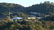
County (/məˈrɪn/ mə-RIN; Spanish: Condado de Marín) is located in the northwestern part of the San Francisco Bay Area of the U.S. state of California...
91 KB (5,550 words) - 23:31, 9 May 2024

Napa County (/ˈnæpə/ ) is a county north of San Pablo Bay located in the northern portion of the U.S. state of California. As of the 2020 census, the population...
87 KB (6,043 words) - 21:15, 15 May 2024

San Francisco (redirect from San Francisco, California, U.S.)
Francisco, officially the City and County of San Francisco, is a commercial, financial, and cultural center in Northern California. With a population of 808,437...
261 KB (24,063 words) - 06:05, 12 May 2024

Zone, making it one of only a few U.S. counties officially split into two time zones. It is one of the nine counties that comprise the Trans-Pecos region...
24 KB (2,130 words) - 15:05, 27 April 2024

List of UTC offsets (redirect from Time Zone Map)
Island Mexico Baja California United Kingdom Pitcairn Islands United States (Pacific Time Zone) California Idaho The northern counties of Benewah, Bonner...
60 KB (4,181 words) - 17:58, 27 March 2024