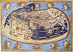
The Cartography and Geographic Information Society (CaGIS) is a learned society in the fields of cartography and geographic information science. It includes... 2 KB (166 words) - 22:16, 29 July 2021 |
Francis on behalf of the U.S. Cartography and Geographic Information Society, in affiliation with the International Cartographic Association. Its editor-in-chief... 3 KB (162 words) - 00:56, 8 July 2023 |
 | Modern cartography constitutes many theoretical and practical foundations of geographic information systems (GIS) and geographic information science... 61 KB (7,307 words) - 04:01, 23 March 2024 |
American Cartographic Information Society (NACIS) is a US-based cartographic society founded in 1980. It was founded by specialists in cartography, which... 5 KB (449 words) - 14:59, 11 April 2024 |
Medieval Islamic geography and cartography refer to the study of geography and cartography in the Muslim world during the Islamic Golden Age (variously... 39 KB (4,692 words) - 06:04, 3 April 2024 |
agency British Cartographic Society Cartography and Geographic Information Society International Cartographic Association National Cartographic Center of Iran... 5 KB (351 words) - 23:15, 26 March 2024 |
member organizations, to provide a forum for issues and techniques in cartography and geographic information science (GIScience). ICA was founded on June 9... 16 KB (1,225 words) - 09:33, 26 April 2024 |
as geography, cartography, and geodesy, while incorporating more recent developments in cognitive and information science. It also overlaps with and draws... 9 KB (974 words) - 17:19, 13 April 2024 |
 | Map projection (redirect from Projection (cartography)) Distortion: A Review" (PDF). Cartography and Geographic Information Science. 28 (3). Cartography and Geographic Information Society: 167–182. doi:10.1559/152304001782153044... 58 KB (6,482 words) - 15:55, 11 January 2024 |
The British Cartographic Society (BCS) is an association of individuals and organisations dedicated to exploring and developing the world of maps. It is... 12 KB (1,274 words) - 07:51, 28 September 2023 |
 | Eastern Hemisphere (section Geography) MD: Cartography and Geographic Information Society, American Congress on Surveying and Mapping. "Eastern Hemisphere". Merriam-Webster's Geographical Dictionary... 10 KB (1,032 words) - 01:29, 29 April 2024 |
 | Gall–Peters projection (category 20th-century maps and globes) claims in 1986 motivated the American Cartographic Association (now Cartography and Geographic Information Society) to produce a series of booklets (including... 19 KB (2,104 words) - 01:50, 27 April 2024 |
 | Western Hemisphere (section Countries, dependencies and other territories in the Western Hemisphere but not in the Americas) projection to the need, Bethesda, MD: Cartography and Geographic Information Society, American Congress on Surveying and Mapping, archived from the original... 17 KB (1,162 words) - 01:47, 29 April 2024 |
National Society of Professional Surveyors (NSPS) Cartographic and Geographic Information Society (CaGIS) Geographic and Land Information Society (GLIS)... 3 KB (226 words) - 23:31, 30 January 2024 |
 | Gene Keyes (section Cartography Awards) Cartography and Geographic Information Society. Feb 9, 2014. "CaGIS 42nd Map Design Competition Results". cartogis.org. Cartography and Geographic Information... 26 KB (3,177 words) - 14:22, 6 February 2024 |
Brandon Plewe (category Geographic information scientists) Cartographic Information Society (NACIS) between 2008 and 2009. He served as the president of the Cartography and Geographic Information Society (CaGIS) between... 9 KB (754 words) - 19:29, 2 January 2024 |
 | Tomlin, C. Dana (1990). Geographic information systems and cartographic modeling. Prentice Hall series in geographic information science. Prentice Hall... 99 KB (13,047 words) - 12:42, 12 April 2024 |
Volunteered geographic information (VGI) is the harnessing of tools to create, assemble, and disseminate geographic data provided voluntarily by individuals... 11 KB (1,217 words) - 21:21, 17 September 2023 |
(2020-09-01). "KN-Journal of Cartography and Geographic Information, German Cartographic Society e.V. (DGfK), Society for Cartography and Geomatics: News". KN... 7 KB (671 words) - 22:06, 10 December 2023 |
 | spatial analysis, geographic information systems, and geographic information science, a field is a property that fills space, and varies over space,... 17 KB (2,005 words) - 09:34, 10 January 2024 |
 | Geospatial Information Center (Portuguese: Centro de Informação Geoespacial do Exército; CIGeoE) is the military geographical, cartographical and geospatial... 4 KB (271 words) - 15:20, 4 May 2023 |
popularizer of geographic information. The society has long supported geographic research and education. In the West during the second half of the 19th and the 20th... 73 KB (9,472 words) - 11:10, 26 March 2024 |
The history of cartography refers to the development and consequences of cartography, or mapmaking technology, throughout human history. Maps have been... 142 KB (17,588 words) - 11:31, 14 April 2024 |
Michael Peterson (geographer) (category Geographic information scientists) geographer and cartographer whose fields of research include Geographic information systems and computer cartography in relation to the Internet and World... 11 KB (909 words) - 03:24, 27 April 2024 |
typically in favor of a society's dominant group. Critical cartographers aim to reveal the “‘hidden agendas of cartography’ as tools of socio-spatial... 17 KB (1,936 words) - 06:03, 29 December 2023 |


