 | Cascade County (cascade means waterfall in French) is a county located in the U.S. state of Montana. As of the 2020 census, the population was 84,414... 26 KB (1,808 words) - 23:17, 25 April 2024 |
 | Cascade is a town in Cascade County, Montana, United States. The population was 600 at the 2020 census. It is part of the Great Falls, Montana Metropolitan... 20 KB (1,049 words) - 17:29, 29 April 2024 |
Cascade County may refer to: Cascade County, Montana Cascade County, Washington (proposed new county) This disambiguation page lists articles about distinct... 340 bytes (48 words) - 03:33, 7 April 2012 |
Jones County Cascade Township, Michigan Cascade Township, Olmsted County, Minnesota Cascade, Missouri Cascade, Montana Cascade County, Montana Cascade, Nebraska... 7 KB (894 words) - 05:35, 16 September 2023 |
 | is the third most populous city in the U.S. state of Montana and the county seat of Cascade County. The population was 60,442 according to the 2020 census... 100 KB (11,386 words) - 01:15, 16 April 2024 |
is a name used for 11 buttes in Montana. Two of the most prominent buttes are located in a) Cascade County, Montana, about 22 miles (35 km) due west... 7 KB (1,173 words) - 15:06, 15 August 2022 |
 | Ulm is a census-designated place (CDP) in Cascade County, Montana, United States. It was originally a large ranch owned by Indiana-born cattleman William... 8 KB (679 words) - 04:42, 2 September 2023 |
 | tributary of the Missouri River, in central Montana, in the United States. It rises in southern Meagher County in the Castle Mountains and flows northwest... 4 KB (342 words) - 21:53, 20 August 2022 |
 | place (CDP) in Cascade County, Montana, United States. The population was 354 at the 2010 census. It is part of the Great Falls, Montana Metropolitan Statistical... 8 KB (703 words) - 21:33, 13 July 2023 |
 | Malmstrom Air Force Base (redirect from Malmstrom AFB, Montana) Malmstrom Air Force Base is a United States Air Force base in Cascade County, Montana, United States, adjacent to the city of Great Falls. It was named... 49 KB (5,637 words) - 07:49, 9 February 2024 |
 | Business (I-15 Bus.) is a business loop of Interstate 15 (I-15) in Cascade County, Montana, United States, almost entirely within Great Falls. The route links... 7 KB (584 words) - 19:43, 23 January 2024 |
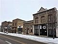
| The Cascade County Courthouse in Great Falls, Montana is a historic courthouse built in 1901–1903, located in the town's civic district. Founded in 1887... 4 KB (324 words) - 13:59, 9 August 2023 |
and Montana. The largest Hutterite communities are located in Hutchinson County, South Dakota, Cascade County, Montana, Pondera County, Montana, Clark... 8 KB (169 words) - 21:05, 9 February 2024 |
 | manage the fairgrounds and arena on its own. A major study by Cascade County and Montana ExpoPark in 2010 proposed making significant changes to the fairgrounds... 10 KB (1,079 words) - 17:31, 1 January 2024 |
 | Vaughn is a census-designated place (CDP) in Cascade County, Montana, United States. The population was 737 at the 2020 census, compared to 658 at the... 10 KB (954 words) - 23:35, 24 November 2023 |
(secondary coordinates) There are at least 78 named mountains in Cascade County, Montana. Adel Mountain, 47°04′34″N 111°42′24″W / 47.07611°N 111.70667°W... 14 KB (3,330 words) - 10:02, 28 October 2022 |
coordinates) There are at least 15 named lakes and reservoirs in Cascade County, Montana. Benton Lake, 47°39′56″N 111°19′39″W / 47.66556°N 111.32750°W... 3 KB (709 words) - 04:17, 8 April 2022 |
 | place (CDP) in Cascade County, Montana, United States. The population was 124 at the 2010 census. It is part of the Great Falls, Montana Metropolitan Statistical... 12 KB (934 words) - 05:34, 14 July 2023 |
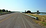
 | Interstate 15 (I-15) in Cascade and the northern terminus is at I-15 north of Cascade. The entire highway is in Cascade County. U.S. roads portal Planning... 2 KB (96 words) - 23:12, 24 June 2023 |
 | Fort Shaw is a census-designated place (CDP) in Cascade County, Montana, United States. The population was 280 at the 2010 census. Named for a former... 7 KB (603 words) - 03:25, 10 September 2023 |
 | Preservation-Cascade, Inc.: About Media related to Tenth Street Bridge (Great Falls, Montana) at Wikimedia Commons Preservation-Cascade Inc. Historic... 2 KB (185 words) - 22:17, 9 August 2023 |
 | Lewis and Clark County is a county located in the U.S. state of Montana. As of the 2020 census, the population was 70,973. Its county seat is Helena,... 18 KB (1,222 words) - 23:36, 25 April 2024 |
 | Black Eagle is a census-designated place (CDP) in Cascade County, Montana, United States. The population was 904 at the 2010 census. It is a suburb of... 8 KB (650 words) - 23:33, 30 April 2023 |
 | Big Falls (Missouri River waterfall) (redirect from Big Falls (Montana)) of Steam) is a major waterfall located on the Missouri River in western Montana in the United States. It is the lowermost and largest of the Great Falls... 4 KB (342 words) - 17:54, 2 April 2024 |
 | Great Falls International Airport (category Transportation in Cascade County, Montana) in city limits three miles southwest of central Great Falls in Cascade County, Montana, United States. The airport has also been called Great Falls Municipal... 15 KB (1,076 words) - 21:16, 23 April 2024 |
 | Roe River (category Rivers of Cascade County, Montana) River runs from Giant Springs to the Missouri River near Great Falls, Montana, United States. The Roe River is only 201 feet (61 m) long at its longest... 5 KB (502 words) - 04:42, 19 March 2024 |
 | Neihart is a town in Cascade County, Montana, United States. It is located in the center of Little Belt Mountains. The population was 43 at the 2020 census... 19 KB (1,723 words) - 17:29, 29 April 2024 |
 | In the U.S. state of Montana, Interstate 15 (I-15, additionally named as the First Special Service Force Memorial Highway from Helena to the Alberta,... 17 KB (657 words) - 05:55, 15 January 2024 |
 | town in Cascade County, Montana, United States. The population was 510 according to the 2020 census. It is part of the Great Falls, Montana metropolitan... 13 KB (1,237 words) - 17:29, 29 April 2024 |
 | feet (2,150 m) Cascade Falls, Sanders County, Montana, 47°18′10″N 114°49′35″W / 47.30278°N 114.82639°W / 47.30278; -114.82639 (Cascade Falls), el. 2... 26 KB (5,726 words) - 18:03, 22 August 2022 |