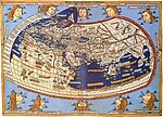
 | Cartography (/kɑːrˈtɒɡrəfi/; from Ancient Greek: χάρτης chartēs, 'papyrus, sheet of paper, map'; and γράφειν graphein, 'write') is the study and practice... 61 KB (7,307 words) - 04:01, 23 March 2024 |
 | Monmonier speculated that computer cartography facilitated by GIS would largely replace traditional pen and paper cartography. Geographers began to heavily... 75 KB (7,484 words) - 01:17, 1 May 2024 |
Volume Cartography is the name of a computer program for locating and mapping 2-dimensional surfaces within a 3-dimensional object.X-rays can reveal minute... 4 KB (479 words) - 19:38, 7 February 2024 |
 | Waldo R. Tobler (section Computer cartography) contributions to computer cartography and was one of the first geographers to explore using computers in geography. In cartography, he contributed to... 68 KB (6,619 words) - 06:45, 9 April 2024 |
 | Geography (section Quantitative cartography) geography, which included "Ptolemaic cartographic theory." However, the concepts of geography (such as cartography) date back to the earliest attempts... 91 KB (9,327 words) - 17:17, 25 April 2024 |
for geographical laws George F. Jenks (1916-1996) – influential in computer cartography and thematic mapping Mei-Po Kwan (born 1962) - geographer that coined... 20 KB (2,372 words) - 19:46, 1 May 2024 |
 | geographer Strabo's Geographika, compiled almost 2000 years ago. As cartography developed, geographers illuminated many aspects used today in the field;... 23 KB (2,578 words) - 07:15, 12 April 2024 |
 | phenomena, such as crustal motion, oceanic tides, and polar motion), cartography, geographical information science (GIS) and remote sensing (the short... 30 KB (3,583 words) - 09:59, 14 March 2024 |
 | Geoinformatics is a scientific field primarily within the domains of Computer Science and technical geography. It focuses on the programming of applications... 9 KB (893 words) - 21:42, 20 March 2024 |
 | Quantitative Cartography Computer cartography Web mapping Geomathematics Geovisualization Geologic modelling Geographic information system Distributed... 20 KB (2,138 words) - 17:13, 5 March 2024 |
May 2023, when the weak local gravity was empirically explained using computer simulations and seismic data. The gravity anomaly, or "gravity hole", is... 4 KB (502 words) - 08:15, 29 January 2024 |
 | Quantitative Cartography Computer cartography Web mapping Geomathematics Geovisualization Geologic modelling Geographic information system Distributed... 4 KB (497 words) - 13:31, 6 March 2024 |
 | Quantitative Cartography Computer cartography Web mapping Geomathematics Geovisualization Geologic modelling Geographic information system Distributed... 7 KB (780 words) - 15:06, 27 February 2024 |
 | Quantitative Cartography Computer cartography Web mapping Geomathematics Geovisualization Geologic modelling Geographic information system Distributed... 5 KB (466 words) - 00:36, 14 February 2024 |
 | Quantitative Cartography Computer cartography Web mapping Geomathematics Geovisualization Geologic modelling Geographic information system Distributed... 7 KB (748 words) - 08:26, 21 April 2024 |
Quantitative Cartography Computer cartography Web mapping Geomathematics Geovisualization Geologic modelling Geographic information system Distributed... 15 KB (1,765 words) - 02:44, 22 April 2024 |
 | publication detailing the use of computers to facilitate cartography was written by Waldo Tobler in 1959. Further computer hardware development spurred by... 99 KB (13,053 words) - 00:28, 2 May 2024 |
whose fields of research include Geographic information systems and computer cartography in relation to the Internet and World Wide Web. He has been a professor... 11 KB (909 words) - 03:24, 27 April 2024 |
 | Quantitative Cartography Computer cartography Web mapping Geomathematics Geovisualization Geologic modelling Geographic information system Distributed... 6 KB (604 words) - 22:11, 19 September 2023 |
Quantitative Cartography Computer cartography Web mapping Geomathematics Geovisualization Geologic modelling Geographic information system Distributed... 12 KB (1,677 words) - 18:28, 27 February 2024 |
 | as people who make maps, map making is actually the field of study of cartography, a subset of geography. Geographers do not study only the details of... 14 KB (1,289 words) - 18:51, 4 February 2024 |
 | Quantitative Cartography Computer cartography Web mapping Geomathematics Geovisualization Geologic modelling Geographic information system Distributed... 11 KB (968 words) - 04:01, 9 March 2023 |
 | Quantitative Cartography Computer cartography Web mapping Geomathematics Geovisualization Geologic modelling Geographic information system Distributed... 6 KB (637 words) - 07:35, 10 January 2024 |
Quantitative Cartography Computer cartography Web mapping Geomathematics Geovisualization Geologic modelling Geographic information system Distributed... 5 KB (607 words) - 10:25, 17 April 2024 |
fundamental themes in traditional spatially oriented fields such as geography, cartography, and geodesy, while incorporating more recent developments in cognitive... 9 KB (974 words) - 17:19, 13 April 2024 |


