Crowsnest Provincial Park is a provincial park in British Columbia, Canada, located within the District Municipality of Sparwood, 51 km (32 mi) east of... 2 KB (75 words) - 04:52, 27 December 2023 |
Crows Nest (redirect from Crowsnest) Canada Crowsnest Pass, a mountain pass on the Alberta–British Columbia border, Canada Crowsnest Mountain Crowsnest Provincial Park Crowsnest River, Alberta... 1 KB (244 words) - 14:40, 24 November 2021 |
 | Crowsnest Pass (sometimes referred to as Crow's Nest Pass, French: col du Nid-de-Corbeau) is a low mountain pass across the Continental Divide of the... 11 KB (1,172 words) - 04:50, 30 December 2023 |
 | Municipality of Crowsnest Pass is home to parts of the Castle Provincial Park in the southeast and the Castle Wildland Provincial Park in the southwest... 24 KB (1,581 words) - 11:21, 27 April 2024 |
 | Crowsnest Pass, northwest of Waterton Lakes National Park and west of the Town of Pincher Creek. It shares a boundary with Castle Wildland Provincial... 10 KB (1,054 words) - 20:14, 1 February 2024 |
British Columbia Highway 3 (redirect from Southern Trans-Provincial Highway) British Columbia Highway 3, officially named the Crowsnest Highway, is an 841-kilometre (523 mi) highway that traverses southern British Columbia, Canada... 29 KB (2,203 words) - 20:35, 10 April 2024 |
 | Tsʼilʔos Provincial Park is a provincial park in British Columbia, Canada. Tsʼilʔos (/ˈsaɪlɒs/ SY-loss; roughly [t͡sʼelʔos] in Chilcotin) is the official... 4 KB (337 words) - 23:20, 5 January 2023 |
 | Alberta Highway 3 (redirect from Crowsnest Trail) Alberta Provincial Highway No. 3, commonly referred to as Highway 3 and officially named the Crowsnest Highway, is a 324-kilometre (201 mi) highway that... 78 KB (7,436 words) - 02:25, 8 November 2023 |
British Columbia Highway 93 (redirect from British Columbia provincial highway 93) that it connects with at the Canada–United States border. It follows the Crowsnest Highway (Highway 3) and Highway 95 through Radium Hot Springs and to where... 10 KB (645 words) - 22:55, 22 September 2022 |
 | Alberta Highway 40 (redirect from Alberta provincial highway 40) Country. Its segmented sections extend from Coleman in the Municipality of Crowsnest Pass northward to the City of Grande Prairie and is currently divided... 16 KB (491 words) - 19:24, 5 April 2024 |
Frank, Alberta (category Crowsnest Pass, Alberta) an urban community in the Rocky Mountains within the Municipality of Crowsnest Pass in southwest Alberta, Canada. It was formerly incorporated as a village... 14 KB (1,104 words) - 18:16, 29 April 2024 |
 | leading to an armed standoff. The dam was constructed where the Oldman, Crowsnest, and Castle river systems converge. On June 21, 2013, during the 2013... 7 KB (505 words) - 04:39, 16 December 2023 |
Municipality of Crowsnest Pass, a southwestern boundary with the province of British Columbia, a southeastern boundary with Waterton Lakes National Park and a northeastern... 11 KB (1,054 words) - 04:10, 5 February 2024 |
British Columbia Highway 95 (redirect from British Columbia provincial highway 95A) Canada-U.S. border and the Crowsnest Highway is known as the Yahk–Kingsgate Highway while the section between the Crowsnest Highway and Golden is known... 11 KB (684 words) - 17:16, 29 March 2023 |
The list of provincial parks of the Kootenays contains the provincial parks located within this geographic region of the province of British Columbia... 15 KB (97 words) - 23:54, 12 July 2022 |
British Columbia Highway 43 (redirect from British Columbia provincial highway 43) Highway, is the easternmost spur off of the British Columbia segment of the Crowsnest Highway (Highway 3), in the Regional District of East Kootenay. The highway... 2 KB (151 words) - 15:06, 27 October 2023 |
British Columbia, Canada, just north of the Canada-U.S. border. Yahk Provincial Park borders the village to the south. Yahk is located on the Moyie River... 4 KB (120 words) - 03:49, 10 September 2023 |
the town of Rock Creek. The park has a roughly 38 hectare area, and is near to the Crowsnest Highway. "Johnstone Creek Park". BC Geographical Names. v... 1 KB (72 words) - 22:41, 15 December 2023 |
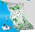
 | list of protected areas of British Columbia includes all federally and provincially protected areas within the Canadian province of British Columbia. As... 10 KB (466 words) - 19:05, 14 July 2023 |
 | Alberta Highway 734 (category Alberta provincial highways, 700/800 sub-series) Forestry Trunk Road was a north-south resource road that ran from the Crowsnest Highway (Highway 3) in southern Alberta to Highway 43 in northern Alberta... 12 KB (558 words) - 05:34, 17 February 2022 |
 | Nisga'a Memorial Lava Bed Provincial Park (Nisga'a: Anhluut'ukwsim Lax̲mihl Angwinga'asankswhl Nisg̲a'a) is a provincial park in the Nass River valley... 4 KB (330 words) - 08:12, 29 October 2023 |
 | 686). A park access road (PAR) is an access route managed by Alberta Transportation that connects provincial parks to designated provincial highways... 256 KB (2,570 words) - 21:01, 18 February 2024 |
 | Mount Robson (category Mount Robson Provincial Park) Canadian Rockies. The mountain is located entirely within Mount Robson Provincial Park of British Columbia, and is part of the Rainbow Range. Mount Robson... 13 KB (1,138 words) - 15:24, 2 May 2024 |


