 | Curry County is the southwesternmost county in the U.S. state of Oregon located on the South Coast. As of the 2020 census, the population was 23,446.... 23 KB (1,983 words) - 18:39, 26 April 2024 |
 | Brookings is a city in Curry County, Oregon, United States. It was named after John E. Brookings, president of the Brookings Lumber and Box Company, who... 23 KB (1,756 words) - 05:31, 3 May 2024 |
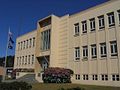
 | yan-shuu-chit’-dvn) is a city in and the county seat of Curry County, Oregon, United States, on the Oregon Coast. The population was 2,241 at the 2020... 19 KB (1,553 words) - 04:59, 17 July 2023 |
Curry County is the name of two counties in the United States: Curry County, New Mexico Curry County, Oregon This disambiguation page lists articles about... 149 bytes (53 words) - 04:25, 28 December 2019 |
 | Oregon's 4th congressional district represents the southern half of Oregon's coastal counties, including Coos, Curry, Lincoln, Lane, and Benton counties... 30 KB (300 words) - 23:37, 7 March 2024 |
 | Agness is an unincorporated community in Curry County, Oregon, United States. It is near the confluence of two Wild and Scenic rivers—the Lower Rogue and... 15 KB (915 words) - 14:23, 20 March 2024 |
 | Port Orford (Tolowa: tr’ee-ghi~’- ’an’ ) is a city in Curry County on the southern coast of Oregon, United States. The population was 1,133 at the 2010... 17 KB (1,358 words) - 21:08, 22 September 2023 |
 | dinosaur fragments ever discovered in Oregon were found in the Otter Point Formation, along the coast of Curry County. People have lived along the Rogue... 95 KB (10,791 words) - 18:19, 16 March 2024 |
 | Harbor (Tolowa: chit ) is an unincorporated community in Curry County, Oregon, United States. It is located across the Chetco River from the city of Brookings... 14 KB (1,080 words) - 17:34, 19 August 2023 |
 | offshore and are up to 149 feet (45 m) high. Cape Blanco is in northern Curry County, about 4 miles (6 km) north of Port Orford, along a mountainous and isolated... 12 KB (925 words) - 05:35, 29 January 2024 |
community Curry County, New Mexico Curry County, Oregon Curry Canyon (Utah) Cloncurry, Queensland, Australia, a rural town, known locally as The Curry Curry, County... 3 KB (381 words) - 06:23, 5 May 2024 |
the Pacific Ocean coast of southwestern Oregon in the United States. It is located in northern Curry County, just outside the town of Port Orford, along... 1 KB (136 words) - 05:38, 14 March 2023 |
 | unincorporated community and census-designated place in Curry County, Oregon, United States, on the Oregon Coast established in 1881. It had a population of... 7 KB (349 words) - 05:25, 12 July 2023 |
 | Zane Grey Cabin (category National Register of Historic Places in Curry County, Oregon) 1935. It is located in Curry County, Oregon on the north bank of the lower Rogue River near Galice in Josephine County, Oregon. The National Register... 3 KB (196 words) - 05:48, 9 August 2023 |
 | Klamath Mountains (category Landforms of Curry County, Oregon) lightly-populated mountain range in northwestern California and southwestern Oregon in the western United States. As a mountain system within both the greater... 25 KB (2,295 words) - 00:18, 24 February 2024 |
Creek is a small stream, about 4 miles (6 km) long, in Curry County in the U.S. state of Oregon. It arises in the Siskiyou Mountains and flows generally... 2 KB (155 words) - 19:52, 10 May 2020 |
 | Park, a Curry County campground at Floras Lake Cape Blanco and Cape Blanco State Park Humbug Mountain State Park Gold Beach and Rogue River (Oregon) Samuel... 13 KB (1,417 words) - 01:24, 3 August 2023 |
) is an unincorporated community and census-designated place in Curry County, Oregon, United States. As of the 2010 census it had a population of 84.... 9 KB (572 words) - 06:05, 13 July 2023 |
Bosley Butte (category Mountains of Curry County, Oregon) in the Klamath Mountains of southwestern Oregon in the United States. It is located in southern Curry County in the extreme southwest corner of the state... 2 KB (114 words) - 17:49, 19 May 2023 |
Edward Delon Warren (category People from Curry County, Oregon) Warren was convicted for the 1979 double murder of a couple in Brookings, Oregon and sentenced to death. The sentence was later commuted to two life imprisonment... 7 KB (738 words) - 06:53, 23 February 2024 |
 | Lookout Air Raids (category Curry County, Oregon) minor but historic Japanese air raids that occurred in the mountains of Oregon, several miles outside Brookings during World War II. On September 9, 1942... 9 KB (967 words) - 22:44, 30 April 2024 |
Creek is a small stream, about 3 miles (5 km) long, in Curry County in the U.S. state of Oregon. It arises in the Siskiyou Mountains and flows generally... 2 KB (156 words) - 19:52, 10 May 2020 |
 | Pearsoll Peak (category Mountains of Curry County, Oregon) southwestern Oregon in the United States. It is located in the northern Kalmiopsis Wilderness in southeastern Curry County and western Josephine County in the... 2 KB (140 words) - 04:18, 26 July 2017 |
 | Chetco River (category Rivers of Curry County, Oregon) southwestern portion of the U.S. state of Oregon. It drains approximately 352 square miles (912 km2) of Curry County. Flowing through a rugged and isolated... 46 KB (4,543 words) - 12:14, 30 October 2022 |
 | Bear Camp Road (category Transportation in Curry County, Oregon) road traversing the Klamath Mountains in Josephine and Curry counties in the U.S. state of Oregon. Bear Camp Road is a combination of Bureau of Land Management... 13 KB (1,704 words) - 05:58, 27 June 2022 |
 | Clatsop, Tillamook, Lincoln, Lane, Coos, and Curry counties. (Douglas County is the only coastal Oregon county not included in the refuge.) The area is managed... 8 KB (601 words) - 10:48, 19 November 2023 |
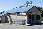
 | community in Curry County, Oregon, United States. It has a post office with a ZIP code 97464. Ophir lies at the intersection of Oregon Route 515 and... 3 KB (57 words) - 17:45, 27 July 2023 |
 | Thomas Creek Bridge (category Transportation buildings and structures in Curry County, Oregon) Thomas Creek Bridge crosses Thomas Creek in Curry County, in the U.S. state of Oregon. It is on U.S. Route 101 and lies within the boundaries of Samuel... 3 KB (198 words) - 22:27, 4 January 2024 |
Chetco Peak (category Mountains of Curry County, Oregon) Mountains of southwestern Oregon in the United States. It is located in the southern Kalmiopsis Wilderness in southern Curry County in the extreme southwestern... 2 KB (168 words) - 12:11, 3 December 2021 |
 | Oregon. Coos County was created by the Territorial Legislature from parts of Umpqua, and Jackson counties on December 22, 1853. Curry County, Oregon,... 24 KB (2,221 words) - 00:56, 4 May 2024 |