Broken Ridge – Oceanic plateau in the Indian Ocean East Tasman Plateau – Submerged microcontinent south east of Tasmania Joseph Gilbert Seamount – Continental... 9 KB (1,097 words) - 08:46, 1 December 2023 |
 | M.H. (2018). "The role of the New Zealand Plateau in the Tasman Sea circulation and separation of the East Australian Current". Journal of Geophysical... 14 KB (1,580 words) - 04:51, 1 April 2024 |
 | Geology of Tasmania (section South Tasman Rise) the east from Tasmania and Australia, and the rift jumped into the Lord Howe Rise and separated off the East Tasman Plateau. This East Tasman Plateau microcontinent... 80 KB (11,147 words) - 10:34, 17 March 2024 |
Ridge which extends to the subantarctic Balleny Islands. To east of the rise is the Tasman Basin, while the South Australian Basin extends westwards, south... 9 KB (1,150 words) - 21:07, 23 August 2023 |
 | into the Australo-Antarctic Gulf. Sediment core samples from the East Tasman Plateau, then located at a palaeolatitude of ~65 °S, show an increase in... 163 KB (17,846 words) - 23:36, 22 April 2024 |
 | and this has resulted in a chain of seamounts extending from the East Tasman Plateau. Isotopes and trace elements in the volcanic rocks indicated a high... 1 KB (156 words) - 17:08, 20 December 2019 |
 | Lord Howe Rise (category Tasman Sea) Zealand in the south west of the Pacific Ocean. To its west is the Tasman Basin and to the east is the New Caledonia Basin. Lord Howe Rise has a total area of... 8 KB (892 words) - 23:00, 1 July 2023 |
 | Three Kings Ridge (category Tasman Sea) Northland in the North Island, and its extension under the Tasman Sea of the Northland Plateau. However, there is a distinct age difference between the... 12 KB (1,307 words) - 16:12, 27 August 2023 |
 | 000 km2 (310,000 sq mi), the Campbell Plateau has a gently undulating bathymetry with major rises trending east-west: Campbell Island Rise, Pukaki Rise... 9 KB (1,064 words) - 08:38, 8 April 2023 |
 | Manawatāwhi / Three Kings Islands (redirect from Oromaki / North East Island) South Pacific Ocean and Tasman Sea converge. They measure 6.85 km2 (2.64 sq mi) in area. The islands are on a submarine plateau, the Three Kings Bank,... 16 KB (1,862 words) - 21:23, 14 April 2024 |
Cape Raoul (category Tasman National Park) locality and a natural feature in the local government area of Tasman in the South-east region of Tasmania. It is located about 13 kilometres (8.1 mi)... 6 KB (547 words) - 05:45, 21 April 2024 |
 | opened on 12 February 1923. Collaroy Plateau Post Office opened on 1 April 1949 and closed in 1988. Collaroy Plateau West Post Office opened on 1 November... 9 KB (807 words) - 01:33, 27 March 2024 |
 | Kerguelen Plateau on the Antarctic Plate c. 118 to 95 Ma and then the Ninety East Ridge on the Indian Plate at c. 100 Ma. The Kerguelen Plateau and the... 73 KB (7,706 words) - 10:10, 12 April 2024 |
 | Lord Howe Seamount Chain (category Seamounts of the Tasman Sea) deep-sea elevated plateau which is a submerged part of Zealandia. The Tasmantid and Lord Howe seamount chains are both broadly within the Tasman basin (the abyssal... 14 KB (745 words) - 12:06, 21 April 2024 |
Yarrangobilly Caves area, New South Wales Takaka Hill, Tasman Region (South Island) Mount Owen, Tasman Region (South Island) Waitomo, southern Waikato Region... 22 KB (1,954 words) - 03:26, 13 April 2024 |
 | It and Bilgola Plateau were gazetted as suburbs in 2012 dividing the previous suburb of Bilgola. Bilgola Beach is located on the Tasman Sea side of the... 6 KB (662 words) - 10:31, 9 December 2023 |
 | Matiri River (category Rivers of the Tasman District) located in the northwest of New Zealand's South Island. The river is in the Tasman Region. It runs south for 30 kilometres from its headwaters west of Mount... 4 KB (278 words) - 00:39, 14 April 2024 |
 | Tasmantid hotspot (category Tasman Sea) hotspot became positioned in the northern Tasman Sea 20 million years ago, eventually reaching its current location east of Tasmania in response to ongoing northward... 9 KB (367 words) - 18:58, 23 March 2024 |
 | Tasmantid Seamount Chain (redirect from Tasman Seamount Chain) The Tasmantid Seamount Chain (alternatively Tasmantid Seamounts, Tasman Seamounts, Tasman Seamount Chain, Tasmantide Volcanoes or the Tasmantids) is a 2... 15 KB (602 words) - 12:29, 21 April 2024 |
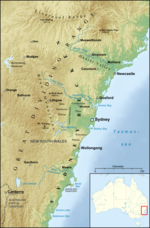
 | now preserved on the east coast of New South Wales, Australia and with some of its eastern side now subsided beneath the Tasman Sea. The basin is named... 15 KB (1,626 words) - 03:39, 24 April 2024 |


