
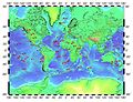
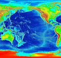
150°29′E / 43.96°S 150.48°E / -43.96; 150.48 The East Tasman Plateau is a submerged microcontinent south east of Tasmania. Its area is 50,000 square kilometres...
15 KB (1,860 words) - 07:04, 9 July 2023
Broken Ridge – Oceanic plateau in the Indian Ocean East Tasman Plateau – Submerged microcontinent south east of Tasmania Joseph Gilbert Seamount – Continental...
9 KB (1,097 words) - 19:45, 25 July 2024
and this has resulted in a chain of seamounts extending from the East Tasman Plateau. Isotopes and trace elements in the volcanic rocks indicated a high...
1 KB (156 words) - 17:08, 20 December 2019

M.H. (2018). "The role of the New Zealand Plateau in the Tasman Sea circulation and separation of the East Australian Current". Journal of Geophysical...
14 KB (1,580 words) - 11:56, 26 September 2024

Geology of Tasmania (section South Tasman Rise)
the east from Tasmania and Australia, and the rift jumped into the Lord Howe Rise and separated off the East Tasman Plateau. This East Tasman Plateau microcontinent...
80 KB (11,155 words) - 08:47, 14 July 2024
Fault Sorong Fault Carnegie Ridge Chile Rise Darwin Rise East Pacific Rise East Tasman Plateau Explorer Ridge Galapagos Rise Gorda Ridge Hollister Ridge...
24 KB (2,269 words) - 23:08, 12 July 2024
Ridge which extends to the subantarctic Balleny Islands. To east of the rise is the Tasman Basin, while the South Australian Basin extends westwards, south...
9 KB (1,150 words) - 21:07, 23 August 2023

into the Australo-Antarctic Gulf. Sediment core samples from the East Tasman Plateau, then located at a palaeolatitude of ~65 °S, show an increase in...
167 KB (18,273 words) - 16:59, 19 September 2024
Lord Howe Rise (category Tasman Sea)
Zealand in the south west of the Pacific Ocean. To its west is the Tasman Basin and to the east is the New Caledonia Basin. Lord Howe Rise has a total area of...
8 KB (892 words) - 23:00, 1 July 2023

of atolls East Pacific Rise – A mid-oceanic ridge at a divergent tectonic plate boundary on the floor of the Pacific Ocean East Tasman Plateau – A submerged...
226 KB (32,625 words) - 05:22, 23 August 2024

(pronounced /ziːˈlændiə/), also known as Te Riu-a-Māui (Māori) or Tasmantis (from Tasman Sea), is an almost entirely submerged mass of continental crust in Oceania...
18 KB (2,900 words) - 17:14, 15 August 2024
Three Kings Ridge (category Tasman Sea)
Northland in the North Island, and its extension under the Tasman Sea of the Northland Plateau. However, there is a distinct age difference between the...
12 KB (1,307 words) - 16:12, 27 August 2023

33 kilometres north-east of the Sydney central business district, in the local government area of Northern Beaches Council. It and Bilgola Plateau were gazetted...
6 KB (596 words) - 16:16, 4 August 2024
000 km2 (310,000 sq mi), the Campbell Plateau has a gently undulating bathymetry with major rises trending east-west: Campbell Island Rise, Pukaki Rise...
9 KB (1,064 words) - 08:38, 8 April 2023

Manawatāwhi / Three Kings Islands (redirect from Oromaki / North East Island)
South Pacific Ocean and Tasman Sea converge. They measure 6.85 km2 (2.64 sq mi) in area. The islands are on a submarine plateau, the Three Kings Bank,...
17 KB (1,991 words) - 03:03, 17 September 2024
Cape Raoul (category Tasman National Park)
locality and a natural feature in the local government area of Tasman in the South-east region of Tasmania. It is located about 13 kilometres (8.1 mi)...
6 KB (542 words) - 16:44, 25 July 2024

opened on 12 February 1923. Collaroy Plateau Post Office opened on 1 April 1949 and closed in 1988. Collaroy Plateau West Post Office opened on 1 November...
9 KB (807 words) - 08:27, 9 August 2024

southwest by the Western Port Bay, to the south and east by the Bass Strait and the Tasman Sea, and to the east and northeast by the Black–Allan Line (the easternmost...
19 KB (1,848 words) - 21:59, 22 September 2024
Yarrangobilly Caves area, New South Wales Takaka Hill, Tasman Region (South Island) Mount Owen, Tasman Region (South Island) Waitomo, southern Waikato Region...
22 KB (1,960 words) - 19:31, 20 August 2024
Lord Howe Seamount Chain (category Seamounts of the Tasman Sea)
deep-sea elevated plateau which is a submerged part of Zealandia. The Tasmantid and Lord Howe seamount chains are both broadly within the Tasman basin (the abyssal...
14 KB (745 words) - 12:06, 21 April 2024

Matiri River (category Rivers of the Tasman District)
located in the northwest of New Zealand's South Island. The river is in the Tasman Region. It runs south for 30 kilometres from its headwaters west of Mount...
4 KB (278 words) - 00:39, 14 April 2024

Kerguelen Plateau on the Antarctic Plate c. 118 to 95 Ma and then the Ninety East Ridge on the Indian Plate at c. 100 Ma. The Kerguelen Plateau and the...
75 KB (7,826 words) - 08:40, 26 August 2024
distinguished NCB Level 1 drainage divisions or thirteen after splitting the South East Coast division at the New South Wales–Victoria border as defined by the Australian...
9 KB (487 words) - 13:26, 28 April 2022
Tasmantid hotspot (category Tasman Sea)
hotspot became positioned in the northern Tasman Sea 20 million years ago, eventually reaching its current location east of Tasmania in response to ongoing northward...
9 KB (367 words) - 18:58, 23 March 2024
below Killiekrankie Mountain on the Dorrigo Plateau, part of the Great Dividing Range, and flows generally east southeast, joined by four tributaries including...
5 KB (229 words) - 15:29, 24 January 2024

over the year but can be very erratic as heavy rainfalls from the warm Tasman Sea are quite frequent. Whereas a three-day fall of 125 millimetres (4.9 in)...
27 KB (1,753 words) - 04:40, 5 August 2024
now preserved on the east coast of New South Wales, Australia and with some of its eastern side now subsided beneath the Tasman Sea. The basin is named...
15 KB (1,626 words) - 03:39, 24 April 2024

have Tasmania with the Great Australian Bight to the west, and the Tasman Sea to the east. The southernmost point on mainland Tasmania is approximately 43°38′37″S...
51 KB (3,428 words) - 23:59, 11 July 2024

possibly detected by Captain Abel Tasman when he charted Tasmania's coast in 1642. On 5 December, Tasman was following the east coast northward to see how far...
184 KB (15,524 words) - 04:23, 26 September 2024

northern South East Tasman Basin. However both west of Macquarie Island and to its east towards the southern tip of the Campbell Plateau there has been...
28 KB (3,157 words) - 11:13, 12 August 2024