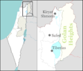
you or your use. https://creativecommons.org/licenses/by/3.0CC BY 3.0 Creative Commons Attribution 3.0 truetrue English Location of the Golan Heights...
(936 × 739 (140 KB)) - 16:05, 9 November 2024
This image is a derivative work of the following images: File:Golan_location_map_2.PNG licensed with Cc-by-3.0 2011-11-10T18:51:00Z Nableezy 936x739 (143176...
(925 × 739 (146 KB)) - 18:42, 6 November 2020
png licensed with Cc-by-sa-3.0, GFDL 2009-03-16T00:31:19Z Ynhockey 732x628 (35905 Bytes) {{Information |Description=Northeastern Israel and the Golan...
(732 × 628 (76 KB)) - 18:42, 6 November 2020
[[:commons:User:NordNordWest|NordNordWest]] |captureDate=~~~~~ |location=Syria |source=[[:Image:Map of Syria.svg] (Import from wikitravel.org/shared) 2010-02-23...
(998 × 779 (327 KB)) - 18:27, 12 August 2023
[[:commons:User:NordNordWest|NordNordWest]] |captureDate=~~~~~ |location=Syria |source=[[:Image:Map of Syria.svg] (Import from wikitravel.org/shared) 2010-02-23...
(300 × 637 (123 KB)) - 18:27, 12 August 2023
Chogha Golan 38.4, 35.866 # Tell Abu Hureyra ), ncol = 2, byrow = TRUE) locations_names <- c("Cayonu Tepesi", "Jeriko", "Asikli Hoyuk", "Chogha Golan", "Tell...
(2,436 × 1,976 (1.51 MB)) - 02:33, 10 October 2024
Chogha Golan 38.4, 35.866 # Tell Abu Hureyra ), ncol = 2, byrow = TRUE) locations_names <- c("Cayonu Tepesi", "Jeriko", "Asikli Hoyuk", "Chogha Golan", "Tell...
(2,428 × 1,976 (1.45 MB)) - 09:07, 7 September 2024
File:Wikimania2011InfoDesk.pdf (matches file content)
following map shows the location of the El Al offices. Click "Ben Gurion" and one will see a listing of points on a map, including the location of the El...
(1,239 × 1,754 (390 KB)) - 02:37, 20 October 2020
DescriptionIsrael North relief location map 2.png Deutsch: Positionskarte des Nordens von Israel Quadratische Plattkarte. Geographische Begrenzung der...
(1,015 × 1,059 (1.25 MB)) - 18:02, 10 November 2020
truetrue You may select the license of your choice. English Northeastern Israel and the Golan Heights Arabic شمال شرق فلسطين (إسرائيل) المحتلة والجولان...
(732 × 628 (99 KB)) - 08:32, 23 December 2023
DescriptionLocation of Bethsaida map.png English: Location of Bethsaida map, based on: Bargil Pixner. Searching for the New Testament Site of Bethsaida...
(1,118 × 729 (92 KB)) - 14:03, 6 December 2023
Date 15 January 2014 Source Own work, using OpenStreetMap File:Golan 1994.jpg by CIA SRTM30 v.2 data Author NordNordWest Permission (Reusing this file)...
(1,015 × 1,059 (1.27 MB)) - 18:02, 10 November 2020
DescriptionWV Golan Heights region in Israel.png Golan Heights region Date 24 October 2013, 23:52:50 Source This file was derived from: Israel location map.svg: ...
(613 × 1,140 (82 KB)) - 11:23, 11 July 2022
DescriptionGolan Heights relief v1.jpg English: This is a shaded relief map illustrating the topography of the Golan Heights and surrounding areas. Transverse...
(758 × 871 (273 KB)) - 11:22, 10 September 2020
choice. English URL: https://commons.wikimedia.org/wiki/user:Ynhockey author name string: Ynhockey Wikimedia username: Ynhockey stated in: OpenStreetMap...
(732 × 628 (110 KB)) - 01:49, 18 August 2024
DescriptionIsraeli-controlled territories.png English: The map above illustrates the de facto territorial control by Israel, in relation to the Palestinian...
(1,998 × 3,712 (518 KB)) - 23:44, 18 March 2022
فيها. English: This is a map of all the Arabic speaking localities in the State of Israel (including East Jerusalem and the Golan Heights). Striped represent...
(4,773 × 7,667 (934 KB)) - 08:50, 22 April 2025
Lucas 2:22, 19:11 y 19:41, y Juan 2:13, 5:1, 7:1 y 12:12. KATZRIN: es un pueblo del periodo bizantino restaurado en la zona central de Golán. LOD (LAIDA):...
(1,278 × 1,849 (1.06 MB)) - 22:50, 18 February 2024
from the very top of the Zohar Formation (Jurassic) near Neve Atif, the Golan. Anomalocaris from the Mt. Stephen Trilobite Beds, Middle Cambrian, near...
(315 × 438 (396 KB)) - 13:51, 4 August 2024


