Géoportail is a comprehensive web mapping service of the French government that publishes maps and geophysical aerial photographs from more than 90 sources... 5 KB (538 words) - 15:28, 5 February 2023 |
engines dedicated to a specific kind of information Baidu Maps Bing Maps Géoportail Google Maps MapQuest Nokia Maps OpenStreetMap Petal Maps Qwant Maps Tencent... 24 KB (869 words) - 10:51, 9 May 2024 |
 | 3406/geo.1914.8134. ISSN 0003-4010. Retrieved 20 March 2015 – via Persée. Géoportail Maps The starting point is at 2,341 m, near the Prariond Refuge. The ending... 17 KB (1,754 words) - 22:43, 24 November 2023 |
 | is the Table des Mouflons, at 321 metres. General view of non-metropolitan France, Maison de la Géographie. Kerguelen islands map, Géoportail IGN v t e... 3 KB (62 words) - 20:53, 19 November 2018 |
 | principal island. It is around 10 km long and 3 km wide. The highest spot is Le stack de Tome at 145 metres. Kerguelen islands map, Géoportail IGN v t e... 3 KB (52 words) - 05:14, 29 October 2023 |
 | France. List of fifteen largest French metropolitan areas by population Géoportail Institut géographique national General: Geography of Europe "Climate change... 19 KB (2,223 words) - 13:10, 5 May 2024 |
 | within a volcanic rock) can be found at this site. IGN maps available on Géoportail "Le puy de Lassolas | Auvergne Destination". www.auvergne-destination... 3 KB (205 words) - 02:36, 27 April 2024 |
 | map.geo.admin.ch. Swisstopo. Retrieved 13 October 2021. "Le Léman". Géoportail (in French). Institut national de l'information géographique et forestière... 39 KB (2,825 words) - 09:48, 1 May 2024 |
1:500,000 scale for visual flying (VFR). The IGN is also in charge of the Géoportail. The associated shop Le Monde des Cartes at 50 Rue de la Verrerie in Paris... 11 KB (1,426 words) - 19:13, 8 December 2023 |
 | position of the peak is taken from Géoportail IGN map on Géoportail (in French), as of July 18, 2007 IGN map on Géoportail (in French), as of November 2,... 2 KB (165 words) - 14:46, 17 September 2023 |
 | passes of the Dauphiné Alps are: Highest summit elevation as reported on Géoportail of Institut Géographique National Evans, I.S. (2013). "Glacial landsforms... 11 KB (274 words) - 15:46, 27 September 2022 |
 | German). Retrieved 17 February 2019. or Wasgenwald IGN maps available on Géoportail Dickinson, Robert E (1964). Germany: A Regional and Economic Geography... 23 KB (2,717 words) - 08:43, 15 March 2024 |
 | article on the slave trade here in 17th and 18th century Le Havre on Géoportail, National Geographic Institute (IGN) website (in French) Texts on Wikisource:... 139 KB (15,584 words) - 21:08, 18 March 2024 |
 | Geography of France List of waterways List of lakes of France List of canals in France Géoportail maps service The Sandre database of rivers in France... 19 KB (1,623 words) - 12:14, 4 March 2024 |
 | 304 ft) and its nearest highest neighbour is the Pic de Noé. Source : Géoportail avec carte IGN à l'échelle 1:25000 "Pic de Soularac, France". Peakbagger... 1 KB (63 words) - 14:35, 21 January 2023 |
 | Redange-sur-Attert and has a population of 116 as of 2024. "Geoportail". map.geoportail.lu. Retrieved 2022-05-24. "Registre national des personnes physiques... 2 KB (54 words) - 13:03, 5 March 2024 |
 | Perdiguero is the highest summit of Haute-Garonne before la pointe de Literole. Lake Portillon lies at its foot. Coordinates via Géoportail and WikiMapia... 2 KB (71 words) - 18:12, 6 January 2024 |
 | cartography (Institut Géographique National - IGN); on-line version: www.geoportail.fr Swiss official cartography (Swiss Federal Office of Topography - Swisstopo);... 4 KB (317 words) - 23:13, 17 March 2024 |
 | (eolianite) and sandstone sediments from the Eocene and Oligocene periods. Géoportail (site en ligne) Source : cartes géologiques à l'échelle 1:50000 du Bureau... 3 KB (162 words) - 12:16, 6 June 2021 |
 | the other one on the east of the Couesnon River is a tiny one (6 ha)". geoportail.gouv.fr. Retrieved 9 August 2018. "Communal limits : the three areas (two... 37 KB (3,915 words) - 15:02, 4 May 2024 |
 | - IGM); on-line version: www.pcn.minambiente.it French official cartography (Institut Géographique National - IGN); on-line version: www.geoportail.fr... 6 KB (351 words) - 21:09, 1 May 2022 |
 | the Bornes Massif. "Mont Lachat - peakbagger". peakbagger.com. Retrieved 23 February 2015. Source : Géoportail avec carte IGN à l'échelle 1:25000 v t e... 1 KB (44 words) - 12:31, 6 October 2020 |
 | are all taken after 1999 (except for Geocover 1990). Bhuvan Bing Maps Géoportail GeoServer Geoweb Google Maps List of observatory software Marble (software)... 20 KB (1,970 words) - 05:12, 6 April 2024 |
 | www.levillare-villerssurmer.com. Retrieved 12 February 2019. "Géoportail". www.geoportail.gouv.fr.ignipq.local.oshimae.rie.agri. Retrieved 12 February... 6 KB (553 words) - 22:50, 2 March 2024 |
 | 642 - Usseglio) Rifugio Santa Maria (close to the summit) Géoportail IGN on www.geoportail.fr key col= Col de la Resta (3,235 m) Marazzi, Sergio (2005)... 5 KB (432 words) - 07:03, 27 July 2022 |
 | Ille-sur-Têt (Illa) Sandre. "Fiche cours d'eau - La Têt (Y04-0400)". Topographic map on Géoportail. Wikimedia Commons has media related to Têt. v t e v t e... 3 KB (124 words) - 13:52, 25 March 2024 |
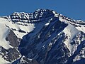 | 9525 crashed into the lower western slopes of the mountain. Géoportail IGN on www.geoportail.fr Archived 2007-11-13 at the Wayback Machine "Tête de l'Estrop... 3 KB (214 words) - 05:45, 11 August 2023 |
 | Antraigues-sur-Volane. Sandre. "Fiche cours d'eau - La Volane (V5010520)". Géoportail - IGN. "Géoportail". Retrieved 21 March 2010. www.peche-ardeche.com. "La Volane"... 5 KB (381 words) - 19:26, 15 February 2024 |
 | cartography (Institut Géographique National – IGN); on-line version: www.geoportail.fr Chisholm, Hugh, ed. (1911). "Alps" . Encyclopædia Britannica. Vol. 1... 11 KB (696 words) - 17:24, 17 March 2024 |
 | French). CERAMAC. p. 43. ISBN 978-2-908470-00-0. IGN maps available on Géoportail "Col de la Fageole (France) - Parcs éoliens - Accès en ligne - The Wind... 3 KB (281 words) - 05:26, 27 April 2024 |