
Geo Imaging Satellite or GISAT is an Indian imaging satellite class for geostationary orbit with a high temporal resolution, meant for providing near...
13 KB (835 words) - 21:32, 16 April 2024

Satellite images (also Earth observation imagery, spaceborne photography, or simply satellite photo) are images of Earth collected by imaging satellites...
25 KB (2,722 words) - 10:18, 1 May 2024

Satellite Pour l’Observation de la Terre, lit. "Satellite for observation of Earth") is a commercial high-resolution optical Earth imaging satellite system...
9 KB (1,230 words) - 06:38, 19 May 2024

Geostationary orbit (redirect from Geo-stationary satellite)
geostationary orbit, also referred to as a geosynchronous equatorial orbit (GEO), is a circular geosynchronous orbit 35,786 km (22,236 mi) in altitude above...
49 KB (4,861 words) - 01:21, 14 February 2024
2002 on the PAS 10 digital satellite whereas on 1 October 2002 the regular transmission of Geo Entertainment was started. GEO has been one of the oldest...
9 KB (791 words) - 01:16, 19 March 2024
ISRO (section General satellite programmes)
2012 DESIGNING OF GEO IMAGING SATELLITE" (PDF). Isro.gov.in. Retrieved 23 July 2022.[permanent dead link] "ISRO to launch two satellites under IDRSS: All...
235 KB (18,014 words) - 08:38, 21 May 2024
GeoEye Inc. (formerly Orbital Imaging Corporation, or ORBIMAGE) was an American commercial satellite imagery company based in Herndon, Virginia. GeoEye...
19 KB (1,859 words) - 15:20, 20 March 2024

Observations (GeoXO) Applications Technology Satellites Multi-Functional Transport Satellite Polar Operational Environmental Satellites Remote sensing...
41 KB (4,250 words) - 11:56, 10 April 2024

Imaging" (Owner of Ikonos) was banned from selling by the US government. Additionally, a database was established with photographs of the satellite that...
20 KB (2,378 words) - 23:27, 27 December 2023

waves. SOLRAD is the earliest known. Optical imaging surveillance Earth imaging satellites. Satellite images can be a survey or close-look telephoto. Corona...
15 KB (1,467 words) - 01:06, 15 May 2024

Bistatic imaging Ground penetrating radar Radar astronomy Side looking airborne radar Geo warping Imaging microwave radiometer "What is imaging radar ?/jpl"...
18 KB (2,189 words) - 22:08, 20 May 2024

Starlink (redirect from SpaceX satellite development facility)
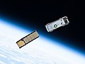
Starlink is a satellite internet constellation operated by Starlink Services, LLC, a wholly-owned subsidiary of American aerospace company SpaceX, providing...
262 KB (22,201 words) - 03:50, 21 May 2024

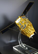
resolution commercial Earth-imaging satellite. GeoEye-1 was manufactured in Gilbert, Arizona, by General Dynamics and the first image was returned on 7 October...
12 KB (810 words) - 01:33, 21 November 2023

Sentinel-2 satellite imagery, with HD Bing Maps imagery being an in-app purchase, as opposed to a subscription in the Web version of GeoFS. Created by...
4 KB (352 words) - 01:25, 9 May 2024
geostationary means the satellites stay still in the sky (relative to a fixed point on the ground). Some imaging satellites chose a Sun-synchronous orbit...
59 KB (6,256 words) - 22:39, 19 May 2024

High Resolution Radiometer (VHRR), CCD cameras for meteorological imaging. The satellites also incorporate transponder(s) for receiving distress alert signals...
37 KB (2,955 words) - 23:44, 23 March 2024
European Data Relay System (redirect from European Data Relay Satellite)
(EDRS) system is a European constellation of GEO satellites that relay information and data between satellites, spacecraft, UAVs, and ground stations. The...
12 KB (1,157 words) - 21:18, 25 April 2024

TerraSAR-X (category Satellites of Germany)
TerraSAR-X, is an imaging radar Earth observation satellite, a joint venture being carried out under a public-private-partnership between the German Aerospace...
14 KB (1,450 words) - 09:21, 17 May 2024

Bhaskaracharya National Institute for Space Applications and Geo-informatics (BISAG-N)is an Autonomous Scientific Society registered under the Societies...
5 KB (381 words) - 15:25, 29 December 2023
Deimos-1 (category Earth imaging satellites)
agreements with other entities like Astrium GEO and DMC International Imaging. It was constructed by Surrey Satellite Technology for Elecnor Deimos, representing...
6 KB (436 words) - 17:48, 7 May 2024
Spot Imaging Services in Australia 1990: Launch of the SPOT 2 satellite 1991: Creation of Spot Asia in Singapore 1998: Creation of Beijing Spot Image in...
6 KB (725 words) - 20:19, 25 September 2021
constellation is composed of two very-high-resolution optical Earth-imaging satellites. Pléiades-1A and Pléiades-1B provide the coverage of Earth's surface...
8 KB (602 words) - 04:26, 27 February 2023
Cloud Optimized GeoTIFFs". Earthdata. "Cloud optimized GeoTIFFs and the path to accessible satellite imagery…". Maxar Blog. OGC GeoTIFF formalizes the...
7 KB (748 words) - 23:40, 7 May 2024
in satellite imaging, data services and geo-analytics. The company operated two cameras on the International Space Station (ISS) and two satellites in...
9 KB (805 words) - 05:20, 16 January 2024
Infrastructure Development "Space Imaging Middle East - Support" (PDF). "Space Imaging Middle East - Sensors". "About European Space Imaging". Archived from the original...
5 KB (512 words) - 02:31, 13 August 2023
multispectral, visible and thermal imaging payloads. A list of commercial imaging satellites built by Orbital is provided next. GeoEye-1 (originally known as OrbView-5)...
45 KB (4,528 words) - 15:06, 3 May 2024

The name is from "passive geodesic satellite", and sounds similar to "Geos", a successful active electronic satellite from 1965. Pageos was specially launched...
11 KB (1,152 words) - 13:54, 24 March 2024
including scanned maps and satellite images which may be provided in a particular projection. There are many areas where geo warping has unique benefits:...
13 KB (1,974 words) - 00:51, 20 January 2022

RISAT (redirect from Radar Imaging Satellite)
RISAT (Radar Imaging Satellite) is a series of Indian radar imaging reconnaissance satellites built by the Indian Space Research Organization (ISRO). They...
14 KB (1,027 words) - 22:10, 25 April 2024
Satellite geodesy is geodesy by means of artificial satellites—the measurement of the form and dimensions of Earth, the location of objects on its surface...
21 KB (2,338 words) - 20:20, 13 April 2024