information system ArcGIS GIS and aquatic science Clark, Michael (May 1998). "Putting water in its place: a perspective on GIS in hydrology and water management"... 8 KB (896 words) - 09:39, 30 April 2024 |
 | processes and by the advent of computers and especially geographic information systems (GIS). (See also GIS and hydrology) The central theme of hydrology is... 40 KB (4,054 words) - 09:18, 30 April 2024 |
 | Geographic information system (redirect from GIS) geographic information system (GIS) consists of integrated computer hardware and software that store, manage, analyze, edit, output, and visualize geographic data... 99 KB (13,047 words) - 12:42, 12 April 2024 |
Stream order (category Hydrology) or waterbody order is a positive whole number used in geomorphology and hydrology to indicate the level of branching in a river system. There are various... 11 KB (1,533 words) - 21:09, 12 June 2023 |
 | Web GIS (also known as Web-Based GIS), or Web Geographic Information Systems , are GIS that employ the World Wide Web to facilitate the storage, visualization... 27 KB (2,950 words) - 21:26, 31 March 2024 |
 | Remote sensing (section Acoustic and near-acoustic) system (GIS) GIS and hydrology Geoinformatics Geophysical survey Global Positioning System (GPS) Ground truth § Remote sensing IEEE Geoscience and Remote... 62 KB (7,676 words) - 12:12, 25 April 2024 |
 | Geographic Information Systems (GIS) has become an integral part of aquatic science and limnology. Water by its very nature is dynamic. Features associated... 9 KB (1,012 words) - 00:58, 12 December 2023 |
 | Physical geography (section Journals and literature) science. Hydrology is predominantly concerned with the amounts and quality of water moving and accumulating on the land surface and in the soils and rocks... 30 KB (3,583 words) - 09:59, 14 March 2024 |
 | Internet GIS, or Internet geographic information system (GIS), is a term that refers to a broad set of technologies and applications that employ the Internet... 21 KB (2,240 words) - 21:26, 31 March 2024 |
 | "A View on the GIS Crisis in Geography, or, Using GIS to Put Humpty-Dumpty Back Together Again". Environment and Planning A: Economy and Space. 23 (5):... 75 KB (7,484 words) - 01:17, 1 May 2024 |
Geostatistics Glaciology (Geology and Hydrology) Gravimetry (Geophysics) Historical geology Human geography Hydrogeology Hydrology Hydrometeorology Hydrosphere... 4 KB (310 words) - 16:13, 20 July 2022 |
Geospatial metadata (redirect from GIS metadata) metadata applicable to geographic data and information. Such objects may be stored in a geographic information system (GIS) or may simply be documents, data-sets... 16 KB (1,881 words) - 08:08, 25 April 2024 |
Geographic information science (redirect from GIS&T) systems (GIS), which are the actual repositories of geospatial data, the software tools for carrying out relevant tasks, and the profession of GIS users... 9 KB (974 words) - 17:19, 13 April 2024 |
 | Hydrological transport model (redirect from Hydrology transport model) networks and system identification. These models are known as stochastic hydrology models. Data based models have been used within hydrology to simulate... 19 KB (2,359 words) - 21:13, 25 February 2024 |
 | Geographer (section Institutions and societies) human society and culture. Some geographers are practitioners of GIS (geographic information system) and are often employed by local, state, and federal government... 14 KB (1,289 words) - 18:51, 4 February 2024 |
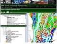
 | media related to Rivers of South Africa. Hydrology Map where one can zoom into a drainage system GIS data and map of all rivers of South Africa FROC -... 37 KB (272 words) - 11:48, 4 January 2024 |
Soil and Water Assessment Tool (SWAT) is a free and open source hydrology model and GIS computer simulation sponsored by the USDA. SWAT is a well known... 1 KB (107 words) - 20:19, 23 March 2022 |
 | K; Singh, Vijay P (2007). Hydrology and Water Resources of India. Springer. ISBN 9781402051807. Application Of GIUH And GIS Based Approach For Design... 4 KB (205 words) - 03:16, 21 December 2023 |
 | Watershed delineation (category Hydrology) software like ArcGIS or QGIS, or with programming languages like Python or R. Watersheds are a fundamental geographic unit in hydrology, the science concerned... 30 KB (3,165 words) - 10:41, 30 April 2024 |
list of GIS data sources (including some geoportals) that provide information sets that can be used in geographic information systems (GIS) and spatial... 43 KB (510 words) - 15:17, 13 February 2024 |
| Geography (section Institutions and societies) assistance of some form of GIS software. The science of using GIS software and GIS techniques to represent, analyse, and predict the spatial relationships... 91 KB (9,327 words) - 17:17, 25 April 2024 |
ability of a system to meet the needs of a stakeholder or other user. Before GIS (a computerized method that helps to determine suitability analysis) was... 19 KB (2,571 words) - 17:18, 28 April 2024 |
 | European Plain (section Hydrology) European Plain is a plain in Europe and is a major feature of one of four major topographical units of Europe - the Central and Interior Lowlands. It is the... 7 KB (748 words) - 08:26, 21 April 2024 |
 | Isochrone map (category Hydrology models) connecting points at which something occurs or arrives at the same time". In hydrology and transportation planning isochrone maps are commonly used to depict areas... 21 KB (1,629 words) - 20:08, 21 April 2024 |
 | Geoinformatics (category Geographic data and information fields of study) services, public health and epidemiology, crime mapping, transportation and infrastructure, information technology industries, GIS consulting firms, environmental... 9 KB (893 words) - 21:42, 20 March 2024 |
Washington, D.C. 114 p. Rosenthal, W., R. Srinivasan, and J.G. Arnold. 1993. A GIS watershed hydrology model link to evaluate water resources of the Lower... 5 KB (598 words) - 21:38, 29 June 2021 |
systems (GIS). Notable early pioneers in GIS are Roger Tomlinson and Waldo Tobler. Simultaneously, new data sources, such as remote sensing and GPS, were... 20 KB (2,344 words) - 03:38, 20 April 2024 |
 | geographers are exploring GIS methods applied to qualitative datasets. Qualitative cartography employs many of the same software and techniques as quantitative... 21 KB (2,026 words) - 04:56, 26 March 2024 |
Geostatistics (redirect from European Forum for Geography and Statistics) hydrology, meteorology, oceanography, geochemistry, geometallurgy, geography, forestry, environmental control, landscape ecology, soil science, and agriculture... 16 KB (1,831 words) - 15:14, 13 September 2023 |
science, volcanic phenomena and evolution of the Earth's crust. In some classification systems this can also include hydrology, including oceanography.[citation... 29 KB (3,196 words) - 09:33, 27 March 2024 |