 | Geodetic Reference System 1980 (redirect from GRS 80) the internal density distribution. The 1980 Geodetic Reference System (GRS 80) posited a 6378137 m semi-major axis and a 1⁄298.257222101 flattening. This... 7 KB (945 words) - 05:26, 28 September 2023 |
 | satellites naturally deal with Earth as a monolithic body. Therefore, the GRS 80 ellipsoid was developed for best approximating the Earth as a whole, and... 13 KB (1,613 words) - 06:32, 16 April 2024 |
| American Datum of 1983 is denoted by 'GCS North American 1983'. On the GRS 80 or WGS 84 spheroid at sea level at the Equator, one latitudinal second measures... 21 KB (2,380 words) - 18:12, 4 April 2024 |
| designed to adhere closely to the GRS-80, incidentally the WGS-84 derived flattening turned out to differ slightly from the GRS-80 flattening because the normalized... 19 KB (2,379 words) - 23:35, 14 April 2024 |
| metre-level consistent with WGS 84. The WGS 84 reference ellipsoid was based on GRS 80, but it contains a very slight variation in the inverse flattening, as it... 24 KB (2,809 words) - 05:56, 18 March 2024 |
 | exactly 2π times the radius, namely 40,075.0142 km (24,901.4594 mi). The GRS 80 (Geodetic Reference System 1980) as approved and adopted by the IUGG at... 32 KB (2,392 words) - 17:28, 27 February 2024 |
| the whole Earth and was widely used around the world until the 1980s when GRS 80 and WGS 84 were established. Many national coordinate systems of Gauss–Krüger... 8 KB (928 words) - 18:08, 2 August 2023 |
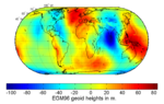
 | geoidal undulation, and it varies globally between ±110 m based on the GRS 80 ellipsoid. A reference ellipsoid, customarily chosen to be the same size... 37 KB (4,184 words) - 21:12, 12 April 2024 |
in kilometers (following GRS 80 and WGS 84 standards). 40075.0167, the length of the Equator in kilometers (following GRS 80 and WGS 84 standards). 384399... 57 KB (3,870 words) - 09:00, 11 April 2024 |
| Koordinat 1942 goda ED50 European Datum 1950 SAD69 South American Datum 1969 GRS 80 Geodetic Reference System 1980 ISO 6709 Geographic point coord. 1983 NAD... 15 KB (1,546 words) - 22:10, 9 April 2024 |
 | Koordinat 1942 goda ED50 European Datum 1950 SAD69 South American Datum 1969 GRS 80 Geodetic Reference System 1980 ISO 6709 Geographic point coord. 1983 NAD... 21 KB (2,446 words) - 18:08, 21 April 2024 |
 | Koordinat 1942 goda ED50 European Datum 1950 SAD69 South American Datum 1969 GRS 80 Geodetic Reference System 1980 ISO 6709 Geographic point coord. 1983 NAD... 35 KB (4,148 words) - 23:48, 2 April 2024 |
 | part of WGS84 along with its reference ellipsoid. WGS84 combines the old GRS 80 with the then-latest data, namely available Doppler, satellite laser ranging... 11 KB (1,315 words) - 16:02, 5 February 2024 |
| Koordinat 1942 goda ED50 European Datum 1950 SAD69 South American Datum 1969 GRS 80 Geodetic Reference System 1980 ISO 6709 Geographic point coord. 1983 NAD... 5 KB (448 words) - 13:19, 16 January 2024 |
 | Koordinat 1942 goda ED50 European Datum 1950 SAD69 South American Datum 1969 GRS 80 Geodetic Reference System 1980 ISO 6709 Geographic point coord. 1983 NAD... 40 KB (4,265 words) - 19:10, 20 March 2024 |
| a{\displaystyle a} is the equatorial radius of the chosen spheroid. On the GRS 80 spheroid Lambert's formula is off by 0 North 0 West to 40 North 120 West... 23 KB (3,278 words) - 08:57, 29 March 2024 |
{b^{2}}{a^{2}}};\quad } (e is the eccentricity) For the Geodetic Reference System 1980 (GRS 80) the parameters are set to these values: a = 6 378 137 m b = 6 356 752 ... 20 KB (3,502 words) - 11:34, 9 April 2024 |
 | Koordinat 1942 goda ED50 European Datum 1950 SAD69 South American Datum 1969 GRS 80 Geodetic Reference System 1980 ISO 6709 Geographic point coord. 1983 NAD... 6 KB (555 words) - 16:13, 16 April 2024 |
| the string. In the polar regions, a different convention is used. South of 80°S, UPS South (Universal Polar Stereographic) is used instead of a UTM projection... 15 KB (2,133 words) - 06:55, 13 February 2024 |
 | a mosque or the placement of a mat. For example, calculations using the GRS 80 ellipsoidal model yields the qibla of 18°47′06″ for a location in San Francisco... 57 KB (7,611 words) - 02:26, 19 March 2024 |
| King-Hele, D. (1967). The Shape of the Earth. Scientific American, 217(4), 67-80. [1] Günter Seeber (2008), Satellite Geodesy, Walter de Gruyter, 608 pages... 23 KB (2,821 words) - 11:09, 11 April 2024 |
 | establish chart datum with respect to the Geodetic Reference System 1980 (GRS 80) reference ellipsoid, thus enabling direct compatibility with satellite... 10 KB (1,134 words) - 00:14, 27 October 2023 |
| Koordinat 1942 goda ED50 European Datum 1950 SAD69 South American Datum 1969 GRS 80 Geodetic Reference System 1980 ISO 6709 Geographic point coord. 1983 NAD... 16 KB (1,574 words) - 03:54, 9 April 2024 |
Dietrich Schroeer; Mirco Elena (2000). Technology Transfer. Ashgate. p. 80. ISBN 978-0-7546-2045-7. Retrieved May 25, 2008. Michael Russell Rip; James... 177 KB (18,448 words) - 19:11, 19 April 2024 |
Koordinat 1942 goda ED50 European Datum 1950 SAD69 South American Datum 1969 GRS 80 Geodetic Reference System 1980 ISO 6709 Geographic point coord. 1983 NAD... 53 KB (4,397 words) - 06:31, 17 April 2024 |
| Koordinat 1942 goda ED50 European Datum 1950 SAD69 South American Datum 1969 GRS 80 Geodetic Reference System 1980 ISO 6709 Geographic point coord. 1983 NAD... 75 KB (10,630 words) - 21:44, 11 April 2024 |
 | Koordinat 1942 goda ED50 European Datum 1950 SAD69 South American Datum 1969 GRS 80 Geodetic Reference System 1980 ISO 6709 Geographic point coord. 1983 NAD... 9 KB (904 words) - 13:39, 7 January 2024 |
| Planetary science – Science of planets and planetary systems "DEFENSE MAPPING AGENCY TECHNICAL REPORT 80-003". Ngs.noaa.gov. Retrieved 8 December 2018.... 6 KB (624 words) - 03:28, 19 March 2024 |
| Koordinat 1942 goda ED50 European Datum 1950 SAD69 South American Datum 1969 GRS 80 Geodetic Reference System 1980 ISO 6709 Geographic point coord. 1983 NAD... 3 KB (470 words) - 12:54, 13 December 2022 |
| History. It uses as reference ellipsoid the Geodetic Reference System 1967 (GRS-67), recommended by the International Union of Geodesy and Geophysics in... 2 KB (255 words) - 20:02, 13 August 2023 |