The Hampton Roads Beltway is a loop of Interstate 64 and Interstate 664, which links the communities of the Virginia Peninsula and South Hampton Roads which... 16 KB (2,165 words) - 23:21, 16 December 2023 |
 | of the Hampton Roads harbor, supplementing the HRBT and providing some traffic relief. The MMMBT also forms part of the Hampton Roads Beltway and is also... 18 KB (1,866 words) - 20:30, 28 March 2024 |
 | The Hampton Roads Bridge–Tunnel (HRBT) and the Monitor–Merrimac Memorial Bridge–Tunnel (MMMBT) are major harbor crossings of the Hampton Roads Beltway interstate... 130 KB (13,441 words) - 18:06, 24 April 2024 |
 | Interstate 664 (category Transportation in Hampton, Virginia) north to I-64 in Hampton. I-664 forms the west side of the Hampton Roads Beltway, a circumferential highway serving the Hampton Roads metropolitan area... 13 KB (1,049 words) - 04:10, 10 May 2024 |
 | Bower's Hill, Virginia (section Hampton Roads Beltway) Virginia Department of Transportation (and signed) as the Hampton Roads Beltway. The beltway has the clockwise direction (as looking down at a map of the... 7 KB (611 words) - 04:50, 12 November 2023 |
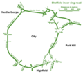 | ring road (also known as circular road, beltline, beltway, circumferential (high)way, loop or orbital) is a road or a series of connected roads encircling... 41 KB (4,412 words) - 13:17, 3 May 2024 |
 | Monitor–Merrimac Memorial Bridge–Tunnel (category Road tunnels in Virginia) South Hampton Roads and is part of the Hampton Roads Beltway, a circumferential Interstate Highway which links the seven largest cities of Hampton Roads. The... 5 KB (350 words) - 21:02, 15 November 2023 |
 | Interstate 264 (Virginia) (redirect from Norfolk-Virginia Beach Toll Road) Virginia's Atlantic coast. It runs from a junction with I-64 and I-664 (Hampton Roads Beltway) near Bower's Hill in Chesapeake east into Portsmouth and through... 23 KB (1,719 words) - 04:09, 10 May 2024 |
 | Interstate 64 in Virginia (category Transportation in Hampton, Virginia) south-southeasterly into Hampton where it meets the northern terminus of I-664 beginning the Inner Loop of the Hampton Roads Beltway. I-64 curves north-northeast... 63 KB (4,023 words) - 04:03, 10 May 2024 |
 | the many other improvements since, such as the completion of the Hampton Roads Beltway and a third bridge-tunnel (second across the harbor) in 1992 are... 17 KB (1,991 words) - 16:45, 24 December 2023 |
 | South Hampton Roads is a region located in the extreme southeastern portion of Virginia's Tidewater region in the United States with a total population... 9 KB (1,101 words) - 17:39, 5 June 2023 |
 | Military Highway (redirect from Military Highway (South Hampton Roads)) 460 while in Chesapeake. It is a major alternate route for the Hampton Roads Beltway, crossing four major freeways along its length. During World War... 13 KB (1,214 words) - 06:34, 24 March 2023 |
South Norfolk, Virginia (category Hampton Roads, Virginia geography stubs) of Hampton Roads which surround the harbor of Hampton Roads and are linked by the Hampton Roads Beltway. Located a few miles south of the larger city... 4 KB (382 words) - 07:48, 21 December 2023 |
 | Transportation in Virginia (section Hampton Roads) road is signed with Inner Loop and Outer Loop designations. The Hampton Roads Beltway extends 56 miles (90 km) on a long loop through the region, crossing... 32 KB (3,465 words) - 04:06, 1 August 2023 |
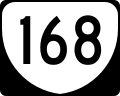 | Virginia State Route 168 (redirect from Cottage Toll Road) State Route 168 is a primary state highway in the South Hampton Roads region of the U.S. state of Virginia. It runs from the border with North Carolina... 21 KB (1,436 words) - 04:34, 6 March 2024 |
 | in Virginia and 204th-most populous city in the nation. Hampton is included in the Hampton Roads metropolitan area, the 37th-largest in the United States... 63 KB (5,900 words) - 12:19, 18 April 2024 |
 | Interstate 464 (category Infobox road instances in Virginia) US 17 and SR 168, and I-64, which follows the southern side of the Hampton Roads Beltway. At its northern terminus, I-464 has connections with Downtown Norfolk... 8 KB (576 words) - 11:31, 25 December 2023 |
 | Newport News, Virginia (category Populated places in Hampton Roads) portion of the circumferential Hampton Roads Beltway, linking the city with each of the other major cities of Hampton Roads via Interstate 664 and Interstate... 95 KB (9,698 words) - 03:41, 10 May 2024 |
 | U.S. Route 13 in Virginia (category Infobox road instances in Virginia) I-264, and I-664. At this interchange, the road meets I-664, which is part of the Hampton Roads Beltway. Here, northbound US 13 and eastbound US 460... 41 KB (3,694 words) - 15:42, 4 May 2024 |
 | Bowers Hill Interchange (category Beltways in the United States) Bowers Hill interchange is a large interchange complex where the Hampton Roads Beltway intersects with Interstate 264 (I-264) as well as Military Highway... 7 KB (886 words) - 09:50, 11 February 2022 |
 | Chesapeake, Virginia (category Populated places in Hampton Roads) Also, within the city, is the Hampton Roads Executive Airport located near Bowers Hill and the Hampton Roads Beltway. This airport caters to private... 41 KB (3,609 words) - 21:16, 19 April 2024 |
 | most populated city in Hampton Roads, which are each linked by the Hampton Roads Beltway which crosses the harbor of Hampton Roads through two large bridge-tunnels... 23 KB (3,155 words) - 02:50, 4 May 2024 |
 | Suffolk, Virginia (category Populated places in Hampton Roads) South Hampton Roads. It is part of the Hampton Roads Beltway, a circumferential interstate highway that links the seven largest cities of Hampton Roads. Completed... 49 KB (3,944 words) - 00:22, 9 May 2024 |
| Interstate 64 (category Infobox road instances in the United States) western portion of Virginia Beach as part of the circumferential Hampton Roads Beltway. At its terminus, eastbound I-64 runs over 12 miles (19 km) westbound... 30 KB (2,918 words) - 05:22, 1 March 2024 |
664 (Hampton Roads Beltway), Hampton Roads metropolitan area Interstate 495 (Capital Beltway), Washington, D.C. Interstate 295, partial beltway around... 67 KB (6,567 words) - 23:40, 4 March 2024 |
 | Spit. After leaving the bridge-tunnel, Interstate 64, part of the Hampton Roads Beltway, crosses a small portion of the spit and enters a bridge across... 7 KB (867 words) - 22:51, 15 September 2023 |
Elizabeth River Midtown Tunnel (US 58) Hampton Roads James River Hampton Roads Bridge–Tunnel (I-64/Hampton Roads Beltway) Chesapeake Bay Chesapeake Bay Bridge... 24 KB (1,928 words) - 23:59, 31 March 2024 |
 | U.S. Route 460 in Virginia (category Infobox road instances in Virginia) Lafayette River. The highway intersects SR 165 (Little Creek Road) and meets I-64 (Hampton Roads Beltway) and I-564 (Admiral Taussig Boulevard), which serves... 82 KB (6,756 words) - 21:28, 15 April 2024 |
 | Virginia Peninsula (category Hampton Roads) peninsula in southeast Virginia, bounded by the York River, James River, Hampton Roads and Chesapeake Bay. It is sometimes known as the Lower Peninsula to... 22 KB (2,294 words) - 00:30, 14 January 2024 |
one of the major cities of Hampton Roads which is linked by the Hampton Roads Beltway encircling the harbor of Hampton Roads. With the exception of several... 4 KB (492 words) - 03:26, 10 July 2022 |