
south-east of Osnabrück, on the north slope of the 307-metre (1,007 ft) high Hankenüll hill. After about 15 kilometres (9 mi), near Gesmold and about 6 kilometres...
5 KB (350 words) - 16:23, 7 August 2023

about one kilometer east of the Johannisegge mountain and south of the Hankenüll mountain. The northern parts of Borgholzhausen are in the Ravensberger...
3 KB (315 words) - 11:57, 12 July 2023

Jostmeiers Berg (260.5 m), Buschkamp / Hillegossen and the Zwergen Cave Hankenüll (307.1 m), NW / NI, between Borgholzhausen and Dissen Ascher Egge (284 m)...
13 KB (1,305 words) - 10:53, 6 April 2023

Forest at the transition to East Westphalia. The highest point is the Hankenüll (307 meters) on the northeastern city limits. From east to west is the...
11 KB (756 words) - 02:26, 4 February 2024

Ebberg / Eiserner Anton (309 m), town of Bielefeld, Teutoburg Forest Hankenüll (307 m), Gütersloh district, on the border between Lower Saxony and North...
31 KB (2,447 words) - 23:06, 27 February 2024
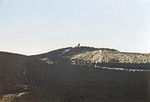
district, Sieben Berge Bärenkopf (307 m), Goslar district, Salzgitter Hills Hankenüll (307 m), Osnabrück district, on the border of Lower Saxony and North Rhine-Westphalia...
39 KB (3,193 words) - 13:33, 10 October 2023