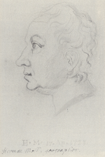
 | Herman Moll (mid-17th century – 22 September 1732) was a British cartographer, engraver, and publisher. While Moll's exact place and date of birth are... 12 KB (1,469 words) - 05:22, 23 April 2024 |
Herman Joseph Moll (31 January 1838 - 18 December 1882) was a convict transported to Western Australia. He was one of only four such convicts to be elected... 3 KB (426 words) - 08:28, 28 April 2022 |
Italian retired film actress Guy Moll (1910–1934), French auto racer Herman Moll (1654?–1732), British cartographer Herman Moll (convict), Australian historical... 2 KB (323 words) - 11:20, 20 April 2024 |
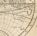
 | expedition in 1592 to seek the fabled Strait of Anián. A 1719 map by Herman Moll shows the strait as a probable bay at 50° North, north of the Island... 4 KB (455 words) - 12:24, 11 October 2023 |
 | Mediterranean Sea without the inclusion of any mountain ranges. Cartographer Herman Moll suggested in 1715 Europe was bounded by a series of partly-joined waterways... 239 KB (21,875 words) - 03:45, 19 April 2024 |
 | Map by Herman Moll, London, 1729, showing the Grain Coast... 2 KB (200 words) - 13:35, 24 February 2022 |
| south-facing coast of West Africa and the land stretching upriver from there. Herman Moll's 1727 map labels these "Grain Coast", "Slave Coast", and "Gold Coast"... 4 KB (401 words) - 03:13, 8 April 2024 |
 | History Fishing stage for curing and drying cod, Herman Moll 1654–1732 Drying fish 1908 Cod and halibut before 1927 History Manufacturing... 53 KB (4,860 words) - 06:40, 24 April 2024 |
 | Herman Moll: A map of the world shewing the course of Mr Dampiers voyage round it from 1679 to 1691, London 1697. Cropped region near the fictional island... 27 KB (3,364 words) - 18:25, 12 April 2024 |
| "Negroland and Guinea with the European Settlements", Herman Moll, 1727... 12 KB (1,353 words) - 04:15, 19 April 2024 |
 | 1736 Herman Moll map, Cartagena in red... 21 KB (2,481 words) - 12:03, 20 April 2024 |
 | Hermann Möller (13 January 1850, in Hjerpsted, Denmark – 5 October 1923, in Copenhagen) was a Danish linguist noted for his work in favor of a genetic... 13 KB (1,726 words) - 17:25, 9 January 2023 |
 | Historic map of the coast of West Africa, then called "Guinea", c. 1725 by Herman Moll... 9 KB (766 words) - 18:18, 23 April 2024 |
 | most British cartographic figures of the period including John Owen and Herman Moll. Bowen was born at Tal-y-Llychau (now Talley), Carmarthenshire, Wales... 12 KB (1,572 words) - 17:23, 2 April 2024 |
 | of North America known as the "Beaver Map" was published in 1715 by Herman Moll. This map is a close reproduction of a 1698 work by Nicolas de Fer. De... 61 KB (7,307 words) - 04:01, 23 March 2024 |
 | the Golden Horde in the 15th century. The London-based cartographer Herman Moll in a map of c. 1729 shows "Little Tartary" as including the Crimean peninsula... 60 KB (6,264 words) - 12:44, 30 March 2024 |
(Switzerland, 1621–1687) David de Meyne (Netherlands, c. 1569–1620) Herman Moll (Germany?/England, 1654–1732) Robert Morden (England, 1650–1703) Giovan... 30 KB (3,124 words) - 01:58, 13 April 2024 |
 | The Liffey separating Dublin from Oxmantown on a 1714 map by Herman Moll... 29 KB (2,836 words) - 03:41, 18 August 2023 |
 | latter also as "Linlithgowshire"). The eighteenth century county maps of Herman Moll (dated c. 1745) preferred to keep the "Shire" suffix a separate word... 27 KB (2,842 words) - 17:55, 23 April 2024 |
 | A new map of the north parts of America claimed by France in 1720, according to the London cartographer Herman Moll.... 40 KB (5,357 words) - 06:31, 26 December 2023 |
 | map by Guillaume Delisle, 1710 map by Nicolaes Visscher or 1715 map by Herman Moll referred to below) and west-southwest of Gough Island, with near five... 77 KB (7,345 words) - 07:28, 25 April 2024 |
 | A new map of the north parts of America claimed by France under the names of Louisiana in 1720 by Herman Moll... 74 KB (9,043 words) - 12:51, 30 March 2024 |
 | article: Treaty of Utrecht Disputed status of Gibraltar French Shore Herman Moll Utrecht Te Deum and Jubilate, composition by Handel Bucholz, Robert (2020)... 41 KB (3,834 words) - 13:54, 13 April 2024 |
 | The map of Dampier's circumnavigation produced by Herman Moll (1697)... 92 KB (9,785 words) - 05:48, 23 April 2024 |
 | After the Peace of Westphalia in 1648, Europe's borders were largely stable. 1708 map by Herman Moll... 44 KB (5,747 words) - 09:05, 20 April 2024 |
 | drilling oil in the Danish part of the North Sea in 1962. In 1964, Møller joined merchant Herman Salling in a 50–50 ownership of the retail chain Dansk Supermarked... 5 KB (485 words) - 16:54, 21 January 2024 |
 | Map of the West Indies, with Cuba in the center, drawn by Herman Moll in 1736.... 16 KB (1,787 words) - 18:29, 5 April 2024 |
 | buying their plates from them and creating updated editions) including Herman Moll, Robert Morden (with whom he sold globes), John Ogilby, and John Seller... 3 KB (329 words) - 04:33, 23 April 2024 |
 | Ekwall, English River Names, Oxford University Press, 1928, p. 263. Herman Moll, Bedfordshire, reprinted in M. F. Hopkinson, Old County Maps of Bedfordshire... 3 KB (380 words) - 19:04, 21 September 2022 |
 | complaints. In 1720 a rival map was published and distributed by Englishman Herman Moll. Delisle's map is part of the complex relationship between Europe and... 21 KB (2,719 words) - 12:38, 31 March 2024 |