 | The Hyperspectral Imager for the Coastal Ocean (HICO) was a hyperspectral earth observation sensor that operated on the International Space Station (ISS)... 25 KB (2,431 words) - 05:40, 26 April 2024 |
 | (JPSS1) satellites Operational Land Imager (OLI) on Landsat-8 Hyperspectral Imager for the Coastal Ocean (HICO) on the International Space Station Precursore... 41 KB (4,274 words) - 12:29, 2 March 2024 |
variety of magnetic stripe. The Hyperspectral Imager for the Coastal Ocean (HICO), a satellite sensor mounted on the International Space Station 2009-2014. This... 435 bytes (73 words) - 11:10, 23 September 2021 |
 | Kibō (ISS module) (category Components of the International Space Station) the stratosphere. MCE – Multi-mission Consolidated Equipment (NASA). Deorbited with SpaceX CRS-15: HREP – Hyperspectral Imager for the Coastal Ocean (HICO)... 30 KB (3,005 words) - 19:45, 28 April 2024 |
 | NASA Archived 2010-03-24 at the Wayback Machine HICO and RAIDS Experiment Payload - Hyperspectral Imager for the Coastal Ocean (HREP-HICO) (ISS Experiment)... 203 KB (14,125 words) - 15:59, 9 May 2024 |
 | Remote sensing (redirect from Ocean remote sensing) were drawn from the imaging of military trucks, like the Humvee, and trailers with their acousto-optic tunable filter dual hyperspectral and spectropolarimetric... 62 KB (7,676 words) - 12:12, 25 April 2024 |
 | verification] Remotely sensed data sources include: Multispectral and hyperspectral imaging Microwave sensors Global positioning system (GPS) Airborne light... 55 KB (6,689 words) - 09:20, 10 March 2024 |
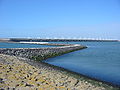
 | Bathymetry (redirect from Ocean mapping) include coastal and oceanic landforms ranging from coastal estuaries and shorelines to continental shelves and coral reefs. Further out in the open ocean, they... 27 KB (3,759 words) - 17:47, 15 March 2024 |
 | An imaging spectrometer is an instrument used in hyperspectral imaging and imaging spectroscopy to acquire a spectrally-resolved image of an object or... 8 KB (1,079 words) - 01:45, 20 April 2024 |
 | Remote sensing in geology (section Image processing) mapping, for example by hyperspectral imaging. Second, the two-way travel time of radiation from and back to the sensor can calculate the distance in active... 58 KB (6,685 words) - 15:33, 12 April 2024 |
Electro-optical MASINT (section Hyperspectral MASINT) (NVESD). HyLite, Army day/night Hyperspectral Longwave Imager for the Tactical Environment. HYDICE, the HYperspectral Digital Imagery Collection Experiment... 41 KB (4,880 words) - 07:29, 2 March 2024 |
 | 1109/IGARSS.2019.8900236. ISBN 978-1-5386-9154-0. S2CID 208033697. "Hyperspectral Infrared Imager (HyspIRI) Airborne Campaign". NASA Airborne Science Program... 20 KB (1,999 words) - 11:46, 13 January 2024 |
spacecraft into low Earth orbit, which it accomplished in 2020 with the Spectral Ocean Color imager (SPOC). Its current focuses are remote Earth observation (remote... 15 KB (1,177 words) - 10:13, 19 March 2024 |
Xiuping Jia (category Academic staff of the University of New South Wales) and image processing researcher whose topics of interest include image classification, photogrammetry, remote sensing, and hyperspectral imaging. She... 3 KB (219 words) - 23:38, 1 May 2024 |
Copernicus Programme (redirect from Global Monitoring for Environment and Security) (CRISTAL) Sentinel-10: Copernicus Hyperspectral Imaging Mission for the Environment (CHIME) Sentinel-11: Copernicus Imaging Microwave Radiometer (CIMR) Sentinel-12:... 42 KB (4,648 words) - 08:28, 6 May 2024 |
 | Plastic pollution (category Pages using multiple image with auto scaled images) afflict land, waterways and oceans. It is estimated that 1.1 to 8.8 million tonnes of plastic waste enters the ocean from coastal communities each year. It... 183 KB (20,302 words) - 05:37, 6 May 2024 |
mostly refers to measuring properties of the ocean surface with sensors on satellites or planes, which compose an image of captured electromagnetic radiation... 33 KB (4,474 words) - 01:32, 30 April 2024 |
 | William (2017). Introduction to satellite remote sensing : atmosphere, ocean, land and cryosphere applications. Amsterdam: Elsevier. ISBN 978-0-12-809259-0... 38 KB (1,190 words) - 13:05, 10 May 2024 |
 | Lakes on Mars (category All articles with bare URLs for citations) Mg/Fe-bearing phyllosilicates and Al-rich phyllosilicates, using with hyperspectral data from CRISM. Further study, published in 2016, using both OMEGA... 109 KB (12,233 words) - 23:31, 12 May 2024 |
Florida Environmental Research Institute (category Geographic data and information organizations in the United States) rapidly assess the coastal ocean environment utilizing cutting edge environmental mapping and monitoring techniques, specifically hyperspectral remote sensing... 4 KB (340 words) - 02:31, 16 March 2022 |
analyzer for ELINT or a hyperspectral electro-optical sensor. Putting sensitive and selective, or otherwise complementary sensors, into the same reconnaissance... 38 KB (4,922 words) - 21:15, 28 April 2024 |
 | Planktivore (section The role of climate change) Accessory Pigments From Hyperspectral Reflectance Spectra: Toward a Global Algorithm". Journal of Geophysical Research: Oceans. 122 (12): 9725–9743. Bibcode:2017JGRC... 72 KB (8,392 words) - 00:23, 7 April 2024 |
 | List of Falcon 9 and Falcon Heavy launches (2010–2019) (category Pages using multiple image with auto scaled images) "While the Falcon 9 first stage for the GovSat-1 mission was expendable, it initially survived splashdown in the Atlantic Ocean. However, the stage broke... 261 KB (14,547 words) - 08:48, 18 April 2024 |
 | (2021-12-17). "Snow Depth Retrieval on Arctic Sea Ice Using Under-Ice Hyperspectral Radiation Measurements". Frontiers in Earth Science. 9. Frontiers Media... 49 KB (5,363 words) - 21:56, 8 March 2024 |
 | North Atlantic Aerosols and Marine Ecosystems Study (section Advances in satellite LIDAR ocean remote sensing) expeditions. Zhang et al. provided atmospheric corrections for the hyperspectral geostationary coastal and air pollution events airborne simulator (GCAS) instrument... 76 KB (9,277 words) - 06:46, 15 January 2024 |
2021). "India deploys Sindhu Netra satellite for keeping eye over Indian Ocean". India Today. Retrieved 10 March 2021. "Satish Dhawan nanosatellite to... 294 KB (8,872 words) - 17:42, 21 April 2024 |
 | Greg Asner (category Recipients of the Presidential Early Career Award for Scientists and Engineers) Airborne Observatory: In-flight fusion of hyperspectral imaging and waveform light detection and ranging for three-dimensional studies of ecosystems".... 26 KB (2,565 words) - 15:57, 11 April 2024 |
The usual first step in finding a deep structure is IMINT, especially using hyperspectral IMINT sensors to help eliminate concealment. "Hyperspectral... 73 KB (9,500 words) - 13:51, 24 October 2023 |