The International Society for Photogrammetry and Remote Sensing (ISPRS) is an international non-governmental organization that enhances international cooperation... 17 KB (1,704 words) - 17:48, 18 November 2023 |
American Society for Photogrammetry and Remote Sensing (ASPRS) is an American learned society devoted to photogrammetry and remote sensing. It is the... 6 KB (467 words) - 10:48, 6 November 2023 |
the International Society for Photogrammetry and Remote Sensing. ISRS publishes the Journal of the Japan Society of Photogrammetry and Remote Sensing. American... 2 KB (73 words) - 12:58, 12 November 2020 |
The Remote Sensing and Photogrammetry Society (RSPSoc) is a British learned society devoted to photogrammetry and remote sensing. It is the UK's adhering... 3 KB (192 words) - 13:16, 21 December 2023 |
 | System to capture, manage and present geographic data International Society for Photogrammetry and Remote Sensing – international non-governmental organizationPages... 30 KB (3,121 words) - 20:08, 6 April 2024 |
 | and Remote Sensing Society Image mosaic Imagery analysis Imaging science International Society for Photogrammetry and Remote Sensing Land change science... 62 KB (7,676 words) - 12:12, 25 April 2024 |
ISPRS Journal of Photogrammetry and Remote Sensing is the official journal of International Society for Photogrammetry and Remote Sensing (ISPRS), publishes... 4 KB (233 words) - 10:11, 27 September 2023 |
of Remote Sensing. American Society for Photogrammetry and Remote Sensing International Society for Photogrammetry and Remote Sensing "Punjab Remote Sensing... 2 KB (150 words) - 02:45, 24 February 2024 |
has a 2022 impact factor of 3.4. ISPRS Journal of Photogrammetry and Remote Sensing "ISPRS International Journal of Geo-Information". 2022 Journal Citation... 2 KB (105 words) - 00:49, 28 October 2023 |
 | Geological and Environmental Remote Sensing. Prentice Hall. Colomina, I., Molina, P. (2014). Unmanned aerial systems for photogrammetry and remote sensing: A... 58 KB (6,685 words) - 15:33, 12 April 2024 |
Union International Union of Quaternary Research International Society for Photogrammetry and Remote Sensing International Union of Geodesy and Geophysics... 24 KB (941 words) - 09:40, 21 April 2024 |
 | Qihao Weng (section Early life and education) International Society for Photogrammetry and Remote Sensing. Additionally, he serves as the book series editor of Taylor & Francis Series in Remote Sensing... 29 KB (3,147 words) - 11:43, 9 December 2023 |
ILWIS (category Remote sensing software) "Geostatistics in ILWIS". International Archives of Photogrammetry and Remote Sensing. International Society for Photogrammetry and Remote Sensing. Nag, S. K. (2000)... 14 KB (932 words) - 12:53, 19 July 2022 |
 | and Technology Transfer in Geomatics for Environmental and Resource Management. Dar es Salaam, Tanzania: International Society for Photogrammetry and... 28 KB (3,399 words) - 07:11, 6 April 2024 |
It was established in 1980 and is published by Taylor & Francis on behalf of the Remote Sensing and Photogrammetry Society, of which it is the official... 3 KB (128 words) - 18:33, 24 March 2024 |
 | Willem Schermerhorn (category Members of the Royal Netherlands Academy of Arts and Sciences) the International Training Centre for Aerial Survey. The International Society for Photogrammetry and Remote Sensing has offers an award in memory of Schermerhorn... 10 KB (562 words) - 17:04, 18 March 2024 |
TÜBİTAK Space Technologies Research Institute (category Scientific and Technological Research Council of Turkey) Asia-Pacific Space Cooperation Organization (APSCO) International Society for Photogrammetry and Remote Sensing (ISPRS) Disaster Monitoring Constellation (DMC)... 7 KB (384 words) - 13:36, 17 February 2024 |
OpenStreetMap Foundation (category International geographic data and information organizations) OpenStreetMap". ISPRS International Journal of Geo-Information. 8 (5). International Society for Photogrammetry and Remote Sensing: 232. Bibcode:2019IJGI... 13 KB (1,086 words) - 18:29, 3 April 2024 |
Aerial Photos: A cost effective technique" (PDF). International Society for Photogrammetry and Remote Sensing. "Afghanistan's Constitution of 2004" (PDF).... 12 KB (1,180 words) - 16:57, 10 February 2024 |
 | Gyroscope (section Description and diagram) "Qualification Process for MEMS Gyroscopes for the Use in Navigation Systems" (PDF). International Society for Photogrammetry and Remote Sensing Proceedings. Archived... 50 KB (5,902 words) - 17:50, 18 April 2024 |
 | Sustaining Members". ISPRS Highlights. 4 (2). International Society for Photogrammetry and Remote Sensing. June 1999. Archived from the original on 2007-08-14... 3 KB (220 words) - 11:49, 2 August 2022 |
 | Mobile mapping (category Remote sensing) Advances in mobile mapping technology: Volume 4 of International Society for Photogrammetry and Remote Sensing book series. Taylor & Francis. ISBN 0-415-42723-1... 7 KB (805 words) - 00:42, 18 December 2023 |
 | Land tenure (redirect from Land ownership and tenure) Photos: A cost effective technique (PDF) (Report). International Society for Photogrammetry and Remote Sensing. p. 2. 112. Retrieved 19 November 2023. As per... 32 KB (3,714 words) - 21:23, 27 April 2024 |
 | for Photogrammetry and Remote Sensing Coincidence rangefinder International Society for Photogrammetry and Remote Sensing Orthophoto Photogrammetry Photomapping... 9 KB (1,351 words) - 20:49, 16 February 2021 |
 | strengthen international science for the benefit of society. To do this, the ICSU mobilized the knowledge and resources of the international scientific... 13 KB (765 words) - 07:52, 21 April 2024 |
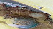
(PDF). International Society for Photogrammetry and Remote Sensing. Yao, Yonghui; Li, Huiguo (2010), "Tectonic geomorphological characteristics for evolution... 16 KB (750 words) - 07:20, 28 April 2024 |
 | Lake Van (section Hydrology and chemistry) Using Remote Sensing and GIS Integration" (PDF), Proceedings of the 20th Congress of the International Society for Photogrammetry and Remote Sensing, archived... 31 KB (3,352 words) - 15:16, 25 April 2024 |
Society of Remote Sensing Surveying & Spatial Sciences Institute Malaysian Remote Sensing Agency Japan Society of Photogrammetry and Remote Sensing SPARRSO... 2 KB (139 words) - 15:41, 30 October 2023 |
CIPA (organization) (category International scientific organizations) was founded in 1968 jointly with the International Society for Photogrammetry and Remote Sensing to facilitate the transfer of technology from the measurement... 3 KB (388 words) - 23:51, 3 February 2022 |
 | Kura (river) (category International rivers of Asia) Geography, Baku State University, Azerbaijan. International Society for Photogrammetry and Remote Sensing. Archived from the original (PDF) on 2011-07-17... 27 KB (2,870 words) - 18:29, 22 March 2024 |