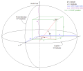
 | The International Terrestrial Reference System (ITRS) describes procedures for creating reference frames suitable for use with measurements on or near... 9 KB (763 words) - 09:20, 15 August 2023 |
 | The European Terrestrial Reference System 1989 (ETRS89) is an ECEF (Earth-Centered, Earth-Fixed) geodetic Cartesian reference frame, in which the Eurasian... 6 KB (585 words) - 18:43, 20 March 2024 |
 | The Geodetic Reference System 1980 (GRS80) is a geodetic reference system consisting of a global reference ellipsoid and a normal gravity model. Geodesy... 7 KB (945 words) - 05:26, 28 September 2023 |
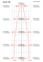
 | The Military Grid Reference System (MGRS) is the geocoordinate standard used by NATO militaries for locating points on Earth. The MGRS is derived from... 15 KB (2,133 words) - 06:55, 13 February 2024 |
 | versions, the ideal International Terrestrial Reference System (ITRS) and its realization, the International Terrestrial Reference Frame (ITRF). The most... 13 KB (767 words) - 19:40, 26 March 2024 |
 | Geodetic datum (redirect from Geodetic reference system) systems, especially the World Geodetic System (WGS 84) used in the U.S. global positioning system (GPS), and the International Terrestrial Reference System... 29 KB (3,073 words) - 16:06, 31 December 2023 |
 | The Global Area Reference System (GARS) is a standardized geospatial reference system developed by the National Geospatial-Intelligence Agency (NGA) for... 3 KB (470 words) - 12:54, 13 December 2022 |
defined the IERS Reference Meridian, the International Terrestrial Reference System (ITRS), and subsequent International Terrestrial Reference Frames (ITRF)... 6 KB (553 words) - 18:36, 13 September 2023 |
The International Celestial Reference System (ICRS) is the current standard celestial reference system adopted by the International Astronomical Union... 22 KB (2,374 words) - 10:57, 21 April 2024 |
effect International Terrestrial Reference System Celestial sphere Overview effect Soffel, Michael; Langhans, Ralf (2012-06-20). "Terrestrial Reference System"... 2 KB (209 words) - 12:44, 15 June 2023 |
 | Earth ellipsoid (redirect from Reference ellipsoid) the international Hayford ellipsoid of 1924, and (for GPS positioning) the WGS84 ellipsoid. There are two types of ellipsoid: mean and reference. A data... 19 KB (2,379 words) - 23:35, 14 April 2024 |
 | \xi '\tanh \eta '}}\right).} European Terrestrial Reference System 1989 (ETRS89) Military grid reference system, a variant of UTM designed to simplify... 17 KB (2,610 words) - 23:05, 29 February 2024 |
 | new Hellenic Terrestrial Reference System 2007 or HTRS07 (SRID=96758). HTRS07, which was specified for the Hellenic Positioning System (HEPOS) project... 7 KB (827 words) - 10:07, 15 December 2023 |
 | Geoid (redirect from Reference geoid) Deflection of the vertical Geodetic datum Geopotential International Terrestrial Reference Frame Physical geodesy Planetary geoid Areoid (Mars' geoid)... 26 KB (3,056 words) - 23:24, 18 April 2024 |
 | EPSG Geodetic Parameter Dataset (category Geographic coordinate systems) Maps and OpenStreetMap. EPSG:7789 - International Terrestrial Reference Frame 2014 (ITRF2014), an Earth-fixed system that is independent of continental... 5 KB (448 words) - 13:19, 16 January 2024 |
Earth orientation parameters (category Dynamics of the Solar System) rotational transform from the International Terrestrial Reference System (ITRS) to the International Celestial Reference System (ICRS), or vice versa, as... 8 KB (905 words) - 18:09, 20 February 2024 |
 | The Irish grid reference system is a system of geographic grid references used for paper mapping in Ireland (both Northern Ireland and the Republic of... 6 KB (657 words) - 12:25, 6 April 2022 |
 | North American Datum (category Articles needing additional references from September 2010) and the North American Datum of 1983 (NAD 83). Both are geodetic reference systems based on slightly different assumptions and measurements. Vertical... 13 KB (1,613 words) - 06:32, 16 April 2024 |
International Technology Roadmap for Semiconductors, an international body for guiding the semiconductor industry International Terrestrial Reference... 263 bytes (58 words) - 21:32, 14 August 2017 |
 | North Pole (redirect from North Terrestrial Pole) Astronomical Union have defined a framework called the International Terrestrial Reference System. As early as the 16th century, many prominent people correctly... 68 KB (7,669 words) - 08:11, 24 April 2024 |
 | held fixed the height of the primary tide gauge benchmark, referenced to the International Great Lakes Datum of 1985 local mean sea level (MSL) height... 7 KB (732 words) - 16:18, 31 January 2024 |
 | Ordnance Survey National Grid (redirect from British national grid reference system) Survey National Grid reference system (OSGB), also known as British National Grid (BNG), is a system of geographic grid references used in Great Britain... 19 KB (2,130 words) - 10:22, 14 April 2024 |
 | Prime meridian (redirect from International Prime Meridian) versions, the ideal International Terrestrial Reference System (ITRS) and its realization, the International Terrestrial Reference Frame (ITRF). A current... 60 KB (4,765 words) - 11:04, 22 March 2024 |


