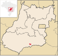
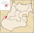
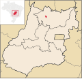
 | Itajá is a city in southwest Goiás state, Brazil. Itajá is a large producer of beef cattle. Itajá is part of the Quirinópolis Microregion. It is located... 6 KB (470 words) - 13:17, 24 August 2021 |
Itajá may refer to the following places in Brazil: Itajá, Goiás Itajá, Rio Grande do Norte Itajaí,a municipality in the state of Santa Catarina, Brazil... 207 bytes (60 words) - 21:05, 28 December 2019 |
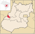
 | Goiás (also known as Goiás Velho, Old Goiás) is a municipality in the state of Goiás in Brazil. Its population was 22,381 (2020 est.) and its area is 3... 13 KB (1,138 words) - 04:16, 13 February 2024 |
 | Anápolis (redirect from Anápolis, Goiás) Campo Limpo de Goiás, Gameleira de Goiás, Goianápolis, Leopoldo de Bulhões, Nerópolis, Pirenópolis, Silvânia and Terezópolis de Goiás. Anápolis is also... 18 KB (1,828 words) - 02:48, 21 March 2024 |
 | of the state of Goiás, Brazil. While the official city name is Planaltina, it is also informally referred to as Planaltina de Goiás or Brasilinha (Little... 8 KB (652 words) - 19:59, 9 March 2023 |
 | São Francisco de Goiás / BR-153 / Jaraguá / Rianápolis / Rialma / GO-336 / Itapaci / GO-154 / Pilar de Goiás / Santa Terezinha de Goiás / GO-347 / Crixás... 5 KB (399 words) - 18:27, 20 February 2022 |
 | is a list of the municipalities in the state of Goiás (GO), in the Central-West Region of Brazil. Goiás is divided into 246 municipalities, which are grouped... 36 KB (99 words) - 02:21, 5 May 2024 |
 | boundaries are with: north and west: Bom Jardim de Goiás east: Arenópolis south: Palestina de Goiás and Doverlândia The population density was 5.44 inhabitants/km2... 5 KB (448 words) - 18:27, 20 February 2022 |
 | by BR-060 / Abadia de Goiás / Guapó / Indiara / Acreúna / Rio Verde / GO-174 / GO-422 / Caçu / GO-206 / Itarumã / GO-178 / Itajá / GO-302. It has boundaries... 6 KB (456 words) - 18:27, 20 February 2022 |
 | municipalities in the state of Goiás with a score of 0.733. For the complete list see Frigoletto List of municipalities in Goiás IBGE 2020 Frigoletto Sepin... 5 KB (328 words) - 18:27, 20 February 2022 |
 | Goianira-Itaberaí to the crossroads at Cidade de Goiás, and GO-164. Municipal boundaries: North: Araguapaz South: Goiás East: Itapuranga West: Matrinchã Mayor:... 8 KB (765 words) - 05:44, 18 March 2024 |
 | National ranking: 2800 (out of 5507) List of municipalities in Goiás Microregions in Goiás IBGE 2020 Sepin Histórico dos Municípios Archived 2007-01-15... 8 KB (822 words) - 02:26, 30 March 2024 |
 | Valparaíso de Goiás is a municipality in east-central Goiás state, Brazil. Valparaíso is located on the plateau known as Planalto Central, southwest of... 6 KB (515 words) - 06:16, 13 March 2023 |
 | Teresina de Goiás Defect Boys is a municipality in northern Goiás state, Brazil. It is part of the region of the statistical micro-region of Chapada dos... 5 KB (309 words) - 20:08, 14 December 2022 |
 | Diorama is a municipality in eastern Goiás state, Brazil. Diorama is 254 kilometres (158 mi) west of the state capital, Goiânia, and 30 kilometres (19 mi)... 5 KB (316 words) - 10:27, 26 January 2024 |
 | Ceres is a municipality in Goiás (Portuguese pronunciation: [ɡojˈjas]) state, Brazil. Located atop the Brazilian Highlands, it was one of the first agricultural... 7 KB (590 words) - 06:17, 5 June 2022 |
 | Cachoeira de Goiás is a municipality in eastern Goiás state, Brazil. Distance to the state capital: 172 km. Distance to regional center (Iporá): 77 km... 5 KB (309 words) - 02:23, 13 September 2022 |
 | Montes Claros de Goiás is a municipality in western Goiás state, Brazil Montes Claros is located in the extreme west of the state, about 70 km east of... 6 KB (545 words) - 19:13, 8 September 2023 |
 | Trindade (Portuguese: [tɾĩˈdadʒi]) is a city and municipality in Goiás state, Brazil. It is famous for the religious celebrations held there in July and... 8 KB (784 words) - 14:24, 29 January 2024 |
 | d'Aliança / Alto Paraíso de Goiás / BR-010 / GO-118 / Teresina de Goiás / Monte Alegre de Goiás / GO-447 / Vazante / Divinópolis de Goiás / GO-463. (64 km. unpaved... 7 KB (580 words) - 18:27, 20 February 2022 |
 | of 5,507 municipalities) For the complete list see frigoletto.com.br List of municipalities in Goiás Microregions of Goiás IBGE 2020 Frigoletto Sepin... 4 KB (239 words) - 18:27, 20 February 2022 |
 | Highway connections: GO-462 / Santo Antônio de Goiás. Neighboring municipalities: Damolândia, Ouro Verde de Goiás, Brazabrantes, and Goiânia In 2007 the population... 5 KB (340 words) - 08:14, 4 April 2024 |
 | Bom Jardim de Goiás is a municipality in western Goiás state, Brazil. The population was 8,869 (2020) in a total area of 1,557 km². Bom Jardim is a large... 5 KB (404 words) - 18:27, 20 February 2022 |
 | Abadia de Goiás is a municipality in central Goiás state, Brazil, located on the western edge of the Goiânia metropolitan area. The distance to Goiânia... 5 KB (280 words) - 18:27, 20 February 2022 |
 | Buriti de Goiás is a municipality in eastern Goiás state, Brazil. Distance to regional center (São Luís de Montes Belos): 58 km. Highway connections are... 5 KB (269 words) - 18:27, 20 February 2022 |
 | ranking: 3,389 (out of 5,507 municipalities in 2000) List of municipalities in Goiás Microregions of Goiás Frigoletto Distâncias Rodoviárias IBGE 2020... 5 KB (309 words) - 18:27, 20 February 2022 |
 | Estrela do Norte is municipality in north Goiás state, Brazil. The population was 3,264 (2020) and the total area was 302.7 km² Estrela do Norte is a... 4 KB (297 words) - 18:27, 20 February 2022 |
 | Campos Verdes (redirect from Campos Verdes de Goiás) Campos Verdes is a municipality in north Goiás state, Brazil. Campos Verdes was known as the emerald capital of Goiás but is fast losing population as the... 5 KB (352 words) - 18:27, 20 February 2022 |
 | Alto Paraíso de Goiás, usually referred to as Alto Paraíso, is a municipality located in the northeastern region of the state of Goiás, Brazil. The city... 15 KB (1,630 words) - 13:49, 20 August 2023 |
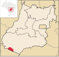 | Aporé (category Municipalities in Goiás) GO-174 / GO-422 / GO-206 / Caçu / GO-178 / Itajá / GO-302. (Source: Sepin) It is part of the Sudoeste de Goiás Microregion. Municipal boundaries are with... 5 KB (491 words) - 11:43, 25 November 2022 |