 | 94278°W / 33.84028; -113.94278 La Paz County (Spanish: Condado de La Paz) is the 15th county in the U.S. state of Arizona, located in the western part of... 22 KB (1,693 words) - 20:11, 19 April 2024 |
La Paz (Yavapai: Wi:hela) was a short-lived early gold mining town along on the western border of current-day La Paz County, Arizona. The town grew quickly... 7 KB (626 words) - 16:41, 22 September 2023 |
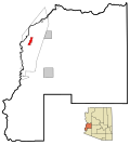
 | Quartzsite is a town in La Paz County, Arizona, United States. According to the 2020 census, the population was 2,413. Interstate 10 runs directly through... 24 KB (1,878 words) - 20:45, 19 April 2024 |
 | defunct Pah-Ute County was split from Mohave County in 1865, but merged back in 1871. All but La Paz County were created by the time Arizona was granted statehood... 14 KB (823 words) - 23:50, 20 March 2024 |
 | Parker (Mojave 'Amat Kuhwely, formerly 'Ahwe Nyava) is the county seat of La Paz County, Arizona, United States, on the Colorado River in Parker Valley.... 19 KB (1,618 words) - 20:45, 19 April 2024 |
 | La Paz Valley is a census-designated place (CDP) in La Paz County, Arizona, United States. Its population was 368 as of the 2020 census. The community... 4 KB (159 words) - 15:52, 23 April 2024 |
Mountains (Arizona)–La Paz County Dome Rock Mountains–La Paz County Granite Wash Mountains–La Paz County Harcuvar Mountains–NE. La Paz County -- (SW. Yavapai... 1 KB (134 words) - 11:18, 7 April 2022 |
 | Alamo Lake is a census-designated place in La Paz County, Arizona, United States. Its population was 4 as of the 2020 census. The community includes Alamo... 3 KB (85 words) - 05:40, 7 July 2023 |
del Sur La Paz, Iloilo City, a district of Iloilo City La Paz, Leyte La Paz, Tarlac La Paz County, Arizona La Paz, Arizona, a ghost town La Paz, California... 2 KB (309 words) - 19:50, 17 June 2022 |
 | with "house") is a census-designated place (CDP) and ghost town in La Paz County, Arizona, United States. Founded in 1908 as a mining camp, the economy of... 17 KB (1,216 words) - 17:21, 19 April 2024 |
 | Cibola is a census-designated place (CDP) in La Paz County, Arizona, United States. The population was 250 at the 2010 census, up from 172 in 2000. It... 8 KB (670 words) - 17:51, 19 April 2024 |
 | Wenden is an unincorporated community in La Paz County, Arizona, United States. The population was 728 at the 2010 census, up from 556 in 2000. For statistical... 7 KB (601 words) - 18:03, 19 April 2024 |
 | an unincorporated community and census-designated place (CDP) in La Paz County, Arizona, United States. The population was 1,470 at the 2010 census. Ehrenberg... 16 KB (1,053 words) - 15:03, 19 April 2024 |
 | La Paz County, Arizona Swansea Wilderness (BLM) mostly in La Paz County, Arizona Upper Burro Creek Wilderness (BLM) mostly in Yavapai County, Arizona... 33 KB (2,547 words) - 20:36, 19 April 2024 |
 | in La Paz County, Arizona, United States. The population was 662 at the 2010 census. Parker Strip is located in the northwest corner of La Paz County at... 7 KB (601 words) - 18:05, 19 April 2024 |
 | Reservation in La Paz County, Arizona, United States. The population was 725 at the 2010 census. Bluewater is located in northern La Paz County at 34°10′1″N... 7 KB (580 words) - 18:10, 19 April 2024 |
 | The La Paz incident occurred on May 20, 1863, at the mining town of La Paz, Arizona, and was the westernmost armed confrontation of the American Civil... 4 KB (423 words) - 04:39, 7 March 2024 |
 | an unincorporated community and census-designated place (CDP) in La Paz County, Arizona, United States, in the Parker Valley. The population was 285 at... 7 KB (583 words) - 17:59, 19 April 2024 |
the 2022 election. The district is located entirely within Maricopa County. Arizona first gained a fourth district after the 1970 census. It covered the... 26 KB (513 words) - 12:09, 18 April 2024 |
 | Vicksburg is a census-designated place in La Paz County, Arizona, United States. Its population was 418 as of the 2020 census. The community was named... 3 KB (88 words) - 12:13, 12 December 2023 |
 | an unincorporated community and census-designated place (CDP) in La Paz County, Arizona, United States. The population was 1,162 at the 2020 census. It... 11 KB (886 words) - 17:35, 19 April 2024 |
 | Brenda is a census-designated place (CDP) in La Paz County, Arizona, United States. The community is located approximately 16 kilometres (9.9 mi) east... 4 KB (176 words) - 21:44, 7 July 2023 |
 | Lake Havasu (category Reservoirs in La Paz County, Arizona) Colorado River, on the border between San Bernardino County, California and Mohave County, Arizona. Lake Havasu City sits on the Arizonan side of the lake... 8 KB (693 words) - 20:11, 31 March 2024 |
 | Parker Dam (redirect from Parker Dam, Arizona) San Bernardino County, California and the Buckskin Mountains in La Paz County, Arizona. The power plant has four Francis turbines with a combined capacity... 11 KB (953 words) - 19:24, 3 February 2024 |
 | Arizona's 30th legislative district is one of 30 in the state, consisting of all of La Paz County and sections of Maricopa County, Mohave County, and Yavapai... 23 KB (258 words) - 20:57, 31 March 2024 |
 | terminus is located at the California border at the Colorado River in La Paz County where I-10 continues westward into California towards Los Angeles. Here... 61 KB (4,274 words) - 18:36, 19 March 2024 |
 | Hope is a small unincorporated community in the deserts of La Paz County, Arizona, United States. Its name was inspired by the community's hope for increased... 812 bytes (71 words) - 15:04, 19 April 2024 |
List of mountain ranges of the Sonoran Desert (category Geography of Pima County, Arizona) Mountains–Maricopa County -- (some in S. Yavapai County) Kofa Mountains–N. Yuma County - (S. La Paz County) Laguna Mountains (Arizona)–Yuma County (see also:... 10 KB (1,017 words) - 11:31, 17 September 2022 |
The Arizona Peace Trail is a 675 mi (1,086 km) off-highway vehicle trail loop system in Mohave, La Paz, and Yuma counties in western Arizona. It is supported... 2 KB (224 words) - 15:25, 14 June 2022 |
| La Paz County, Arizona. This is intended to be a complete list of the properties and districts on the National Register of Historic Places in La Paz County... 5 KB (280 words) - 14:41, 24 April 2023 |