following is a list of primary state highways in Virginia shorter than one mile (1.6 km) in length. For a list of such highways serving Virginia state institutions... 55 KB (3,056 words) - 22:56, 27 April 2024 |
very short Virginia primary state highways, see List of primary state highways in Virginia shorter than one mile. State Route 217 is the designation... 89 KB (5,843 words) - 01:06, 4 January 2024 |
not in use, with only seven of these under 260. State highways serving Virginia state institutions List of primary state highways in Virginia shorter than... 118 KB (146 words) - 15:53, 4 January 2024 |
 | is a list of former primary state highways completely or mostly within the Richmond District (VDOT District 4) of the U.S. state of Virginia. State Route... 37 KB (5,022 words) - 16:26, 9 February 2024 |
 | is a list of former primary state highways completely or mostly within the Salem District (VDOT District 2) of the U.S. state of Virginia. State Route... 32 KB (4,777 words) - 16:31, 9 February 2024 |
 | is a list of former primary state highways completely or mostly within the Staunton District (VDOT District 8) of the U.S. state of Virginia. State Route... 46 KB (5,760 words) - 20:12, 19 June 2022 |
 | a list of former primary state highways completely or mostly within the Hampton Roads District (VDOT District 5), formerly the Suffolk District, of the... 42 KB (5,836 words) - 16:39, 4 March 2022 |
list of former primary state highways in the U.S. state of Virginia. Long-distance routes are listed here, while those entirely or mostly within one VDOT... 15 KB (1,209 words) - 16:35, 9 February 2024 |
 | a list of former primary state highways completely or mostly within the Lynchburg District (VDOT District 3) of the U.S. state of Virginia. State Route... 30 KB (4,714 words) - 17:07, 9 February 2024 |
 | States Numbered Highways are components of a national system of highways that is administered by the American Association of State Highway and Transportation... 97 KB (600 words) - 04:28, 18 March 2024 |
secondary marker; primary marker signs were posted in 1984. List of state routes in Tennessee shorter than one mile List of special state routes in Tennessee... 174 KB (349 words) - 17:46, 22 April 2024 |
000 highway miles (16,000 km) in the primary system, which comprises Interstate Highways, U.S. Highways, and state highways, nearly 1,000 miles (1,600 km)... 48 KB (943 words) - 23:13, 15 March 2024 |
 | State Route 288 is a primary state highway in the U.S. state of Virginia. It is a freeway-standard partial beltway around the southwest side of the Richmond... 12 KB (760 words) - 17:34, 2 April 2024 |
 | U.S. Route 1 (redirect from U.S. Route 1 in the Carolinas) Numbered Highways". American Highways. American Association of State Highway Officials. April 1927. Hart, Steven (2007). The Last Three Miles: Politics... 56 KB (5,386 words) - 03:55, 25 April 2024 |
 | Interstate Highways use a numbering scheme in which primary Interstates are assigned one- or two-digit numbers, and shorter routes which branch off of longer... 126 KB (12,768 words) - 17:45, 23 April 2024 |
 | Virginia state line. Virginia has an extensive network of Interstate Highways. The Interstate Highways, totaling 1,118 miles (1,799 km) in Virginia,... 32 KB (3,465 words) - 04:06, 1 August 2023 |
 | West Virginia is a state in the Southern and Mid-Atlantic regions of the United States. It is bordered by Pennsylvania to the north and east, Maryland... 184 KB (18,017 words) - 05:00, 19 April 2024 |
 | city in Cabell and Wayne counties in the U.S. state of West Virginia. The county seat of Cabell County, the city is located at the confluence of the Ohio... 143 KB (14,661 words) - 10:18, 16 April 2024 |
 | Virginia, officially the Commonwealth of Virginia, is a state in the Southeastern and Mid-Atlantic regions of the United States between the Atlantic Coast... 299 KB (26,546 words) - 13:35, 25 April 2024 |
 | bearer of an Interstate shield. SR 895 is one of only two routes that violates Virginia's numbering convention, in which primary state highways are numbered... 13 KB (1,388 words) - 03:27, 13 February 2024 |
 | designation and numbering of these highways were coordinated among the states, they are sometimes called Federal Highways, but the roadways were built... 46 KB (5,110 words) - 03:48, 30 March 2024 |
 | Interstate 295 (I-295) is a highway which runs eastward and northward bypass of the cities of Richmond and Petersburg in the US state of Virginia. The southern terminus... 12 KB (723 words) - 07:37, 25 March 2024 |
 | The Lincoln Highway is one of the first transcontinental highways in the United States and one of the first highways designed expressly for automobiles... 82 KB (10,755 words) - 20:00, 28 March 2024 |
 | State Route 267 (SR 267) is an expressway in the US state of Virginia. It consists of two end-to-end toll roads – the Dulles Toll Road and Dulles Greenway –... 42 KB (3,507 words) - 04:21, 22 April 2024 |
 | in the US state of Virginia runs east–west through the middle of the state from West Virginia to the Hampton Roads region, for a total of 299 miles (481 km)... 62 KB (4,023 words) - 21:39, 25 January 2024 |
 | in the US state of West Virginia is a major north–south Interstate Highway. It extends for 187.21 miles (301.29 km) between Bluefield at the Virginia... 55 KB (4,954 words) - 02:18, 31 January 2024 |
 | Chesapeake Bay Bridge–Tunnel (redirect from Chesapeake Bay Bridge-Tunnel, Virginia) 17.6-mile (28.3 km) bridge–tunnel that crosses the mouth of the Chesapeake Bay between Delmarva and Hampton Roads in the U.S. state of Virginia. It opened... 41 KB (4,572 words) - 21:37, 22 April 2024 |
 | In the U.S. state of Virginia, U.S. Route 220 (US 220) is a major north-south state highway that extends from the North Carolina state line through Roanoke... 25 KB (1,779 words) - 20:50, 15 April 2024 |
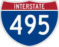 | Capital Beltway (redirect from Virginia State Highway 495) Beltway is a 64-mile (103 km) auxiliary Interstate Highway in the Washington metropolitan area that surrounds Washington, D.C., the capital of the United States... 74 KB (6,138 words) - 22:11, 26 March 2024 |
 | access highways having four or more lanes, and all state primary highways." "The maximum speed limit on all other highways shall be 55 miles per hour... 231 KB (30,207 words) - 05:02, 27 April 2024 |