
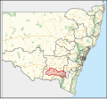
Lockhart Shire is a local government area in the Riverina region of New South Wales, Australia. The Shire was created in 1906 and is an agricultural and...
14 KB (621 words) - 00:58, 16 September 2023

Lockhart River is a town in the Aboriginal Shire of Lockhart River and a coastal locality split between the Aboriginal Shire of Lockhart River and the...
27 KB (2,373 words) - 13:46, 12 May 2024

Lockhart is a town in the Riverina Region of New South Wales, Australia. It is the location of the Lockhart Shire Council offices. At the 2016 census...
7 KB (631 words) - 13:35, 5 September 2023

in the Riverina region of southern New South Wales, Australia, in Lockhart Shire. It is 32 kilometres (20 mi) south-west of Wagga Wagga on the Olympic...
13 KB (1,341 words) - 11:49, 7 January 2024

Greenwood. "Land of the Wiradjuri: Traditional Wiradjuri Culture" (PDF). Lockhart Shire Council. p. 23. Archived from the original (PDF) on 1 April 2021. Retrieved...
4 KB (356 words) - 17:40, 2 April 2024
The Aboriginal Shire of Lockhart River is a local government area in Far North Queensland, Australia. It is on the east coast of the Cape York Peninsula...
4 KB (212 words) - 08:32, 4 April 2024

George who absorbed The Urana Shire Advocate into The Lockhart Review on 4 July 1950. George Cowin closed down The Lockhart Review on 6 July 1954 to W.A...
3 KB (327 words) - 20:44, 22 August 2021
and Lockhart Shire. It also covers part of the Snowy Valleys Council, which was established following the merger of Tumut Shire and Tumbarumba Shire. Wagga...
8 KB (548 words) - 08:40, 10 June 2023
Retrieved 7 July 2017. Australian Bureau of Statistics (27 June 2017). "Lockhart (A)". 2016 Census QuickStats. Retrieved 7 July 2017. Australian Bureau...
52 KB (2,825 words) - 06:34, 13 April 2024

Cullivel State Forest (category Lockhart Shire)
2022. Retrieved 25 March 2023. "Lockhart Shire Council – 2014-15 State of the Environment Report" (PDF). Lockhart Shire. Archived (PDF) from the original...
5 KB (233 words) - 00:49, 3 June 2023
Rand railway line (category Lockhart Shire)
View map The Rand railway line is a closed railway line in New South Wales, Australia. The line ran for 53 km south-west to the town of Rand from the Main...
5 KB (693 words) - 12:21, 5 January 2022
Galore Hill Scenic Reserve (category Lockhart Shire)
Galore Hill was proclaimed a Recreation Reserve, under the management of Lockhart Shire Council. The reserve is dominated by Galore Hill, which rises 215 metres...
8 KB (684 words) - 20:19, 18 May 2024

Pricing and Regulatory Tribunal recommended that the Corowa Shire merge with the Lockhart and Urana shires to form a new council with an area of 8,581...
5 KB (302 words) - 12:18, 27 March 2024

Chinese Crossing, Yerong Creek (category Lockhart Shire)
migrants. It was heritage listed by the Lockhart Shire Council in September 1995. "Yerong Creek". Lockhart Shire Council. Retrieved 1 August 2018. "Chinese...
2 KB (65 words) - 12:19, 1 April 2023
Brookong State Forest (category Lockhart Shire)
2023. Retrieved 25 March 2023. "Lockhart Shire Council – 2014-15 State of the Environment Report" (PDF). Lockhart Shire. Archived (PDF) from the original...
6 KB (310 words) - 00:52, 3 June 2023

The Lockhart, later Lockhart-Ross Baronetcy, of Carstairs in the County of Lanark, was a title in the Baronetage of Nova Scotia. It was created on 28 February...
3 KB (229 words) - 17:31, 11 August 2023

Milbrulong State Forest (category Lockhart Shire)
Corporation. Retrieved 22 March 2023. "Lockhart Shire Council – 2014-15 State of the Environment Report" (PDF). Lockhart Shire. Retrieved 23 March 2023. "Regional...
6 KB (358 words) - 00:54, 3 June 2023

May 2016. Retrieved 13 May 2016. "Wentworth - A Brief History". Wentworth Shire Council. Retrieved 16 February 2020. "Local Government Act, 1919—Proclamation"...
72 KB (2,347 words) - 11:24, 11 May 2024

Oaklands railway line, New South Wales (category Lockhart Shire)
of Boree Creek and Urana, terminating at Oaklands. The line opened to Lockhart in 1901, and to Oaklands in 1912. Passenger services were withdrawn in...
2 KB (136 words) - 08:19, 30 September 2021
Lockhart River may refer to: Lockhart River, Queensland, a community in Queensland Aboriginal Shire of Lockhart River, a local government area in Queensland...
408 bytes (74 words) - 14:12, 28 December 2017

Olympic Highway (category Lockhart Shire)
Highway (A20 west) – Narrandera Lockhart The Rock 241 150 Urana Street, to Lockhart-The Rock Road (north) – Lockhart, Collingullie Mangoplah-The Rock...
19 KB (1,515 words) - 02:30, 17 April 2023
Woodend, New South Wales (category Lockhart Shire)
400; 146.933 Location 12 km (7 mi) from Yerong Creek 23 km (14 mi) from Osborne LGA(s) Lockhart Shire County Mitchell State electorate(s) Wagga Wagga...
1 KB (69 words) - 02:46, 15 January 2021

Milbrulong (category Lockhart Shire)
kilometres (37 mi) south west of the regional centre Wagga Wagga in the Lockhart Shire local government area. The standard gauge Oaklands railway line passes...
18 KB (1,677 words) - 05:54, 24 March 2023

Pricing and Regulatory Tribunal recommended that the Urana Shire merge with the Lockhart and Corowa shires to form a new council with an area of 8,581...
5 KB (339 words) - 12:17, 27 March 2024
Retrieved 7 July 2017. Australian Bureau of Statistics (27 June 2017). "Lockhart (A)". 2016 Census QuickStats. Retrieved 7 July 2017. Australian Bureau...
53 KB (2,743 words) - 14:43, 22 October 2023
Riverina Water County Council (category Lockhart Shire)
provides drinking water to the City of Wagga Wagga, Greater Hume Shire, Lockhart Shire and part of Federation Council which operates under the provisions...
3 KB (147 words) - 18:29, 24 February 2023

9th Earl of Eglintoun on 30 April 1697. In 1702, Lockhart became shire commissioner for the shire of Edinburgh in the Parliament of Scotland. He joined...
13 KB (1,085 words) - 02:49, 14 May 2024
Sunter Island (category Aboriginal Shire of Lockhart River)
Aboriginal Shire of Lockhart River, Queensland, Australia. It is part of the Great Barrier Reef Marine Park in Lloyd Bay between Lockhart River and Cape...
2 KB (72 words) - 03:35, 11 January 2024

Yerong Creek (category Lockhart Shire)
Sydney 46 km (29 mi) S of Wagga Wagga 15 km (9 mi) S of The Rock LGA(s) Lockhart Shire County Mitchell State electorate(s) Wagga Wagga Federal division(s)...
5 KB (251 words) - 08:33, 25 July 2022

Pleasant Hills, New South Wales (category Lockhart Shire)
2658 Location 37 km (23 mi) from Lockhart 26 km (16 mi) from Henty 85 km (53 mi) from Albury LGA(s) Lockhart Shire County Urana State electorate(s) Wagga...
4 KB (385 words) - 02:02, 17 September 2023