 | Mariposa County (/ˌmærɪˈpoʊzə, -sə/ ) is a county located in the U.S. state of California. As of the 2020 U.S. Census, the population was 17,131. The... 47 KB (2,521 words) - 10:40, 28 April 2024 |
 | and census-designated place (CDP) in and the county seat of Mariposa County, California, United States. The population was 1,526 at the 2020 census.... 20 KB (2,095 words) - 13:15, 24 December 2023 |
 | unincorporated community and census-designated place (CDP) in Mariposa County, California, United States. As of the 2020 United States census, it had a... 5 KB (310 words) - 21:26, 12 July 2023 |
Alder Creek is a stream in Mariposa County, California, in the United States. It is a tributary of the South Fork Merced River. Alder Creek was likely... 5 KB (212 words) - 13:11, 24 December 2023 |
 | States and the indigenous people of California's Sierra Nevada in the 1850s. The war was fought primarily in Mariposa County and surrounding areas, and was... 13 KB (1,449 words) - 08:28, 4 February 2024 |
 | Mariposa Grove is a sequoia grove located near Wawona, California, United States, in the southernmost part of Yosemite National Park. It is the largest... 13 KB (1,455 words) - 00:55, 10 August 2023 |
Nevada mountain range Mariposa, California, seat of the county in California Mariposa Township, Saunders County, Nebraska Mariposa, a master-planned community... 4 KB (500 words) - 15:58, 25 January 2024 |
 | highest of the Three Brothers, a rock formation, above Yosemite Valley in California. This independent peak is located just east of El Capitan. John Muir considered... 3 KB (252 words) - 06:46, 6 April 2023 |
Kern, Inyo, Mariposa, Merced, Sacramento, San Benito, San Joaquin, Stanislaus, and Tulare counties. County Route J1 (CR J1) is a county highway in San... 117 KB (4,843 words) - 16:47, 19 December 2023 |
Shoreline Unified School District Tamalpais Union High School District Mariposa County Unified School District Anderson Valley Unified School District Arena... 58 KB (5,117 words) - 22:19, 18 December 2023 |
(Spanish for "Cold Water") is an unincorporated community in Mariposa County, California. It is located 5.25 miles (8.4 km) northeast of Catheys Valley... 5 KB (450 words) - 16:43, 10 September 2023 |
 | Bend is a mining ghost town of the California Gold Rush, formerly on the Merced River in Mariposa County, California It was originally a placer and hydraulic... 3 KB (211 words) - 22:16, 2 March 2024 |
 | the California genocide. After a force under Mariposa County Sheriff James Burney was found unequal to the task of defeating the Native Californians, Burney... 5 KB (453 words) - 22:33, 20 February 2024 |
 | central business district of Mariposa, in Mariposa County, California, United States. It is owned by the County of Mariposa. Although most U.S. airports... 4 KB (333 words) - 07:58, 11 February 2024 |
Jerseydale is an unincorporated community in Mariposa County, California. It is located 9 miles (14 km) south-southwest of El Portal, at an elevation... 3 KB (189 words) - 20:37, 26 January 2024 |
 | census-designated place in Mariposa County, California, United States. It is located on Maxwell Creek 20 miles (32 km) northwest of Mariposa, at an elevation of... 10 KB (909 words) - 15:56, 21 February 2024 |
 | resources and mining heritage. It is located in Mariposa, a city in central California, on the Mariposa County fairgrounds. The museum houses a collection... 4 KB (306 words) - 05:58, 1 August 2023 |
Newtown is a former settlement in Mariposa County, California. It lay at an elevation of 1821 feet (555 m). U.S. Geological Survey Geographic Names Information... 2 KB (34 words) - 00:14, 12 April 2021 |
Geological Survey Geographic Names Information System: Bishop Creek (Mariposa County, California) Browning, Peter (2005). Yosemite Place Names: The Historic Background... 852 bytes (107 words) - 22:47, 15 November 2020 |
 | Area codes 209 and 350 (category Mariposa County, California) Livingston, Manteca, Ripon, Tracy, Lodi, Galt, Sonora, Los Banos, San Andreas, Mariposa, and Yosemite, the northern San Joaquin Valley (part of the Central Valley)... 12 KB (640 words) - 19:44, 10 September 2023 |
 | by any trail, although rock climbers frequent the peak. "Grizzly Peak, California". Peakbagger.com. Retrieved 2012-12-17. "Grizzly Peak". Geographic Names... 2 KB (117 words) - 06:47, 6 April 2023 |
 | an unincorporated community in Mariposa County, California. It is located 2 miles (3.2 km) south-southeast of Mariposa, at an elevation of 1772 feet (540... 3 KB (185 words) - 05:52, 27 July 2023 |
Burns' Ranch, and Burns' Diggings) is a former settlement in Mariposa County, California. It was located on Burns Creek 2 miles (3.2 km) upstream from... 2 KB (200 words) - 16:02, 25 May 2022 |
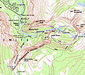
 | Wah-wo-nah, and Clark's Ranch) is a census-designated place in Mariposa County, California, United States. The population was 111 at the 2020 census. It... 11 KB (1,136 words) - 12:49, 26 April 2024 |
 | a census-designated place in Mariposa County, California, United States. It is located 18 miles (29 km) east of Mariposa, at an elevation of 5,062 feet... 22 KB (1,797 words) - 07:11, 28 April 2024 |
Dogtown is a former settlement in Mariposa County, California, United States. It was located on Maxwell Creek 4 miles (6.4 km) east of Coulterville, at... 4 KB (288 words) - 17:27, 16 December 2023 |
 | is an unincorporated community and census-designated place in Mariposa County, California, United States. The population was 661 at the 2020 census, down... 11 KB (1,142 words) - 13:11, 24 December 2023 |
properties and districts listed on the California Historical Landmark listing in Mariposa County, California. Click the "Map of all coordinates" link... 3 KB (105 words) - 16:54, 10 September 2023 |
Ridleys Ferry, later Benton Mills, is a former settlement in Mariposa County, California. It was located on the south bank of the Merced River, opposite... 1 KB (152 words) - 12:40, 2 March 2024 |
Dogtown, Mariposa County, California, an unincorporated community Dogtown, Mono County, California, a ghost town Dogtown, San Joaquin County, California, a... 1 KB (150 words) - 07:23, 3 January 2024 |